Pounds and Pinfolds
National Register of Pounds and Pinfolds---- Part 1
This is the Pounds and Pinfolds National Register set up to record and encourage the knowledge and preservation of these structures in our landscape.
The locations listed have been identified from maps, archive records and by being observant when travelling around our towns, villages and cities. Minimal information is currently recorded and so I am seeking to expand on this with any information that I receive from you, the reader, Please send me any information using the email address nigelmillspp@gmail.com. I am currently expanding the entries so if you can tell me anything about the pinfolds present use and send an image I will credit you with the contribution. Thank you.
This is a WORK IN PROGRESS as I am gradually replacing the one line entries with more information and, where possible, images. If you know of a pound or pinfold listed or not listed please get in touch with me so that I can complete the Register entry.
Please note that when compiling the Registers I have used the English Counties as they are today because I hope people will be able to locate the pounds and pinfolds and explore the English countryside in which they exist. However the changes to counties in 1974 and the later system of Unitary Authorities confuses this county organisation, and me, so please bear this in mind. If you find any discrepancies please let me know.
Grid references: Grid reference X and Y coordinates given. For a 6 digit grid reference read e.g. 317391, 5506847 as 173506. Or enter 12 digit references in www.old-maps.co.uk or www.streetmap.co.uk. Contributions from other than the author are given for each entry.
--------------------------------------------------------------------------------------------------------------------------------------------------------------------------------------------------
Bedfordshire Pounds and Pinfolds
- Lost Bedfordshire Pounds and Pinfolds.xlsx
- Click here to see lost Bedfordshire Pounds and Pinfolds not listed below.
Aspley Guise, Bedfordshire
Grid ref: 494179,236420
Shown on the 1883 OS map but site in Berry Lane is now occupied by a house and garden. Contributed by Michael Trolove March 2022
Blunham, Bedfordshire
Grid ref: 515343,251652
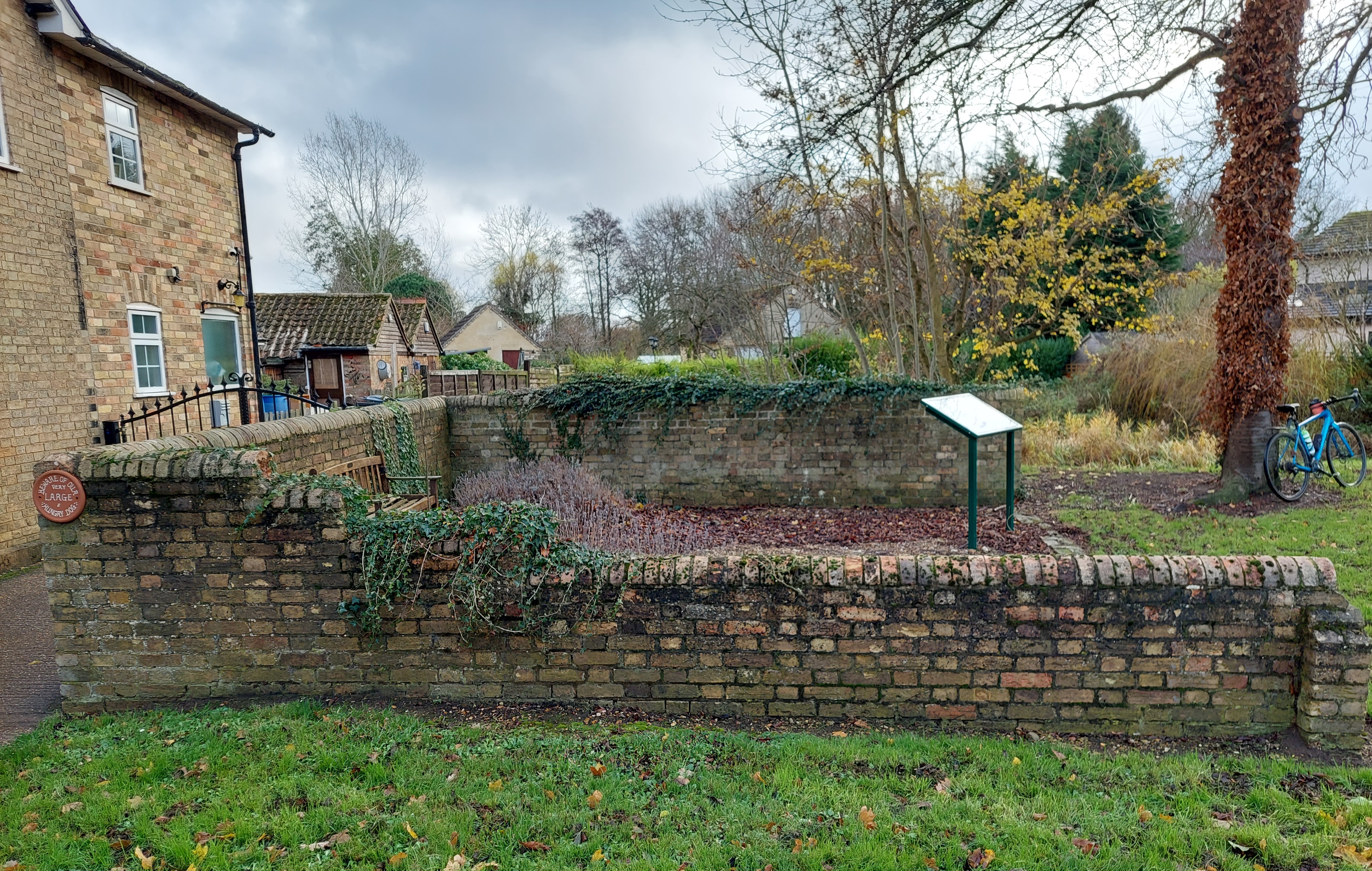
Named as a pound on the 1901 OS map and still substantially complete! Near the junction of High Steet and Tempsford Road it stands three sided and sports an up to date interpretation board. Once on common land it has since 1972 been in the care of the Parish Council. It is of brick construction with round brick coping approx 6m square and well maintained. Contributed by Michael Trolove, June 2022
Clophill, Bedfordshire
Grid ref: 508228,237662
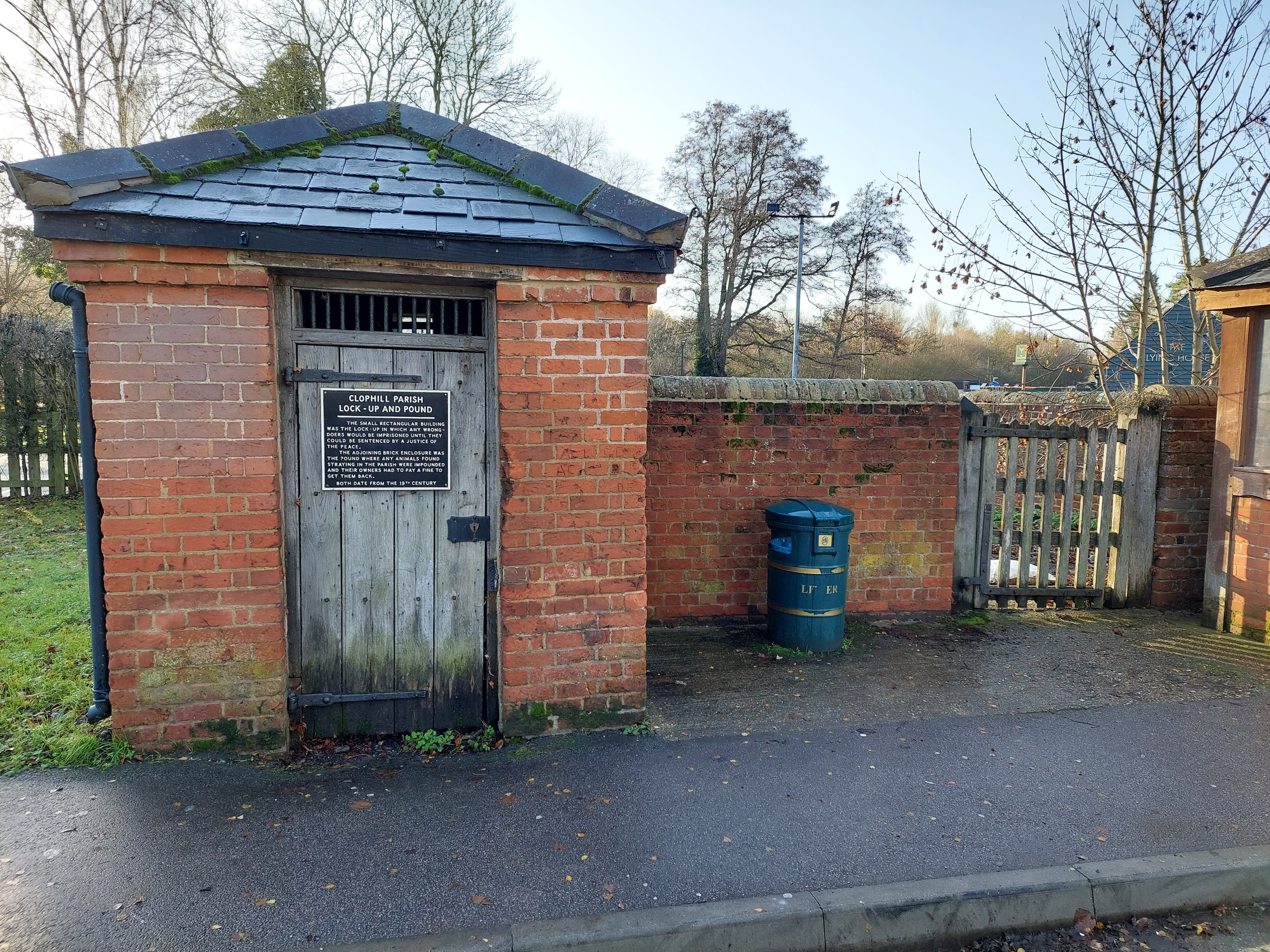
This pound can be found on the Flying Horse roundabout on the A6 opposite the village green. The pound is on the second edition OS 25" map as a pound. It is rectangular shape of brick with an oak gate and the village lock up is attached to it. It measures about 5mtrs square with a hard surface floor. A sign gives some historical information. Contributed by Michael Trolove, December 2022
Colmworth, Bedfordshire
Grid ref: 510770,258627
Was named on OS for 1884 on Chruch Rd but nothing now remains. Contributed by Michael Trolove December 2021
Henlow, Bedfordshire
Grid ref: 517646,238841
On 1882 OS but now an unmarked green space. Contributed by Michael Trolove April 2022
Langford, Bedfordshire
Grid ref: 518557,241127
On the 1886 OS the site is now represented by a bench and Pound Close. A commemorative plack has disappeared. Contributed by Michael Trolove, April 2022
Little Staughton, Bedfordshire
Grid ref: 510442,262851
Shown as a pound at Spring Hill on the 1884 OS map but now replaced by housing. Contributed by Michael Trolove, December 2021
Milton Ernest, Bedfordshire
Grid ref: 501959,256087
The 1884 OS map shows a near rectangular shape with an internal division or trough marked. It has since been subsumed into the churchard. Contributed by Michael Trolove, July 2022
Pertenhall, Bedfordshire
Grid ref: 508240,264600
Recorded at Green End on the 1887 OS map but site now part of farmed arable land. Contributed by Michael Trolove, June 2021
Shillington, Bedfordshire
Grid ref: 512699,233920
Named as a pound on the 1892 OS map but now not trace. Contributed by Michael Trolove, April 2022
Souldrop, Bedfordshire
Grid ref; 498479,261840
Located on the village green near the pond on the 1883 OS map but both pond and pound have disappeared. It also appears on the 1927 OS map so changes to the green are relatively recent. Contributed by Michael Trolove, July 2022
Swineshead, Bedfordshire
Grid ref: 506110,265860
Original site on the west side of Swineshead Road northj of the High Street junction. It was shown as square and named as a pound on the OS 1884 map but now only a hedge exists in it's place. Contributed by Michael Trolove, June 2021
Upper Gravenhurst, Bedfordshire
Grid ref: 511169,235852
On 1901 OS map as a pound but now site is just a grass verge. Contributed by Michael Trolove, April 2022
Woburn, Bedfordshire
Grid ref: 494570,232992
Named as a Pound on the 1901 OS map located in a now closed off lane. It is now car parking and green area for nearby houses. Not far away on the same main road known as Leighton Street we have a Pinfold Pond which is named on several editions of OS maps right up to the present day so whether two Pounds or Pinfolds existed and its odd for the same village to use both names, perhpas tithe maps could help. Contributed by Michale Trolove, March 2022
Yeldon, Bedfordshire
Grid ref: 501120,266660
Named and shown as a square Pound on the 1901 OS map near the River Til, it has now disappeared. The village has a rich recorded history but no mention of a pound. Contributed by Michael Trolove, June 2021
--------------------------------------------------------------------------------------------------------------------------------------------------------------------------------------------------
Berkshire Pounds and Pinfolds
Bucklebury, Berkshire
Grid ref: 456124,170270
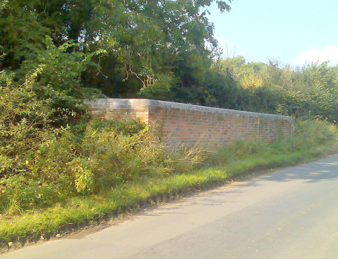
A well maintained large rectangular pound at ths side of the road. No access. It is shown on the 1877 OS 1:2,500 map as a pound.
Nigel Mills December 2008
Remenham, Berkshire
Grid Ref: 477045,184129
A square pound is shown on the 1875 OS map but has now long gone leaving only a grass verge. Contributed by Michael Trolove, September 2022
Speen, Berkshire
Grid ref: 445770,168025
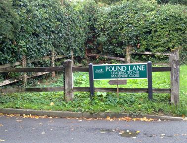
The site of this pound is shown by wooden posts at the junction of Pound Lane and Bath Road. It is shown on the 1881 OS map as a pound.
Nigel Mills December 2018
Waltham St Lawrence, Berkshire
Grid ref:
Shown in the centre of the village on the 1872 OS 1:2,550 map. Any information please?
Wargrave, Berkshire
Grid ref: 478403,178401
A slight trapezoid shaped pound on the 1872 OS map in Station Road which, if accurate at the time, may have been necessary to fit the plot of land available. Perhaps the wall on the site was part of the original pound or perhaps not! Contributed by Michael Trolove, September 2022
-------------------------------------------------------------------------------------------------------------------------------------------------------------------------------------------------
Buckinghamshire Pounds and Pinfolds
- Lost Buckingham Pounds and Pinfolds.xlsx
- Click here to Download Lost Buckinghamshire Pounds and Pinfolds not listed below
Cholesbury Common, Buckinghamshire
Grid ref: 493032,207102
A circular pound is shown on the 1884 OS map but nothing now exists of this structure. Contributed by Michaerl Trolove, June 2022
Ivinghoe Aston, Buckinghamshire
Grid ref: 495228,218193
In 1879 the OS map shows the pound and adjacent to it a letter box but both have long since gone from the centre of this small village. Contributed by Michael Trolove, June 2022
Preston Bissett, Buckinghamshire
Grid ref: 466147,230173
The past existence of a pound is referenced by a road name of Pound Lane but there is no trace on OS maps. Contributed by Michael Trolove, March 2022
Tingewick, Buckinghamshire
Grid ref: 465675,232862
Not found on OS map but referenced by Pinfold Yard off Main Street. Contributed by Michael Trolove
Wendover, Buckinghamshire
Grid ref: 486629,207691
Not well defined but is named as a pound on the 1884 OS map. It no longer exists but the site would have been aligned with the hedge in Pound Street. Contributed by Micael Trolove June 2022
-------------------------------------------------------------------------------------------------------------------------------------------------------------------------------------------------
Cambridgeshire Pounds and Pinfolds
- Lost Cambridgeshire Pounds and Pinfolds.xlsx
- Click here to Download lost Cambridgeshire Pounds and Pinfolds not listed below.
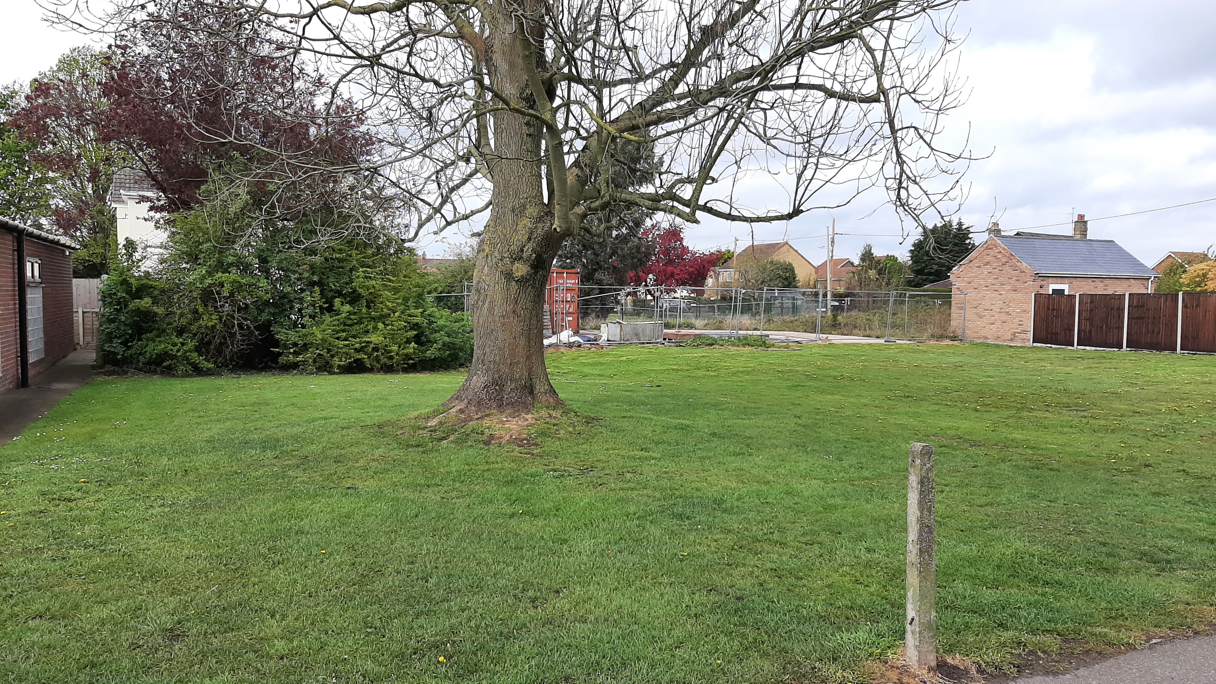
Ailsworth, Peterborough, Cambridgeshire
Grid ref: 511725,298811 (not confirmed)
A transcription of the Tithe Roll of 1847 names Hon. George Fitzwilliam as the landowner of Ailsworth Pound (top of Ailsworth, off Helpston Road) and in this area on the 1886 OS 1:2,500 map is an unamed oval shape which could be a pound or pond. The local council are unable to clarify and the space is now a large grassed amenity area with bus stop and an Ailsworth history interpretation board, with no mention of a pound. All pounds in this area are rectangular in shape so the oval is likely to be a pond. Further enquiries are being made. Contributed by Michael Trolove, April 2021
Benwick, Cambridgeshire
Grid ref: 534270,290160
A mature tree now marks the site of Benwick Pound and a comprehensive historical interpretive board stands near by. It is shown and named on the 1888 1:2,500 OS map and later versions but has disappeared by the 1927 edition. Contributed by Michael Trolove, May 2021
Bluntisham, Cambridgeshire
Grid ref: 536710,274400
A square pound shown on the 1888 and a few editions later of the 1:2,500 OS maps but now long gone making way for modern buildings on Station Road. Contributed by Michael Trolove, June 2021
Brampton, Huntingdon, Cambridgeshire
Grid ref: 521533,270937
A rectangular pound on the 1888 OS map but no evidence of its existence found at the site. Contributed by Michael Trolove, November 2021
Broughton, Cambridgeshire
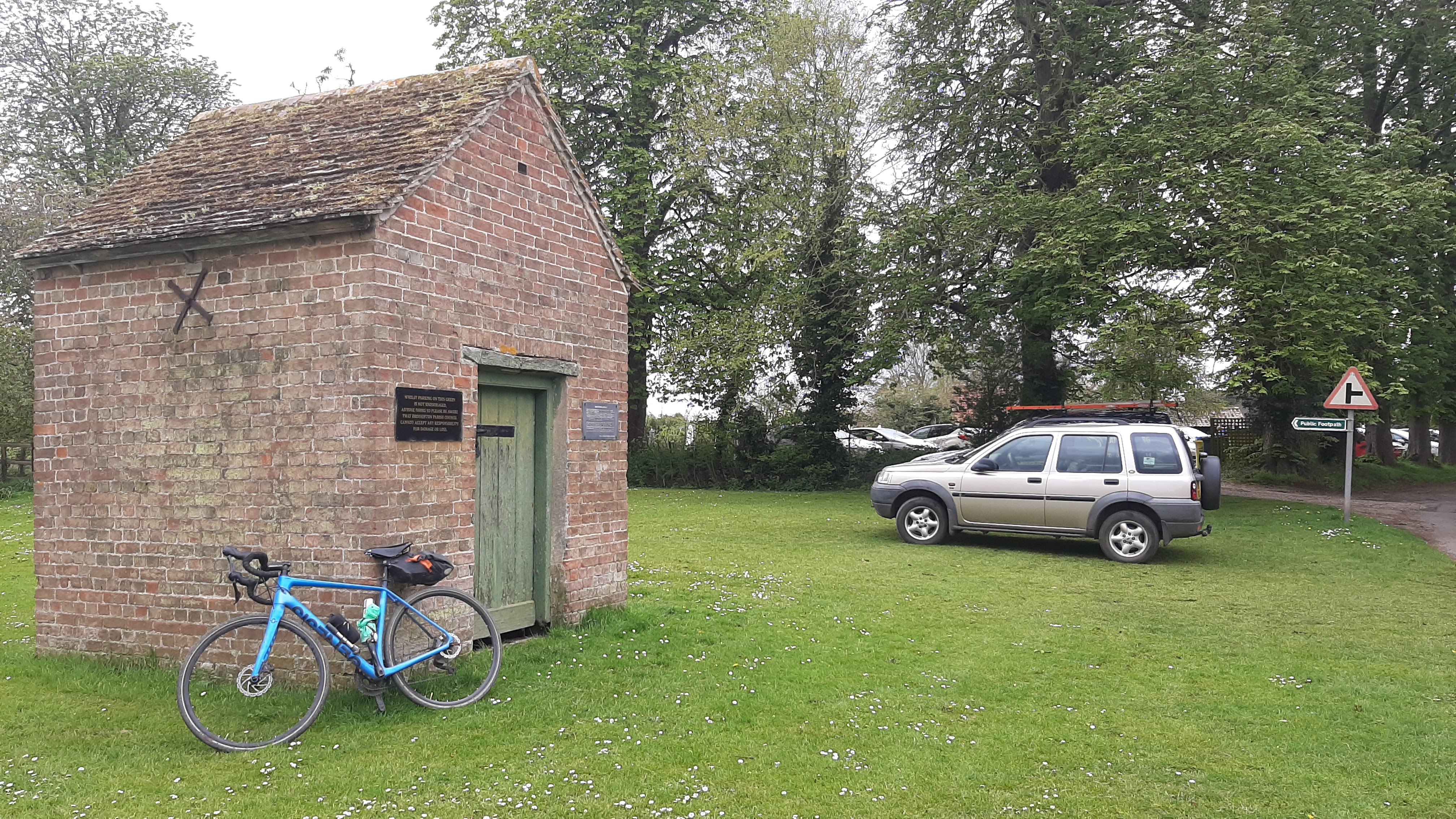
Grid ref: 528120,277911
Although no longer in place the pound is remembered on the interpretive plaque affixed to the lock up on the village green where the Broughton Pinder is descirbed as "a delightful pinder who always seems so sorry if he is obliged to run in your straying horse. He does not demand his bond, which is perhaps 6d a head on all stray cattle, but is willing to accept a liquid composition for his pains!" The pound is shown on the 188 1:2,500 OS map. Contributed by Michael Trolove, that's his bike in the photo, May 2021
Bury, Owls End, Ramsay, Cambridgeshire
Grid ref: 528200,283670
This pound is shown and named on the 1889 OS 1:2,500 map and later maps but gone from the 1926 edition. The location remains as a communal area on a housing estate at the junction of Woodfields Avenue and Tunkers Lane. No trace of the pound is left. Contributed by Michael Trolove, April 2021
Castor, Peterborough, Cambridgeshire
Grid ref: 512204,298595
Shown at the corner of The Green on the 1886 OS 1:2,500 map close to the present electrical sub-station at the corner of this public area. In the Tithe Roll of 1847 The Hon.George Fitzwilliam is recorded as owning Castor Pound on The Green and Ailsworth Pound. No trace of the pound now exists. Contributed by Michael Trolove, April 2021
Chatteris, Cambridgeshire
Grid ref: 538797,286709
The only legacy to this pound is Pound Road which was even in 1888 the access road to the pound situated on the edge of the village of Chatteris. No phyisical trace is left on the site. Shown and named on the 1888 1:2,500 OS map but it had disappeared by 1926. Contributed by Michael Trolove May 2021
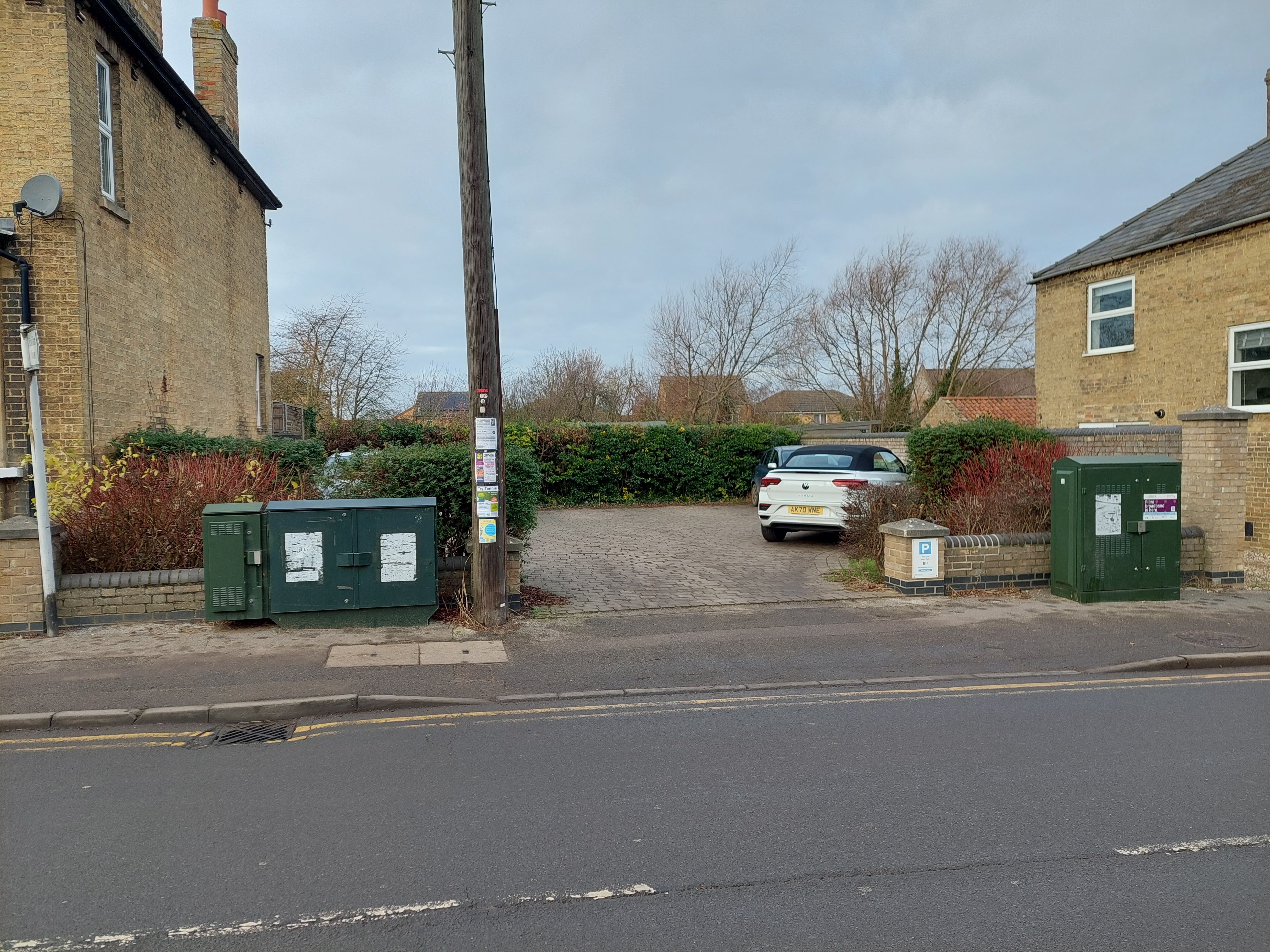
Cottenham, Cambridgeshire
Grid ref: 545137,267971
On the 1887 and 1902 OS maps and now serving as a short term car park for shoppers. Better than demolishment perhaps. Possibly been rebuit or remodelled in places. Contributed by Michael Trolove, January 2021
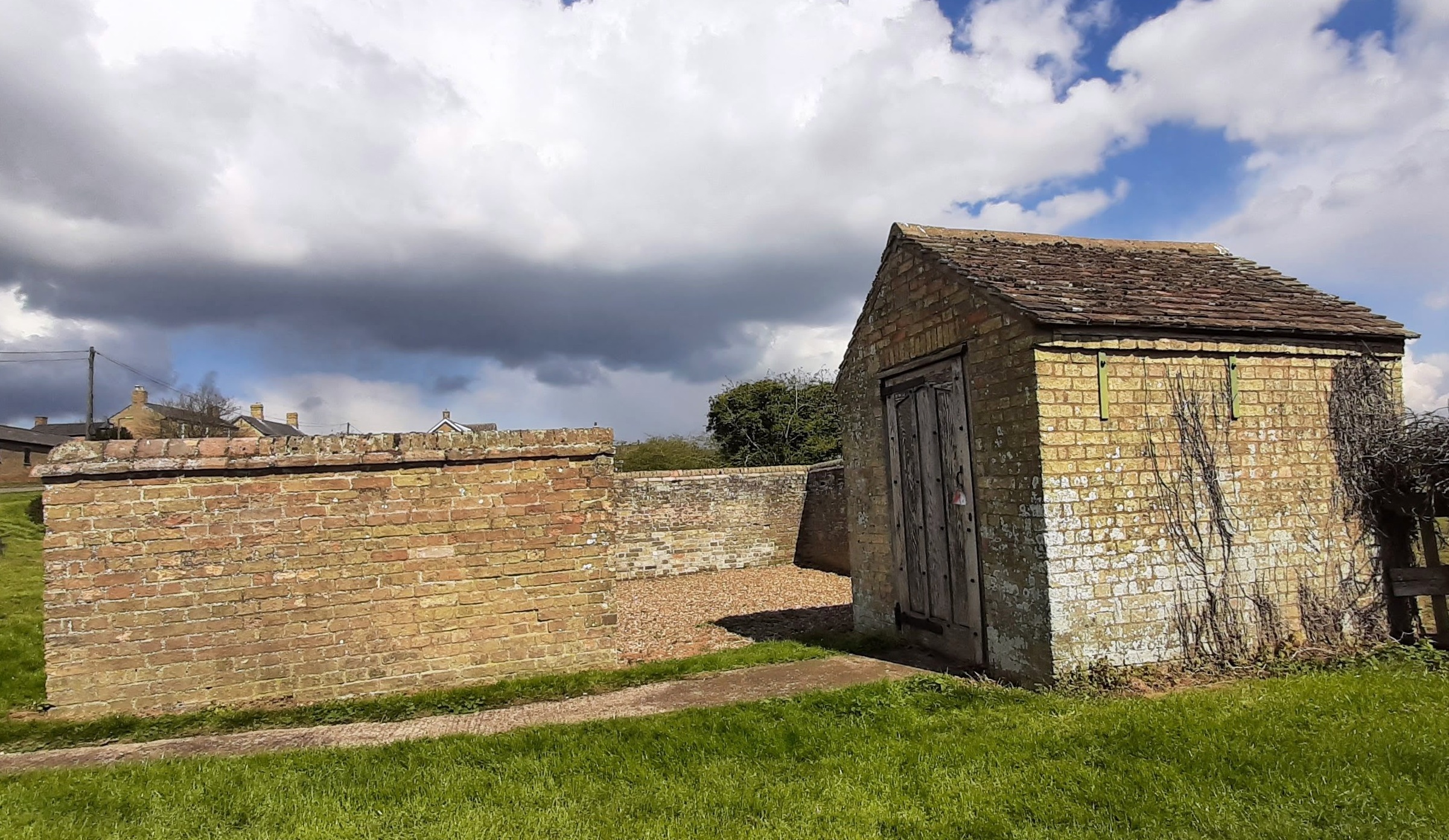
Coveney, Cambridgshire
Grid ref: 548717,281856
This well maintained pound is approx 4 mtrs square with 1.8mtr walls and open 1 mtr entrance. A large interpretative panel is attached to one wall and it is adjcent to a lock - up. Grade II Listed since 1988. Located on Main Street, Coveney close to the Manor House (now Manor House Farm) and named as a Pound on the 1887 1:2,500 OS Map.
Contributed by Michael Trolove April 2021
Doddington, Isle of Ely, Cambridgshire
Grid ref: 540180,290750
No trace left apart from Pound House, High Street on or near the site. Shown on the 1887 1:2,500 OS map adjacent to an open area. Contributed by Michael Trolove, May 2021
Eastrea, Cambridgeshire
Grid ref: 529406,297202
Shown on OS maps but not named until 1926. Now gone making way for a garage in this dormitory village for Peterborough. Contributed by Michael Trolove, April 2022.
Ellington, Cambridgeshire
Grid ref: 516030,271730
The 1888 edition of the 1:2,500 OS map shows a square pound to the south of All Saints Church just outside the south gate of the graveyard. No trace now remains. Contributed by Michael Trolove, June 2021
Elton, Cambridgeshire
Grid ref: 508940,293799
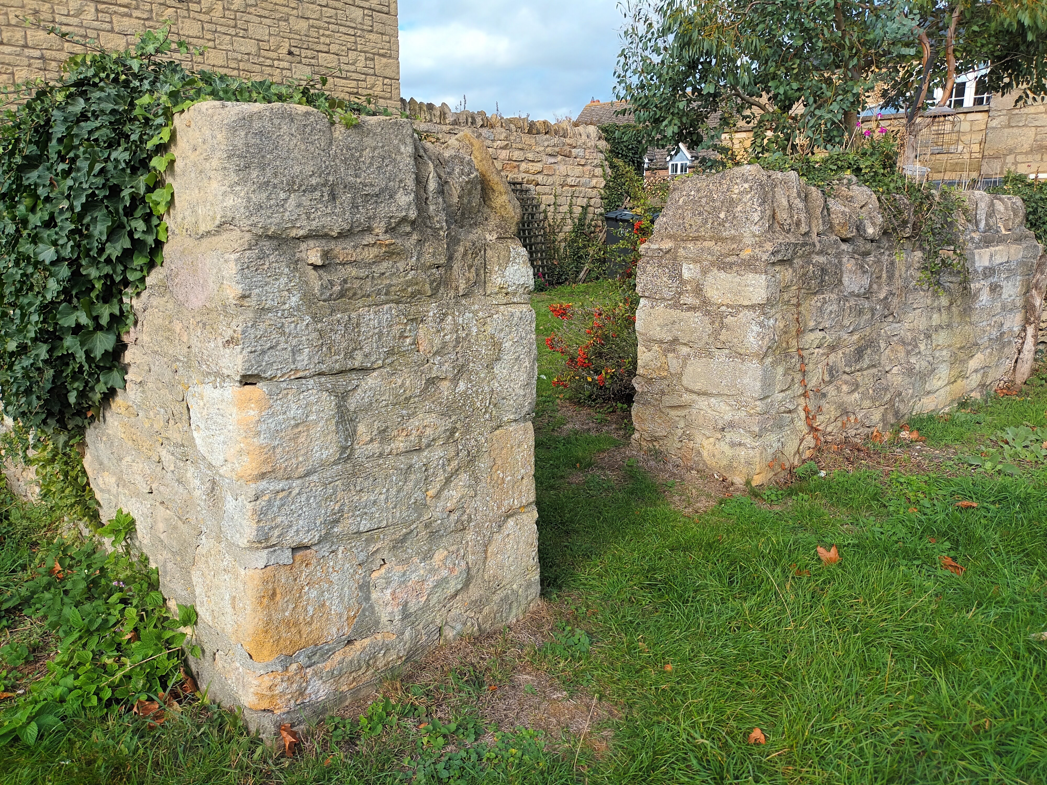
There are two pointers to the site of a pound in Elton in the Highgate area. Pound Cottage in Vinco Terrace and an outline on the 1887 OS map near the Smithy in the same area. It is made of coursed local limestone stone, only two sides remain as the other sides are house walls. The approximate size would have been 10' to 15' sq. Height is around waist level on a taller person.. The top is finished with upright coping stones. There is no gate fixed to the entrance. The pound forms part of the adjacent property. There is no plaque or sign to suggest its historical relevance.Contributed by Michael Trolove, August 2021
Etton, Cambridgeshire
Grid ref: 514020,306419
Named on the 1887 OS map but no trace now. Contributed by Michael Trolove Novemver 2021
Farcet, Cambridgeshire
Grid ref: 520780,294469
Shown as a pound from the 1889 1:2,500 OS map until 1952. The site is now a tree plantation at the corner of New Meadow Drove and Straight Drove on the south eastern outskirts of Farcet. Contributed by Michael Trolove, May 2021
Fordham, Cambridgeshire
Grid ref: 562733,270814
Shown on the 1887 OS map as an irregularly shaped pound it has morphed into a fire engine shed in Carter Street. Signage explains the alteration but it is difficult to spot the original brickwork. Contributed by Micahel Trolove, February 2022
Glinton, Cambridgeshire
Grid ref: 515422,305854
Now part of a garden at 12 Rectory Lane and reduced in size from the square shpe shown on the 1900 OS map. Recognised and listed by the Parish Council. Contributed by Michael Trolove, June 2022
Godmanchester, Cambridgeshire
Grid Ref:
The only hint, but a strong one, of a pinfold here is the name of Pinfold Lane on the maps from as early as 1886. However the site cannot be found. Any help would be appreciated please.
Great Raveley, Cambridgeshire
Grid ref: 525676,281021
This circular pound was named and shown on the 1888 1:2,500 OS and others through to 1926. The original location at a junction no doubt caused its demise as roads were widened in the early 20th Century. No trace is left. Contributed by Michael Trolove, April 2021.
Hail Weston, Cambridgeshire
Grid ref: 516639,261998
Not found on OS maps but a housing development has Pound Close. Contributed by Michael Trolove, December 2021.
Helpston, Peterborough, Cambridgeshire
Grid ref: 512185,304901
Named as a pound at the south end of Heath Road on the 1886 OS map but now no trace exists. John Clare, whose poems celebrated the countryside was born in the village so it is ironic that there is now not trace of the pound that was probably in use in his lifetime although it is mentioned in The Shepherd's Calendar published by him in 1827. Contributed by Michael Trolove November 2021
Hemingford Grey, Cambridgeshire
Grid ref: 529598,270526
A square pound named on the 1888 and 1901 1:2,500 OS maps on the corner of Pound Lane and Back Street. Extensive development of the area and road widening seems to have caused its demise but is still remembered in the road name. Contributed by Michael Trolove June 2021
Impington, Cambridgeshire
Grid ref: 544710,236210
A square structure is shown on earlier maps but not named until the 1927 OS map. Site is now access to a dwelling. Contributed by Michael Trolove, June 2021
Kimbolton, Cambridgeshire
Grid ref: 509650,267940
Pound Lane is named in this village but no trace of a pound could be located and it is not noted on the OS maps. The village, Michael notes, gets a mention in the Uncle Silas book by H.E.Bates "Sugar for the Horse". Contributed by Michael Trolove June 2021
Landbeach, Cambridgeshire
Grid ref: 547610,265360
This pound is shown on the 1887 1:2,500 OS map and even at that early date the improvement and widening of the adjacent road caused one wall of what would have been a square structure to be rebuilt forming the unusual plan it is today. Utilising a house wall to the north east the other walls are approx 2 mtrs high and the interior floor is lower than the road. The whole pound is well maintained. Approx. 7mtrs by 4mtrs and built of pale brick with semi circular coping. A sign on the iron gate leaves no doubt that this is the Landbeach Parish Pound. It stands at Green End near All Saints Church. Contributed by Michael Trolove, June 2021
Litlington, Cambridgeshire
Grid ref: 531008,242899
North west of the village this site is now occupied by housing. Contributed by Michael Trolove, June 2022
Little Downham, Cambridgeshire
Grid ref: 551955,283862
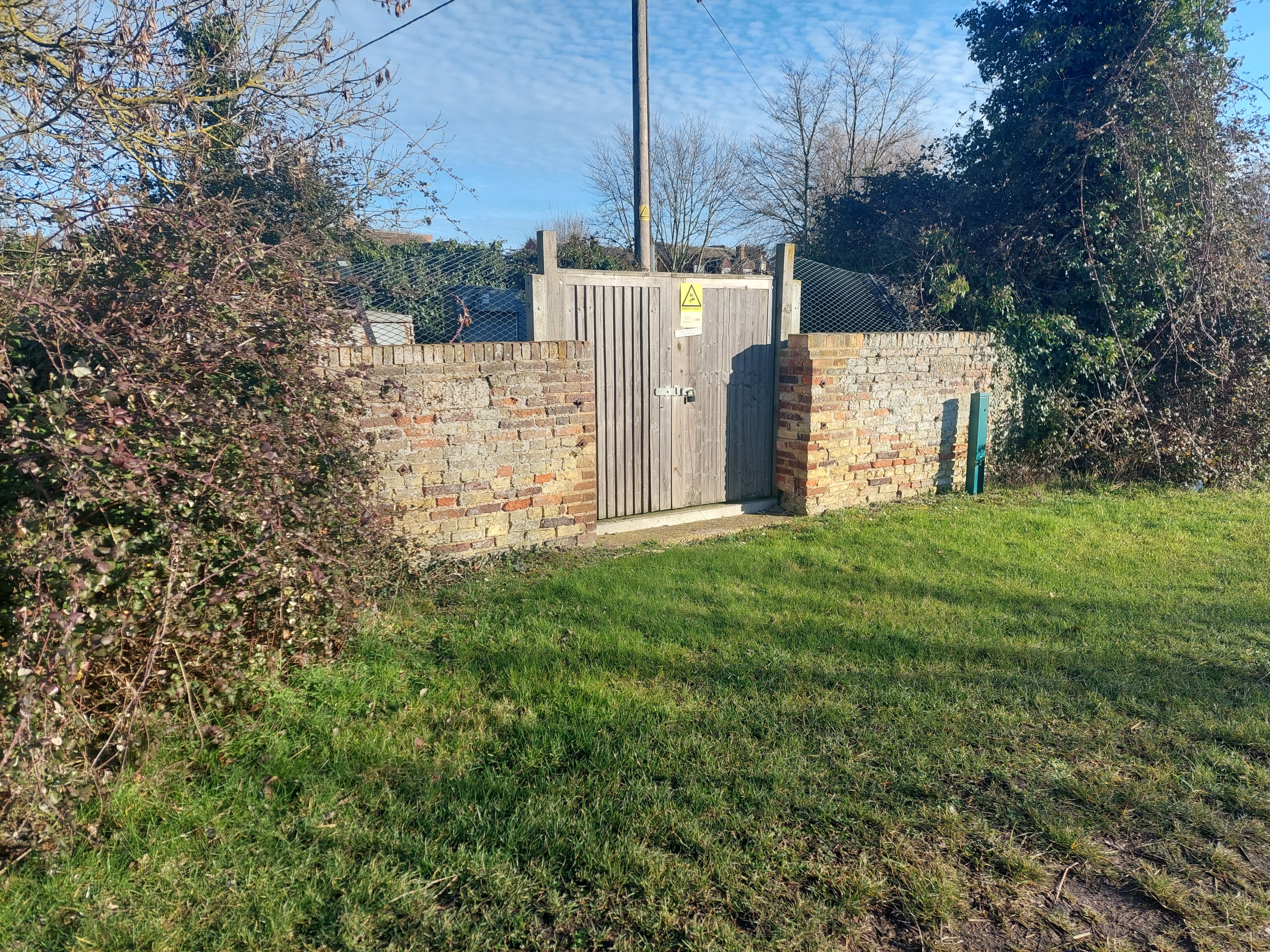
On the site of the OS 1902 Pound near the junction of High Road and Tower Road but re-purposed to house an electrical station. Near by information board fails to mention the pound site. Believed to be the original structure by contributor Michael Trolove, February 2022
Little Eversden, Cambridgeshire
Grid ref: 536953,253120 (Area)
Only reference found to a pound is Pound Drift leading south west fromHarlton Road. Further information welcome. Contributed by Michael Trolove, June 2022
Longstanton,
Cambridgeshire
Grid ref: 539919,266388
Shown as a pound on the 1887 1:2,500 OS map but now site has been lost to the cross roads of School Lane and Woodside. The town is rapidly expanding due to its proximity to Cambridge. Contributed by Michael Trolove, June 2021
Manea, Cambridgeshire
Grid ref: 547581,289288
This pound was situated just beyond the sharp corner on Field Road as it becomes the High Street. Shown and named on the 1902OS map but no longer exists. Contributed by Michael Trolove, November 2022
Marholm, Peterborough, Cambridgshire
Grid ref: 514894,302121
A square pound on the 1886 OS map on the junction of Castor Road with Stamford Road. This is an amenity space with War Memorial and seating but no pound. Contributed by Michael Trolove, November 2021
Maxey, Peterborough, Cambridgeshire
Grid ref: 513106,308238
On the 1887 OS map it is, unusually for the area, named as a pinfold. The village blacksmith was co-located but all have now been replaced with a row of smart bungalows. Contributed by Michael Trolove, November 2021
Mepal, Ely, Cambridgshire
Grid ref: 544274,280990
Shown as a rectangular Pound just north of The Green on the 1887 1:2,500 OS map. No trace found.
Contributed by Michael Trolove, April 2021
Molesworth, Cambridgeshire
Grid ref: 507480,275620
Shown as a square pound to the south end of the High Street in Molesworth on the 1889 1:2,500 OS map but now lost.
Contributed by Michael Trolove, June 2021
Old Hurst, Cambridgeshire
Grid ref: 529810,277230
Found on the 1888 1:2,500 OS map at the junction of Church Street with Warboys Road but no trace found. Contributed by Michael Trolove, May 2021
Over, Cambridgeshire
Grid ref: 538120,270970
A square pound is marked on the 1886 1:2,500 OS map beside the track leading to the fields. It remains on the later editions as late as 1958 but then with the advent of "progress" and the extraction of sand and gravel the track was enlarged to allow easier access and the pound disappears. The site is amongst trees at Furtherford a few metres from the junction with Fen End. Contributed by Michael Trolove, June 2021
Somersham, Cambridgeshire
Grid ref: 536210,278280
The 1888 1:2,500 OS maps shows a pound a field away from the Manor Hall on Parkhall Road. This site and many fields around it now are covered by modern housing. Contributed by Michael Trolove, June 2021
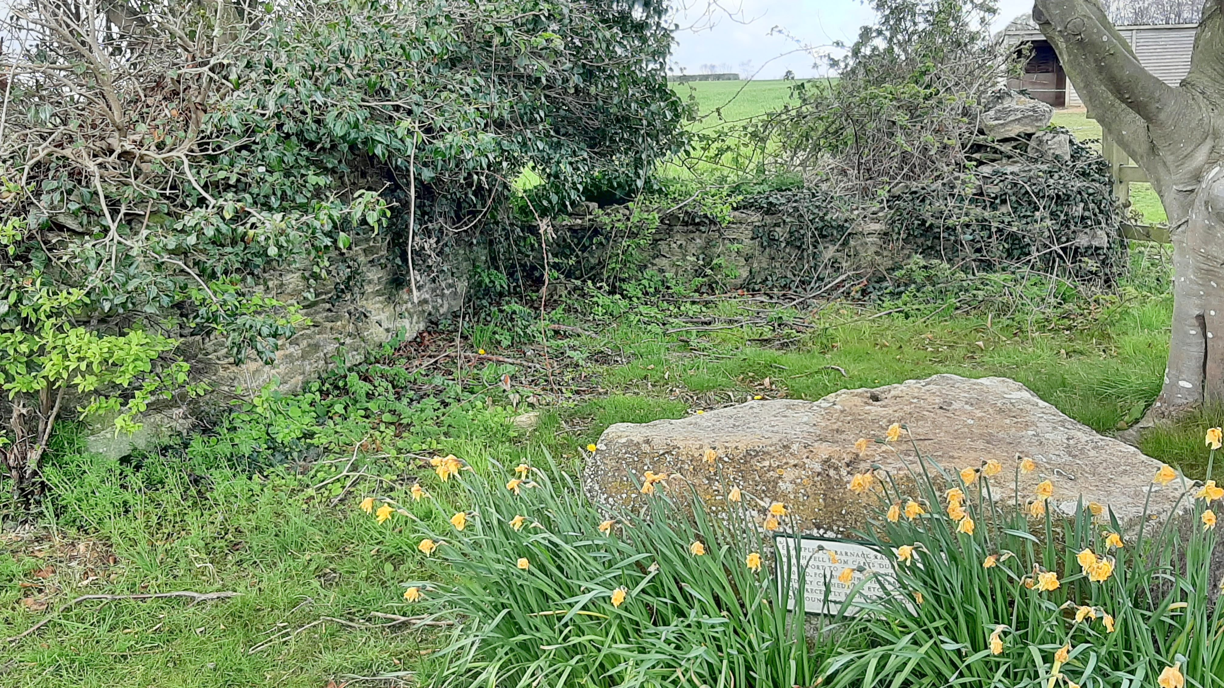
Southorpe, Peterborough, Cambridgeshire
Grid ref: 508160,302900
Possibly two walls at this site are the remains of the Pound named on the 1886 OS 1:2,500 map but this is not mentioned on a small plaque next to two large lumps of Barnack Rag Limestone. These are said to have fallen from carts whilst being taken to Peterborough during the construction of the cathedral. The quarry at nearby Barnack is now the Hills and Holes Nature Reserve. Contributed by Michael Trolove, April 2021
Southoe, Cambridgeshire
Grid ref: 518427,264357
This pound was located on Lees Lane according to the OS but no trace found. Contributed by Michael Trolove.
Spaldwick, Cambridgeshire
Grid ref: 512730,272970
This pound site now has a house named "The Pound" built on it with Pound Close adjacent reminding us of the original use of the site. Named on the 1886 OS map. Contributed by Michael Trolove, June 2021
St Ives, Cambridgeshire
Grid ref: 531197,272208
This pound stood at the corner of St Audreys Lane and Ramsey Road on the 1880 1:2,500 OS map and is remembered in the name of a residential road a block to the north named The Pouns. Contributed by Michael Trolove, June 2021
Stonely, Cambridgeshire
Grid ref: 510660,267230
This site is on Main Street and named as a pound on the 1887 OS map but now grassed over. Contributed by Michael Trolove, June 2021
Stretham, Ely, Cambridgeshire
Grid ref: 551170,2748560
Shown as a large six sided Pound on the 1887 1:2,500 OS map. Site now built upon. No trace found.
Conributed by Michael Trolove, April 2021
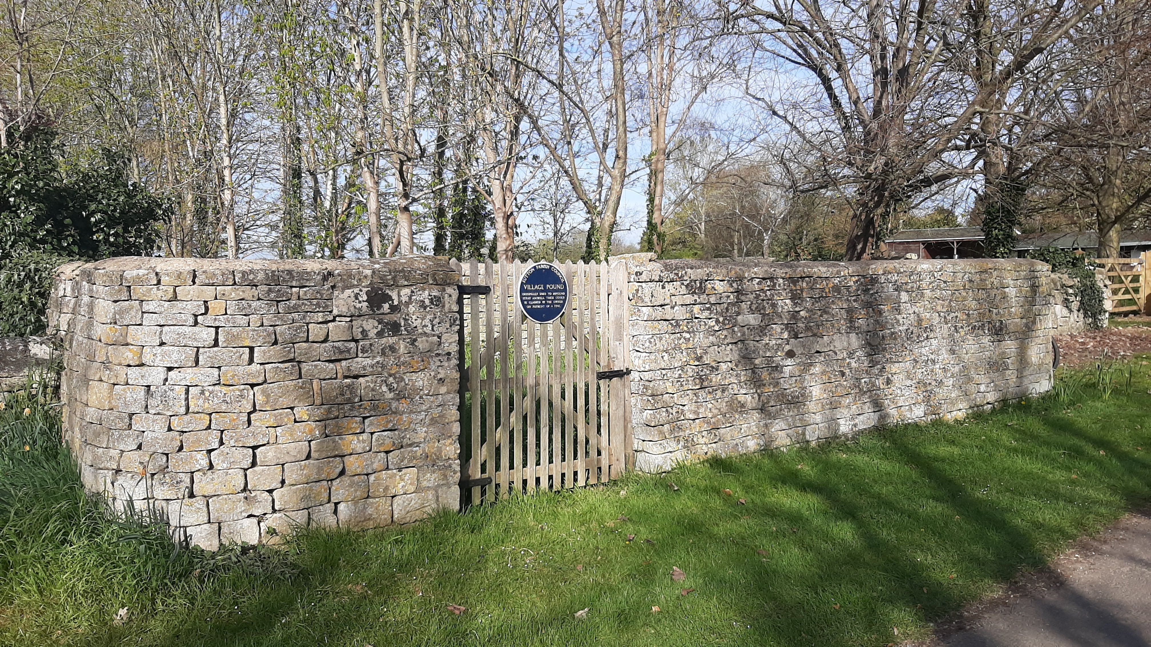
Sutton, Peterborough, Cambridgeshire
Grid ref: 509720,298940
A Grade II listed pound on the 1886 OS 1:2,500 map and kept in excellent condition by Sutton Parish Council. It is drawn on the early OS maps but not named as a pound until the 1901 edition. Standing at the roadside in The Drift it measures approx. 4mtrs by 3mtrs constructed of dressed stone with concrete capping. A plaque is proudly displayed on the wooden gate facing the road. It's proximity to Manor Farm may indicate it was a Manorial pound in its day.
Contributed by Michael Trolove, April 2021.
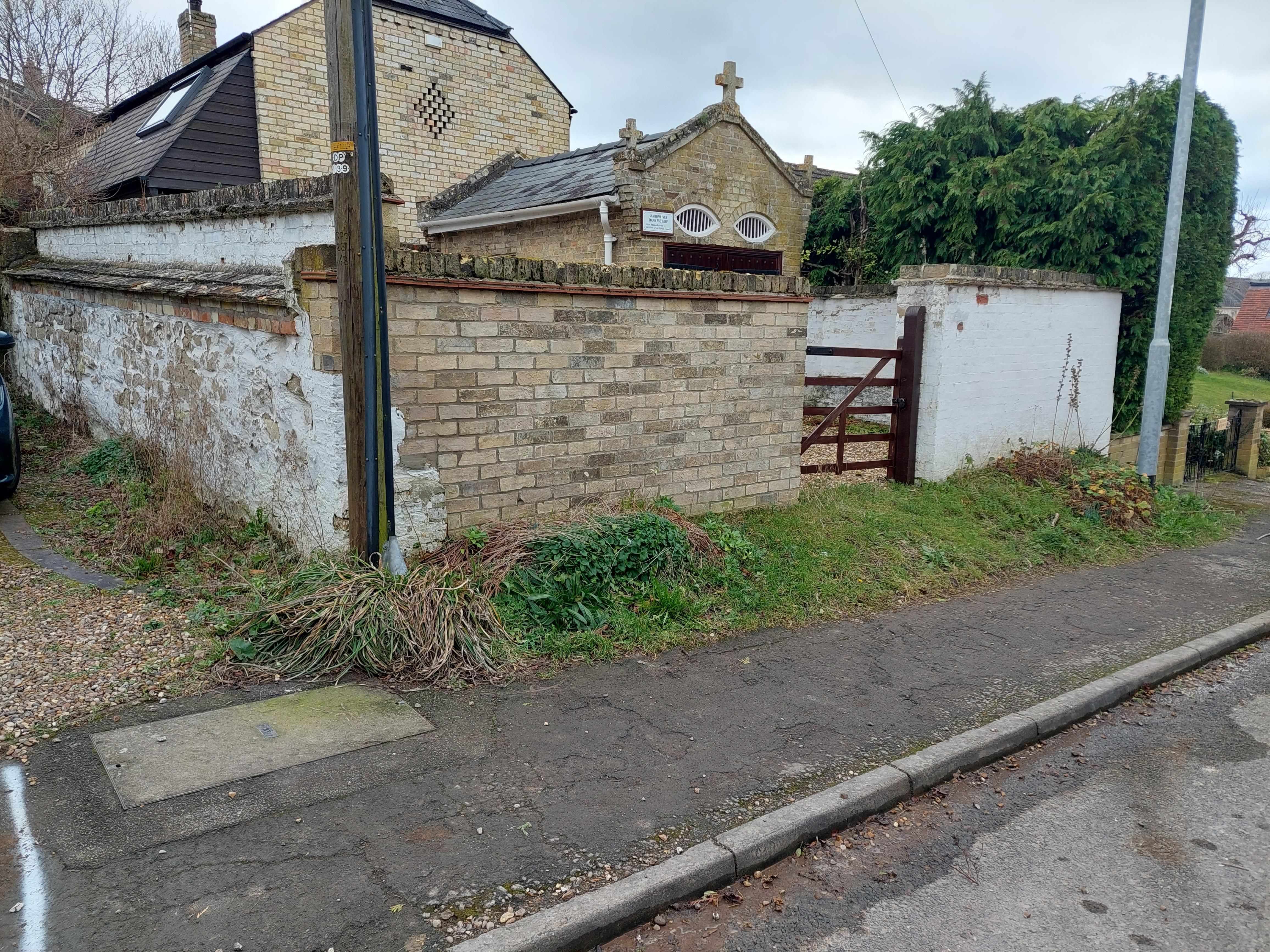
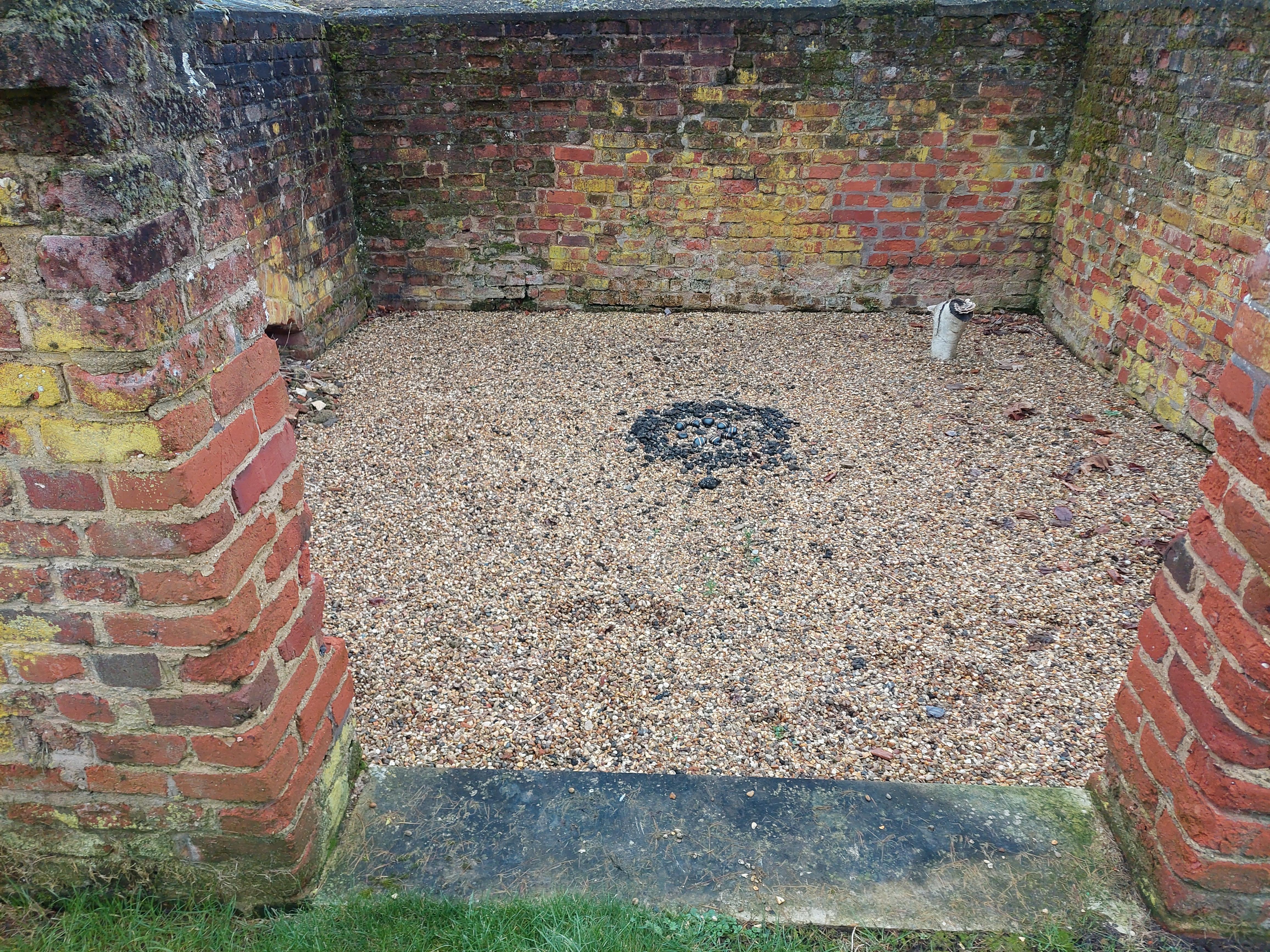
Swaffham Priory, Cambridgeshire
Grid ref: 557018,264150
Combined Pound and Lockup on the 1902 OS on Cage Hill. Walls approx. 2 mtrs high and an arae of 5mtrs by 5mtrs. Lock up features elliptical barred windows and stonework crosses on the eaves. Contributed by Michael Trolove, February 2022
Swavesey, Cambridgeshire
Grid ref: 536230,268540
A pound is named on the 1902 1:2,500 OS but not on the earlier 1886 edition but in the same spot, or adjacent to it, is named a Fire Engine House. The site is at the rear of houses so not accessible. The housing development means it has probably been demolished. The enclosure of a pound lends itself to changes of use over time and it is feasible that the pound and the fire engine house were on the same site. See Kirkby Thore, Cumbria for an example. Contributed by Michael Trolove, June 2021
Ufford, Stamford, Cambridgshire
Grid ref: 509510,303960
Shown as a rectangular pound on the 1886 1:2,500 OS map. The site is now a small amenity area with bus shelter, public seating and an established tree near modern housing at the junction of Main Street and Newport Way. No trace of the pound now exists. Contributed by Michael Trolove, Aprl 2021
West Wratting, Cambridgeshire
Grid ref: 560681,251950
On the 1886 OS map and near the junction of Hayter Close and High Street. A square brick structure with capping slabs and metal reinforcing. A very low arch, probably the water source trough. Stands approx. 1.5 mtrs high and 4 mtrs square. A Parish sign suggests that all parishioners should take ownership and care of the structure. Cotributed by Michael Trolove, January 2022
Whittlesey, Cambridgeshire
Grid ref: 527310,296470
This pound is complete and in good repair being used by the Whittlesey In Bloom group as a garden. It is an irregularly shaped pound built of brick with triangular coping, walls standing approx. 2 mtrs high. On the edge of a green amenity area on Aliwall road. Contributed by Michael Trolove, May 2021
Wilberton, Cambridgeshire
Grid ref: 548610,274880
A bit neglected but still standing is this irregularly shaped pound approx 8mtr by 10mtr with wooden gate. Found at the junction of High Street and Station Road and shown on the 18287 OS map.
Wistow, Cambridgeshire
Grid ref: 528111,281229
Shown as a pound on the 1888 1:2,500 OS map at the east end of Bridge street there is now no trace. Contributed by Michael Trolove, May 2021
Wisbech, Cambridgeshire (1)
Grid ref: 545205,209346
This site was on Barton Road but no remains exist now. Contributed by Michael Trolove, July 2022
Wisbech, Cambridgeshire (2)
Grid ref: 544970,209321
Further from the town than Wisbech (1) and on Barton Road but again no remains exist. Contributed by Michael Trolove, July 2022
Witcham, Ely, Cambridgshire
Grid ref: 546541,280224
Shown as a rectangular Pound on Back Lane on the 1887 1:2,500 OS map. No trace found. Contributed by Michael Trolove April 2021
Yaxley, Peterborough, Cambridgeshire
Grid ref: 517648,291859
Pound Lane recognises the past existence of a pound here next to the church boundary but apart from the change from stone to brick in the construction of the boundary wall there is no trace of this pound. Consistently named and shown on the earlier OS maps, then later not named and then it disappeared from the 1970's maps. Contributed by Michael Trelove, May 2021