Pounds and Pinfolds
National Register of Pounds and Pinfolds ---- Part 4
This is a WORK IN PROGRESS as I am gradually replacing the one line entries with more information and, where possible, images. If you know of a pound or pinfold listed or not listed please get in touch with me so that I can complete the Register entry. Please see my comments at the start of Register 1 to help you navigate these Registers.
Grid references: Grid reference X and Y coordinates given. For a 6 digit grid reference read e.g. 317391, 5506847 as 173506. Or enter 12 digit references in www.old-maps.co.uk or www.streetmap.co.uk. Contributions from other than the author are given for each entry.
--------------------------------------------------------------------------------------------------------------------------------------------------------------------------------------------------
Shropshire Pounds and Pinfolds
-------------------------------------------------------------------------------------------------------------------------------------------------------------------------------------------------
Somersetshire Pounds and Pinfolds
Ashfield, Oakhill, Somerset
Grid ref: 363387,147855
Shown on the 1886 OS 1,2500 map as a pound, image required.
Batheaston, Bath, Somerset
Grid ref:
This pound has been rebuilt several times most recently by The Batheaston Society in 1973. Shown on the 1885 OS 1:2,500 map. It was Grade II listed in 1983.
Kilmersdon, Radstock, Somerset
Grid ref: 369684,152249
Site of pound now a 1950's bungalow. Shown on the 1854 Country Series OS map.
Nigel Mills May 2005
Norton St Philip, Somerset
Grid ref: 377232,155801
No trace of pinfold at the site shown on 1854 County Series OS map.
Stanton Prior, Marksbury, Somerset
Grid ref: 367399,162751
Located at the roadside when approached from Marksbury this circular pound stands about 2mtrs high with a wooden lintel over the entrance. Approx 4mtrs in diameter and Grade II listed in 1985. At time of visit there was evidence of a recent repair. Not found on maps.
Nigel Mills March 2008.
Withybrook, Oakhill, Somerset
Grid ref: 365110,147257
This pound, shown on the 1888 OS 1:10,560 map, is now part of the garden of the adjacent house. It is square but losing its definition due to neglect.
Nigel Mills March 2008
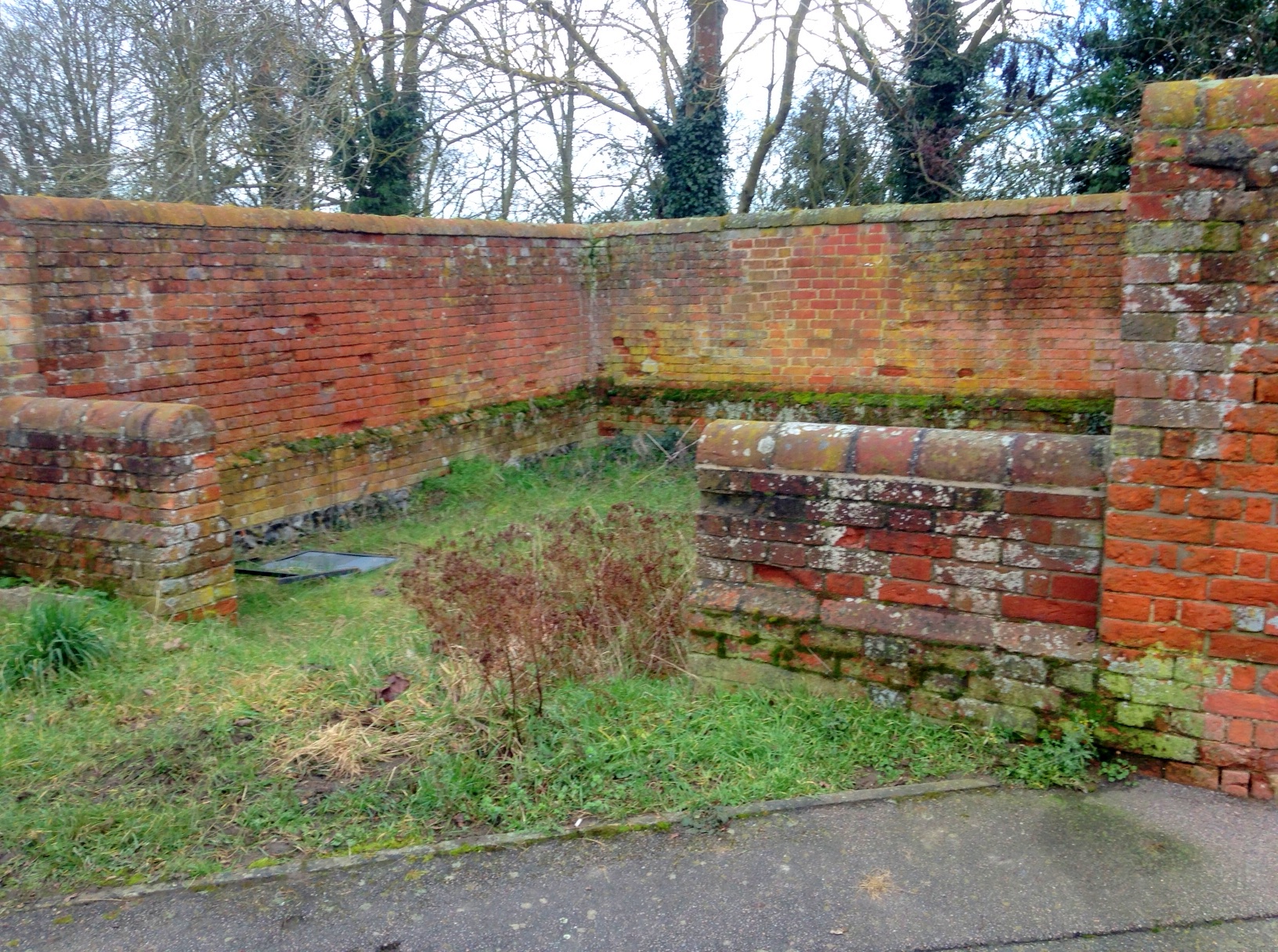
Hemington
--------------------------------------------------------------------------------------------------------------------------------------------------------------------------------------------------
Staffordshire Pounds and Pinfolds
- Lost Staffordshire Pounds and Pinfolds.xlsx
- Click here to view lost Staffordshire Pounds and Pinfolds not included below.
Blounts Green, Uttoxeter, Staffordshire
Grid ref: 407993,332532
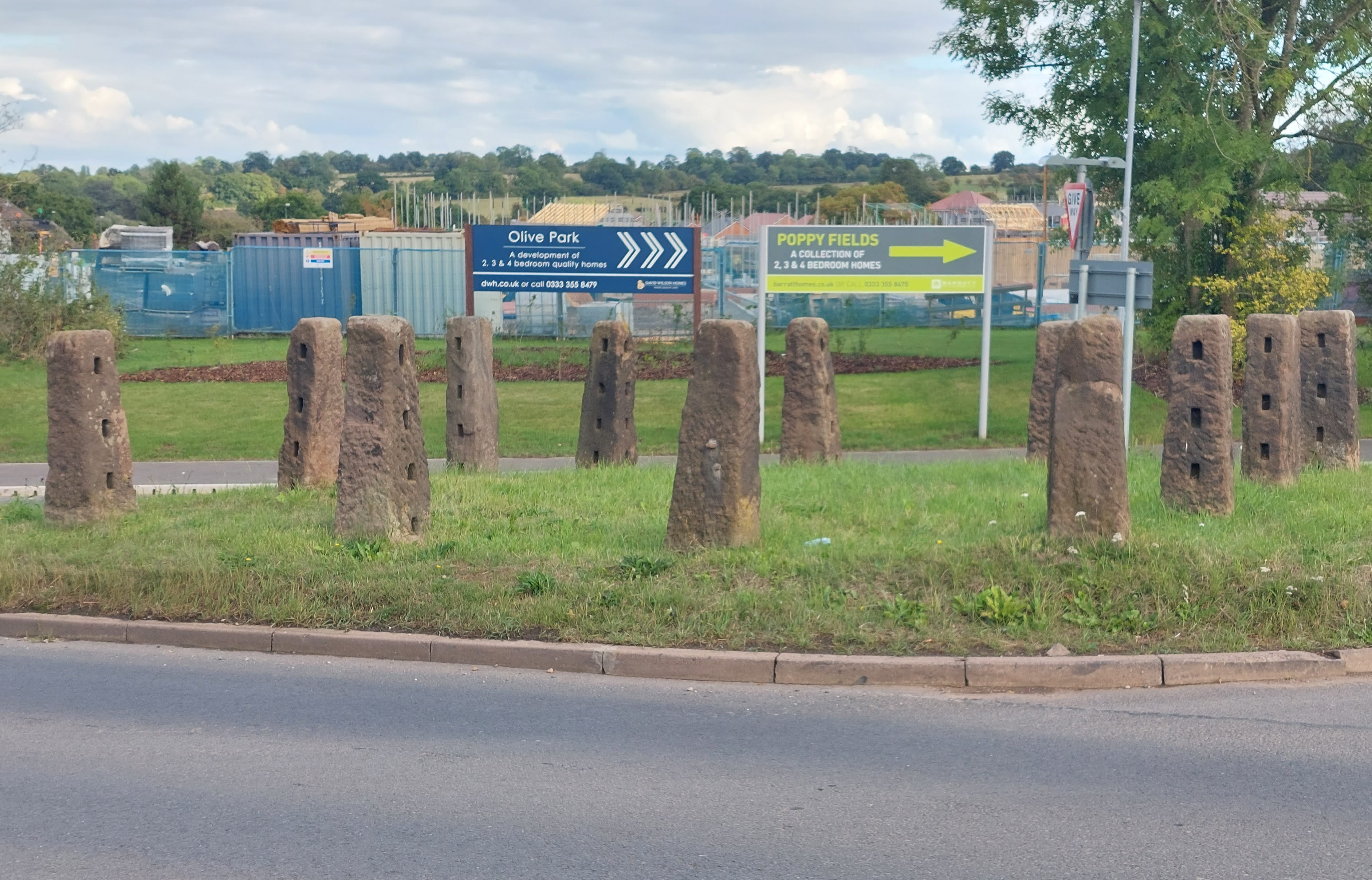
A post and rails pound is preserved on this busy junction. The posts are of Hollingstone sandstone which can be seen all around the area as gateposts. The post are notched to take wooden rails but these are missing. Measures approx. 10 mtrs square and 2 mtrs high. Shown and named on the 1901 OS map. Contributed by Michael Trolove, September 2022
Lichfield, Staffordshire
Grid ref:
--------------------------------------------------------------------------------------------------------------------------------------------------------------------------------------------------
Suffolk Pounds and Pinfolds
- Lost Suffolk Pounds and Pinfolds.xlsx
- Click on image to dowload lost sites not listed below.
Blundeston, Suffolk
Grid ref: 651442,297248
This pound is shown on the 1884 OS 1:2,500 map as a pinfold at the junction of Pound Lane with Church Street. Well maintained, high walled and circular Grade II listed structure.
Nigel Mills August 2014
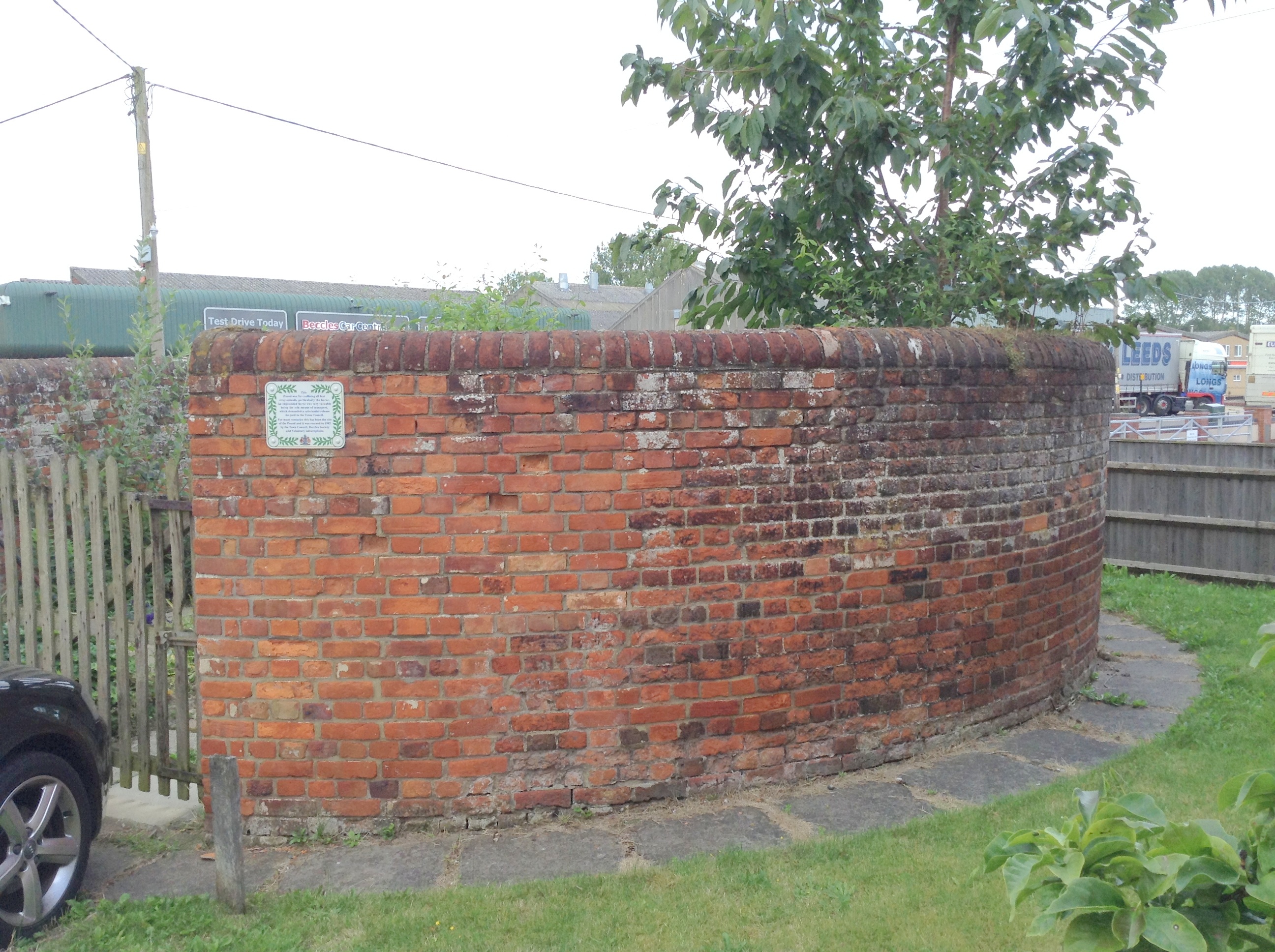
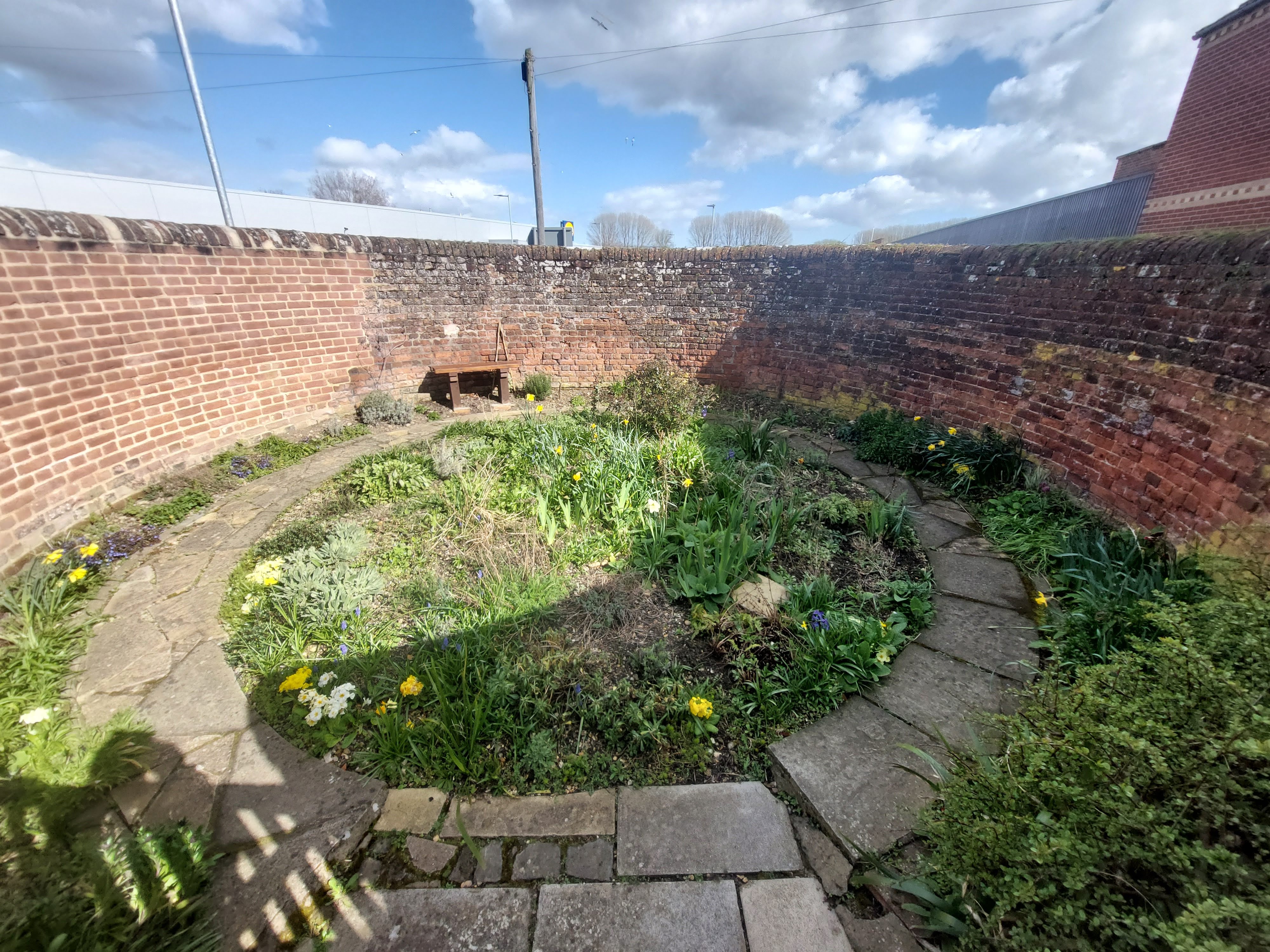
Beccles, Suffolk
Grid ref: 642368,290903
This Grade II listed pinfold is shown on the 1884 OS Town Map of Beccles and today is easily missed as it sits amongst the houses and semi industrial units of Beccles. Found at the junction of Pound Road and Common Lane North it is in great condition. It is accessible and maintained as a flower garden at the time of my visit. Nigel Mills August 2014 & Michal Trolove March 2023
Somerleyton, Suffolk
Grid ref: 648397,296476 (not verified)
This pinfold is shown on the 1884 OS 1:2,500 map and is built into the bank, remaining in good condition if a bit neglected.
Contributed by Matthew of everythingselectric.com November 2020
Walsham-le-Willows, Suffolk
Grid ref: 600829,270953
This pound is at the junction of Townhouse Rd and Jolly's Way, is Grade II listed, square and brick built with three walls 1.8mtrs high. The remaining wall is reduced in height with an open entrance. It is in good condition having been repaired by the Parish Council in 2000. Believed to be a replacement for a previous pound near the current cemetery in the village about 1817.
Contributed by Frances Jenner, January 2021
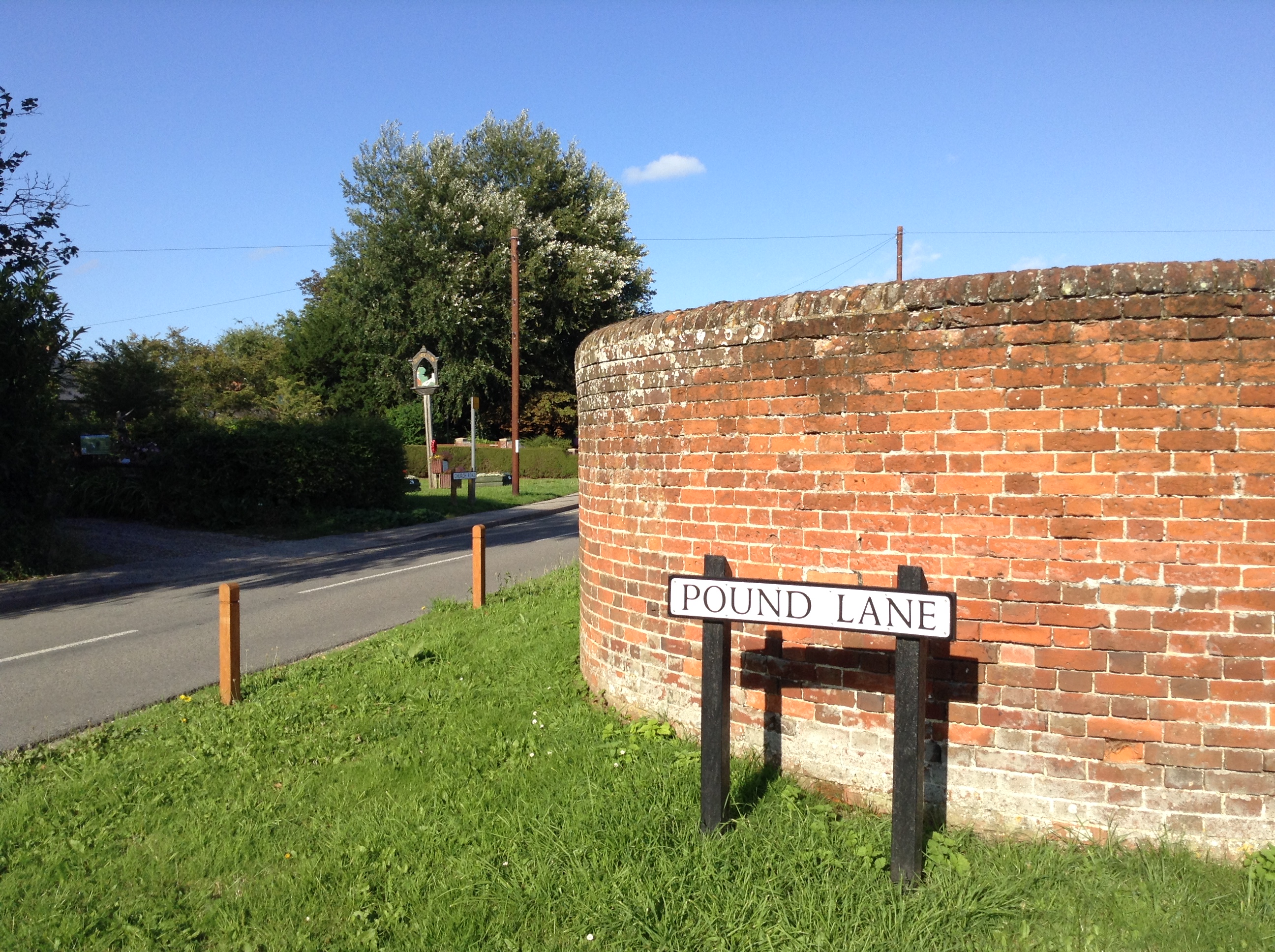
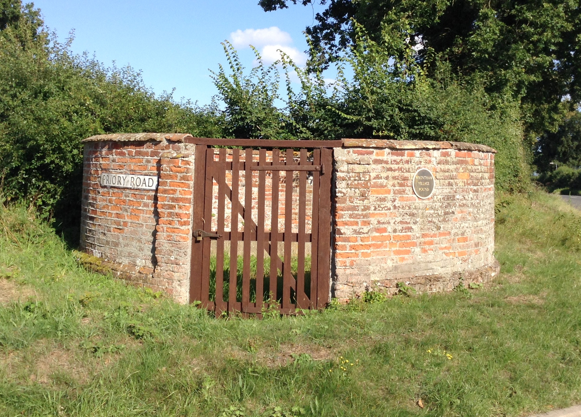
Wrentham, Suffolk
Grid ref: 649031,282938
This pound is at the junction with Chapel Road and Priory Road. It is shown on the 1884 OS 1:2,500 map as a pinfold. It is Grade II listed and a great example, well maintained with 2mtr high circular brick walls and coping stones. A simple plaque is affixed to the rhs of the padlocked wooden gate. A great shame about the road sign also affixed to this listed building!
Nigel Mills August 2014
------------------------------------------------------------------------------------------------------------------------------------------------------------------------------------------------
Surrey Pounds and Pinfolds
--------------------------------------------------------------------------------------------------------------------------------------------------------------------------------------------------
Sussex Pounds and Pinfolds
Kingston, Sussex
Grid ref
--------------------------------------------------------------------------------------------------------------------------------------------------------------------------------------------------
Warwickshire Pounds and Pinfolds
- Lost Warwickshire Pounds and Pinfolds.xlsx
- Click on image to download lost sites not listed below.
Coleshill, Warwickshire
Grid ref: 419807,289639
A square pound shown on the 1887 OS map but the suspected site is now a piece of land with a couple of trees and some shrubs. Contributed by Michael Trolove
Kingsbury, Warwickshire
Grid ref: 421701,296505
On the 1887 OS map located on Tmworth Road but now a garden to the row of cottages adjacent. A capped wall here may be part of the original pound. Contributed by Michael Trolove, June 2022
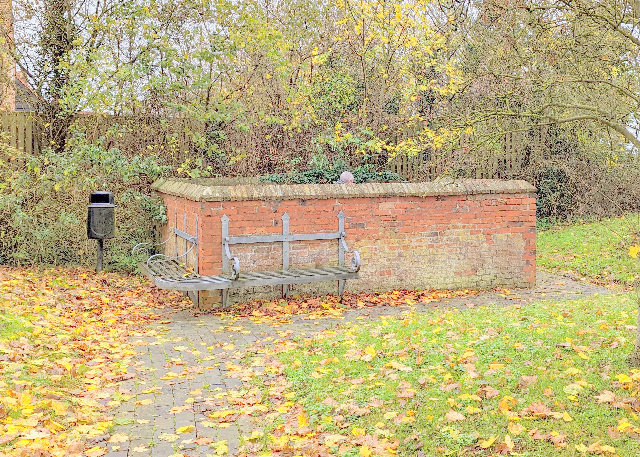
Clifford Chambers, Stratford upon Avon, Warwickshire
Grid ref: 419401,252456
Clearly shown on the 1884 OS map as a square pound it still exists on a piece of amenity land and is well maintained. It is a brick structure with coping. An accompanying interpretive panel plaques adds context and an explanation of its original funcion. It is on Milcote Road close to its junction with Clifford road just north west of the main village.
Contributed by Rachel Hazley November 2022
Wiltshire Pounds and Pinfolds
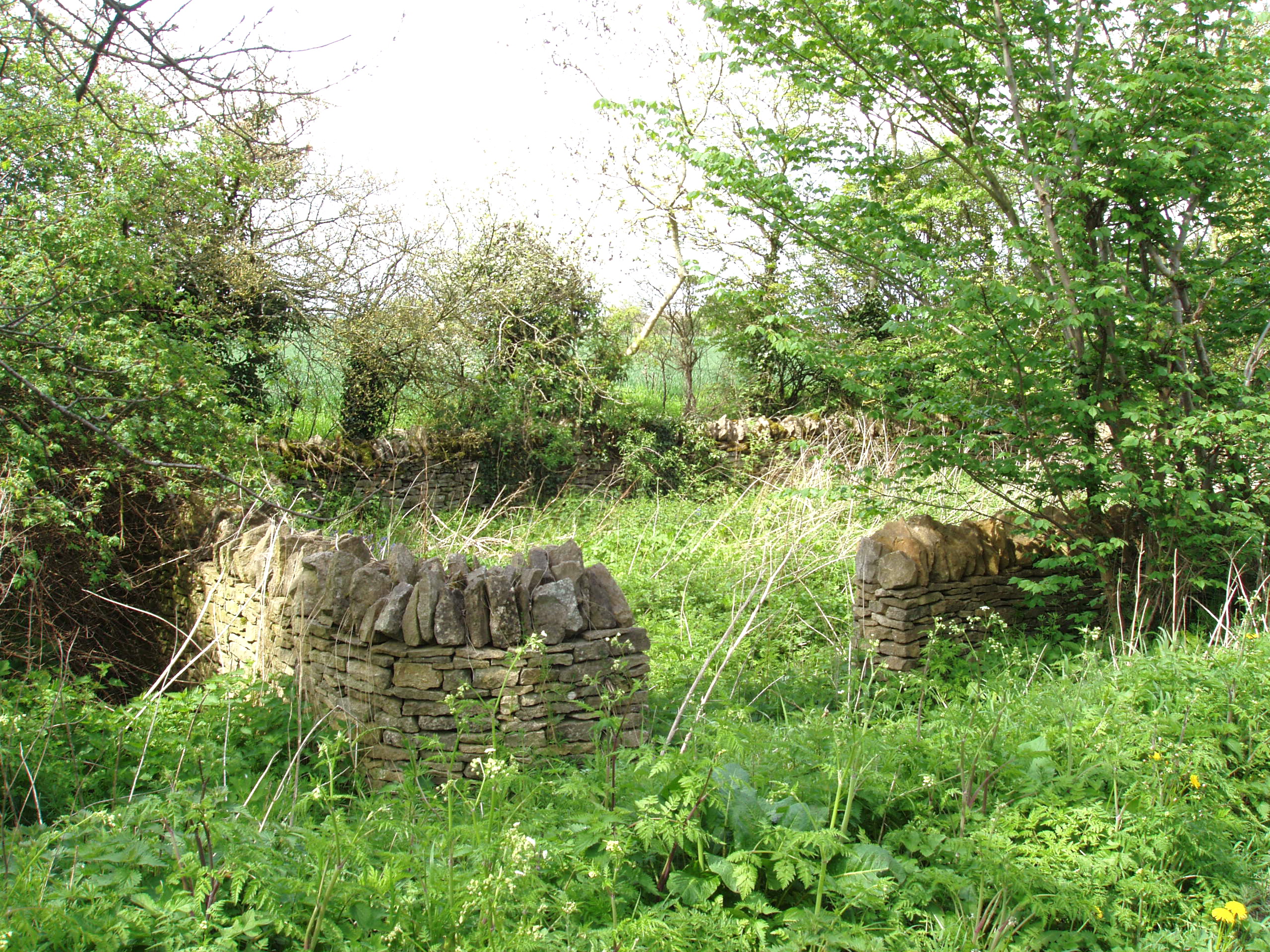
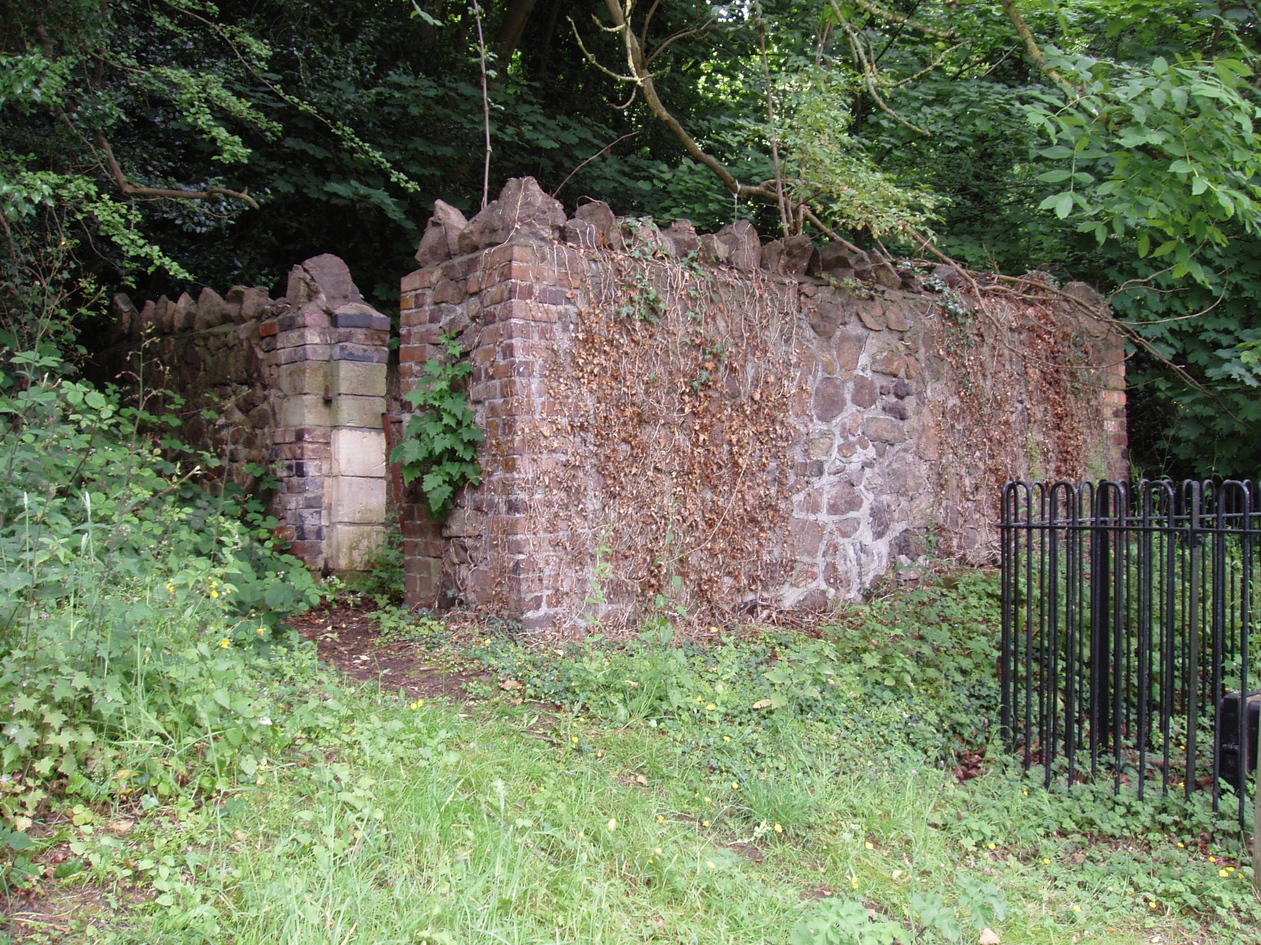
Crudwell, Wiltshire
Grid ref: 395776,193483
This pound is hidden amongst the undergrowth, at a level below the road, at the west side of the A429 just north of Crudwell. It is rectangular with walls at 1.5 mtrs constructed of drystone with on edge coping. Repaired in 1987 and Grade II listed in 1988. It is shown as a pound on the 1885 OS 1: 2,500 map.
Nigel Mills May 2006
Worcestershire Pounds and Pinfolds
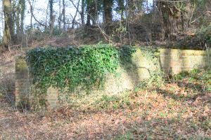
Great Malvern, Worcestershire
Grid ref:
Would appreciate dimensions,
location and any other info on this structure
please.
Sambourne, Worcestershire
Grid ref: 406085,261827
On the 1884 map as a rectangular pound on the village green. The village green is still a green space and at the centre of the village but the pound has ceased to exist. Contributed by Michael Trolove, July 2022
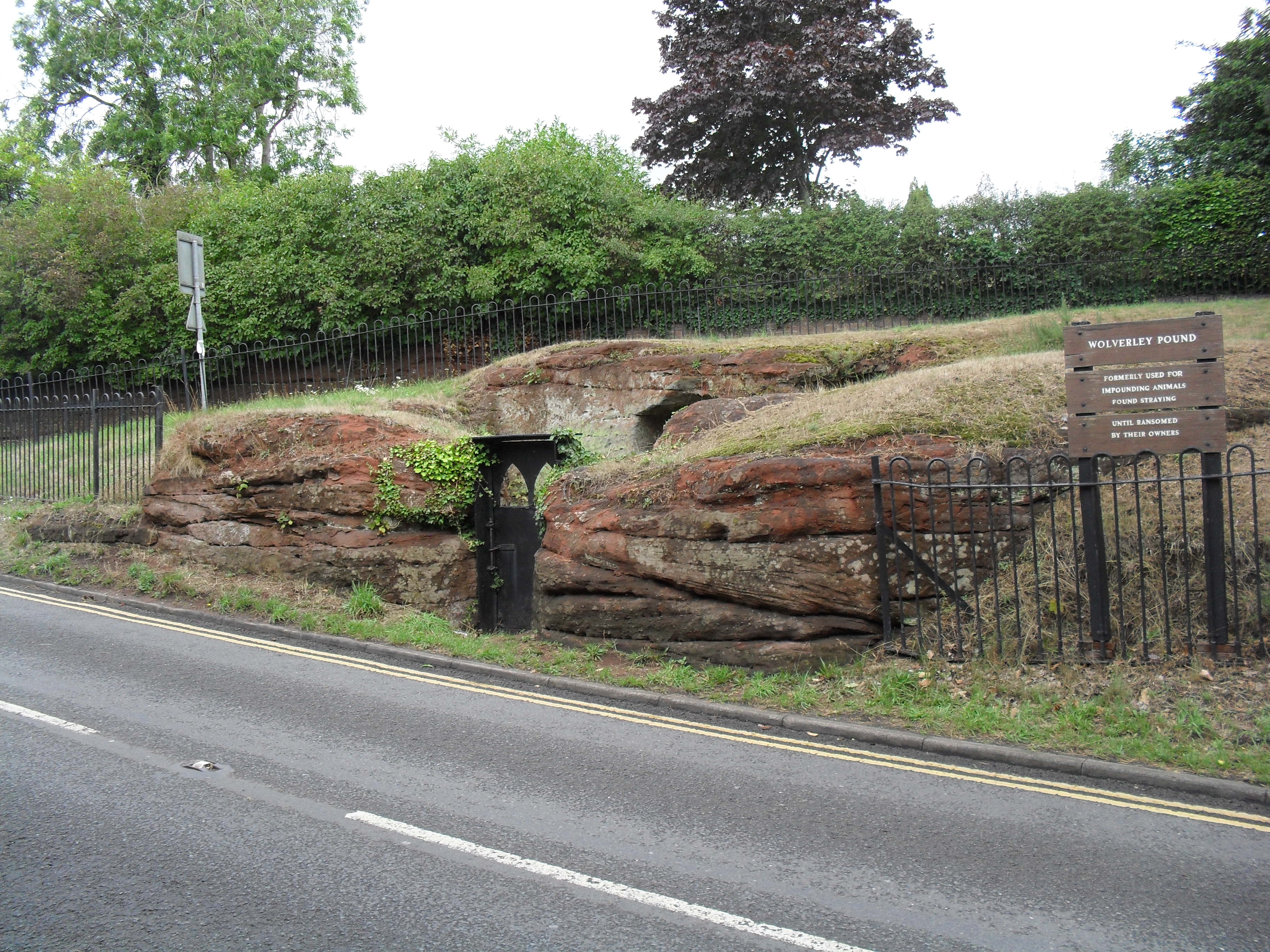
Wolverley, Worcestershire
Would appreciate dimensions, location and any other info on this structure please.