Pounds and Pinfolds
National Register of Pounds and Pinfolds ---- Part 3
This is a WORK IN PROGRESS as I am gradually replacing the one line entries with more information and, where possible, images. If you know of a pound or pinfold listed or not listed please get in touch with me so that I can complete the Register entry. Please see my comments at the start of Register 1 to help you navigate these Registers.
Grid references: Grid reference X and Y coordinates given. For a 6 digit grid reference read e.g. 317391, 5506847 as 173506. Or enter 12 digit references in www.old-maps.co.uk or www.streetmap.co.uk. Contributions from other than the author are given for each entry.
------------------------------------------------------------------------------------------------------------------------------------------------------------------
Merseyside Pounds and Pinfolds
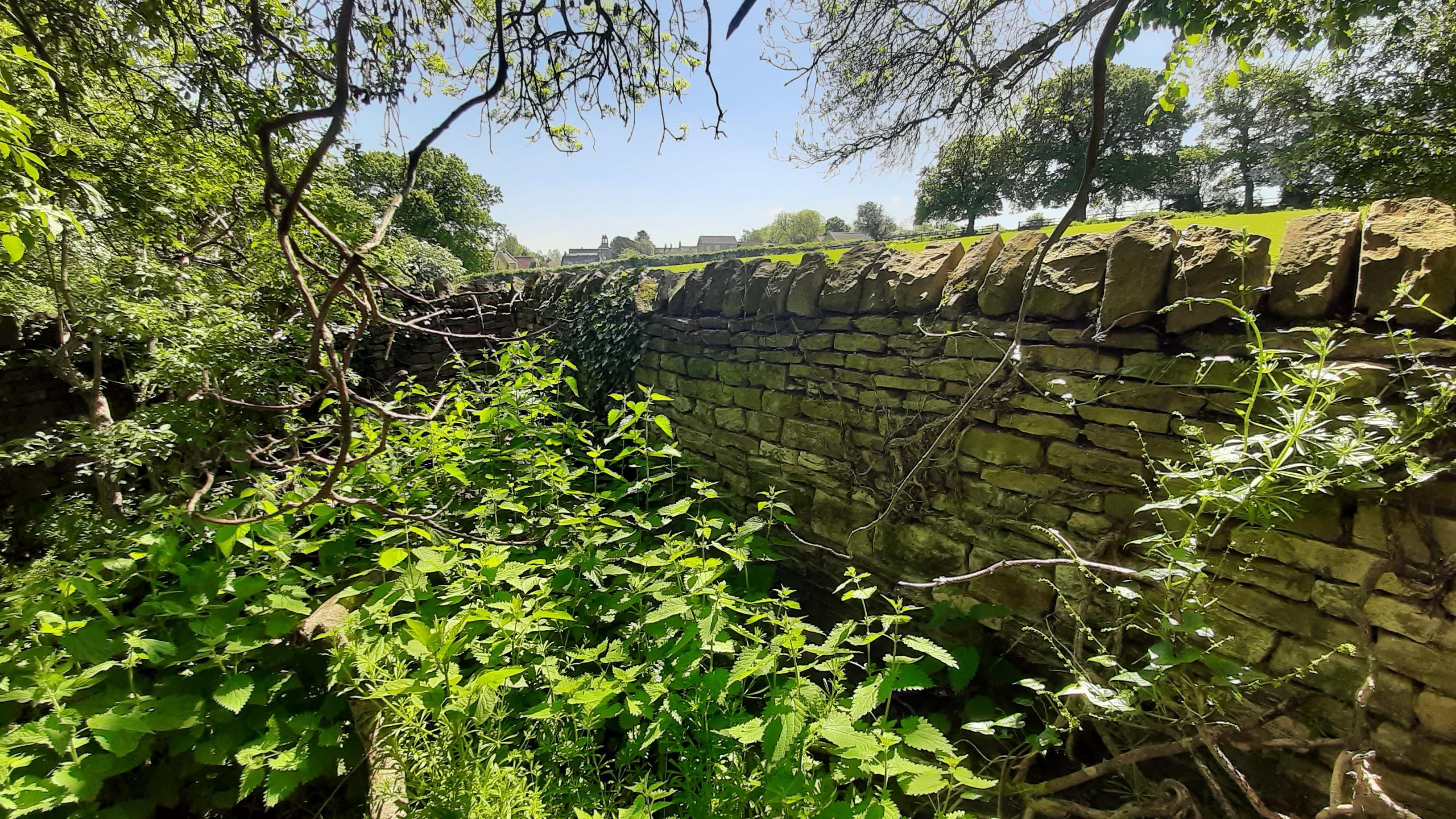
Spital, Bebington, Merseyside
Grid ref: 333108,383202 (not confirmed)
An irregularly shaped stone pinfold with triangular coping and is Grade II listed. Just west of the junction of Church Road with Brimstage Road on north side. Interior has a sunken trough for watering. Maintained by the Borough Council.
Contributed by Dick Fowler March 2008
-------------------------------------------------------------------------------------------------------------------------------------------------------------------------------------------------
Middlesex Pounds and Pinfolds
Harmondsworth, Hillingdon, Middlesex
Grid ref: 505678,177759
A Scout hut at this location has a sign on it that reads "Pound". Not found on any OS maps. Contributed by Michael Trolove May 2022
------------------------------------------------------------------------------------------------------------------------------------------------------------------------------------------------
Norfolk Pounds and Pinfolds
Denver, Norfolk
Grid ref: 561013,301409
Now an open area, either a green or common, which has 4 mature tress standing on the site shown on the 1886 OS map in Sluice Road. Contributed by Michael Trolove, October 2022
Dersingham, Norfolk
Grid ref: 569374,330482
Named as a Pinfold on the 1884 OS map and as a Pound on the 1905 version it is now lost. It is shown as a near circular structure, the site being in the corner of a paddock, just a few hundred yards from the tithe barn.
Docking, Burnham Market, Norfolk
Grid ref: 576359,336598
Measuring about 7 paces by 8 paces the Pound is located on the village side of the cross roads and at the western end of the village. Sharing its location with the village lock up both historic structures are in good repair. The pound walls have been lowered to ease maintenance issues and the front wall removed. The base area has been given over to a low growing shrub garden with a visitor seat amongst the foliage. The Pound is built in local stone. Contributed by Michael Trolove, November 2022
Heacham, Norfolk
Grid ref: 567762,337561 (suggested)
A Pound Lane exists but evidence of their being an actual pound nearby has not been found. Contributed by Michael Trolove, November 2022.
Can anyone help identift the site please?
Hilgay, Norfolk
Grid ref: 562111,298324
Clearly shown on the 1886 OS map as a pound in Church Road. A row of cottages with differing wall heights on the road frontage seem alighned with the walls of the pound but no confirming eveidence found. Contributed by Michael Trolove, October 2022
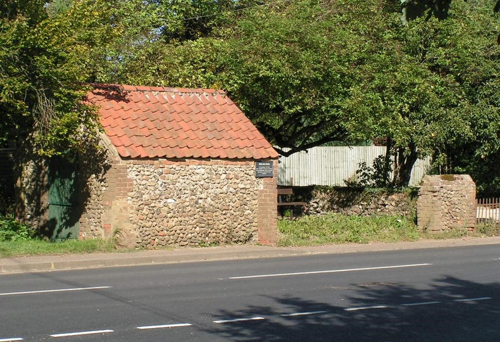
North Elmham, Norfolk
Grid ref: 598675,322080
On the junction of Great Heath Road and Broom Green Road just north of North Elmham this pinfold is in excellent condition, shown on the 1892 OS 1:10,560 map. It is square with walls approx 2mtrs high with a wooden wicket style gate.
Contributed by Colin Sinnot March 2008.
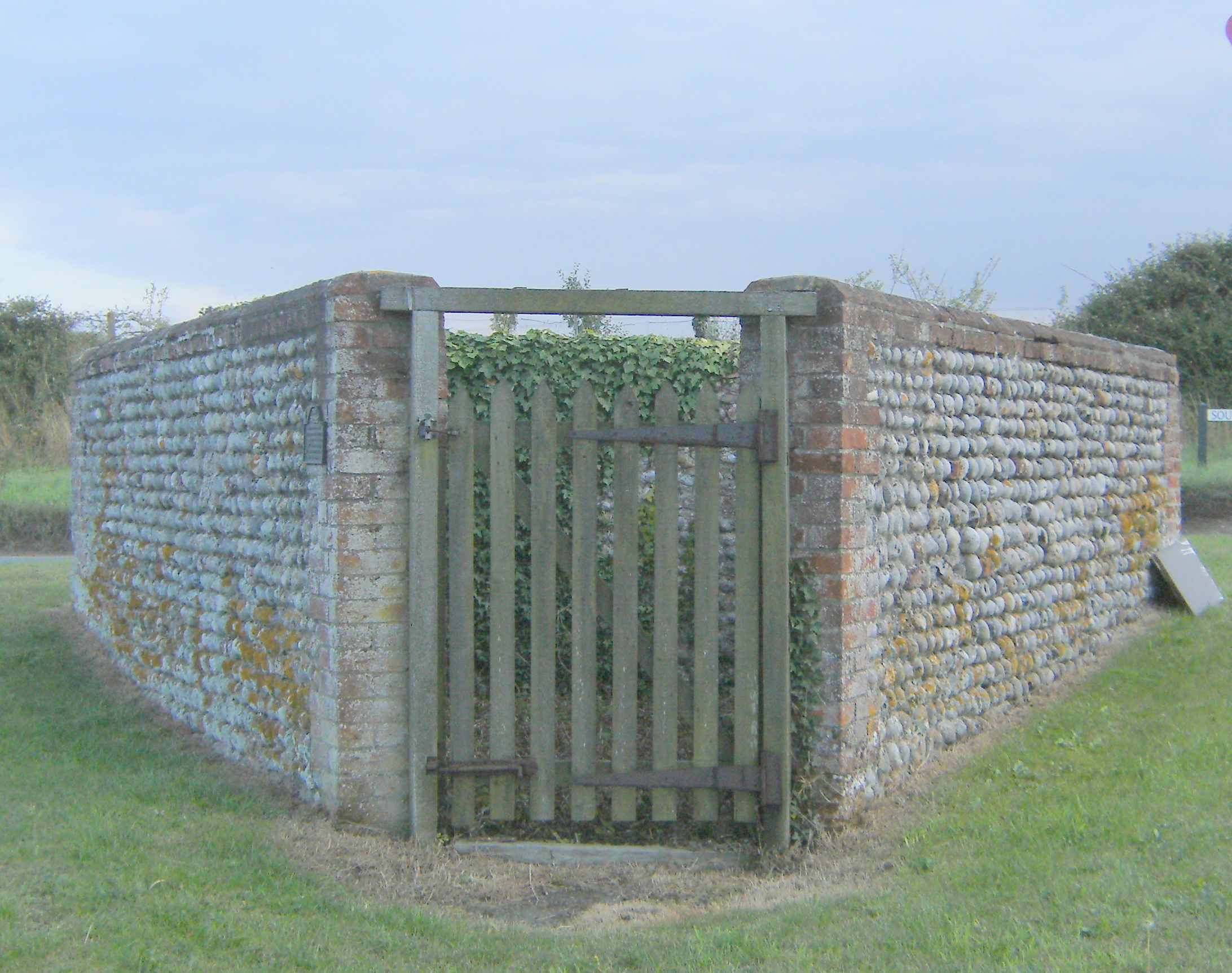
Gimingham, Norfolk
Grid ref: 628362,336064
This unique pound is triangular about 1.5mtrs high walls and a gate at its north point. It is exceptionally small for a pound and kept in great condition. English Heritage state it is Grade II liste, early C19, built of flint with brick dressings and brick quoins and coping. It is situated where Trunch Road and Church Street meet on a cross roads just south of the village of Gimingham.
Shimpling, Norfolk
Grid ref: 615577,282983
Not found on any OS map but a sign at this grid ref reads "site of historic village pound". Contributed by Michael Trolove July 2021
Southery, Norfolk
Grid ref: 562116,294592
This square pound is shown on
the 1886 OS map in Churchgate Street but has been lost. Contributed
by Michael Trolove, October 2022
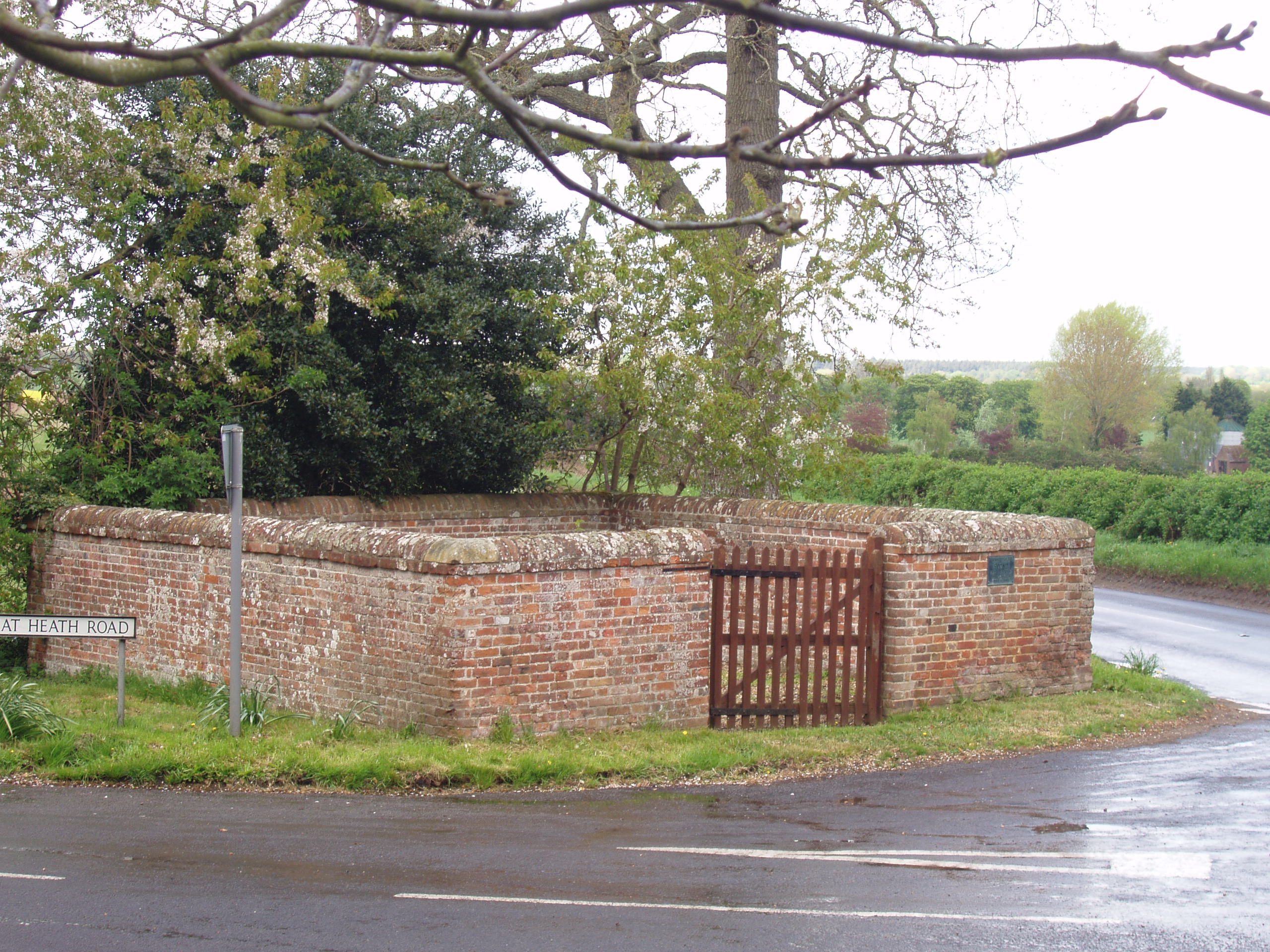
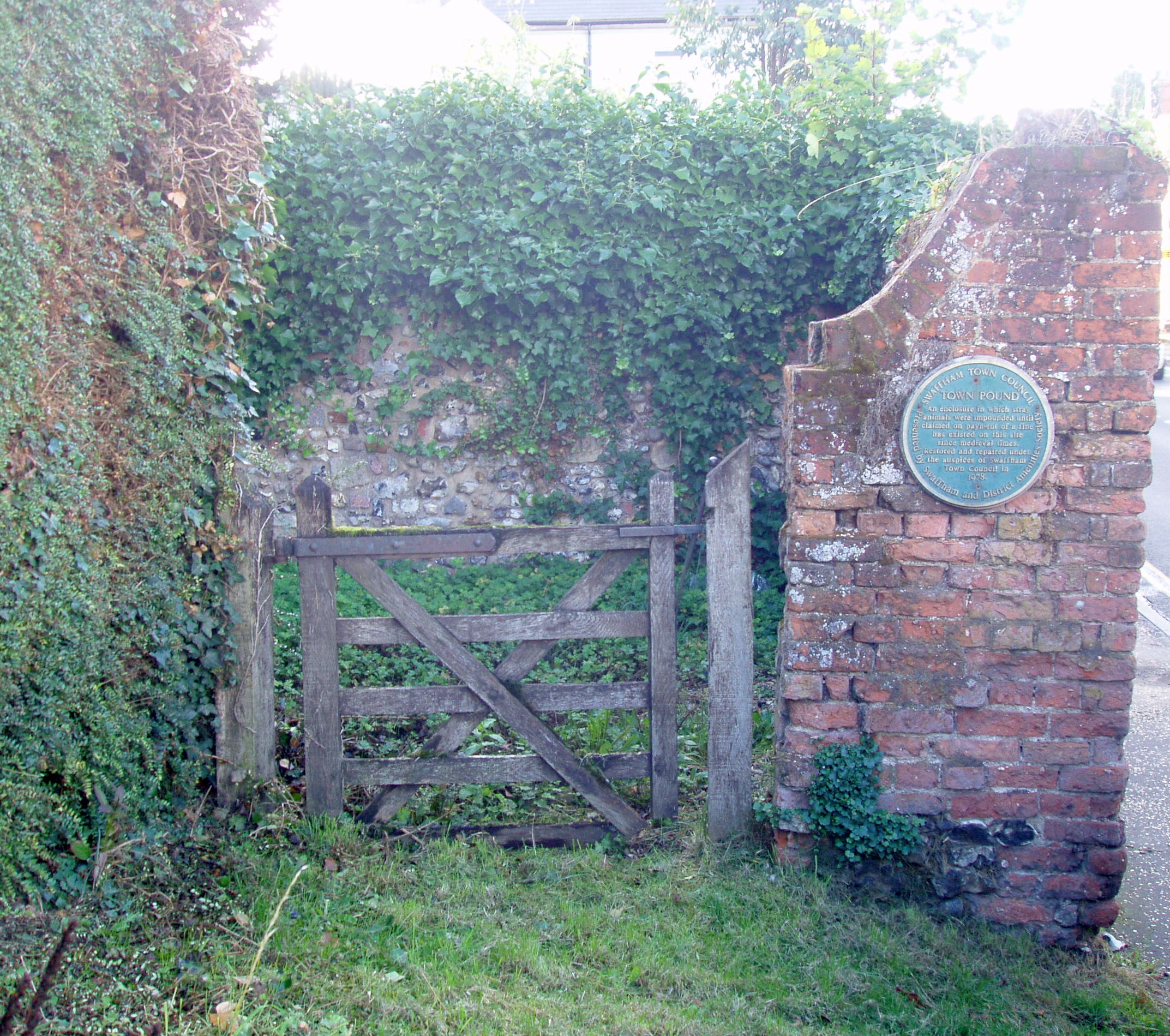
Swaffham, Norfolk
Grid ref: 582076,309055 (Approx)
Described as a Grade II listed Town Pound on the plaque erected by the council who restored it in 1978. English Heritage date it at c1730 and describe it as made of whole and cut flints with brick quoins and dressings. Modern gate gives access to this square pound in need of attention when visited. It is on Mangate street towards the town end, not identified on OS maps.
Nigel Mills September 2013
-------------------------------------------------------------------------------------------------------------------------------------------------------------------------------------------------
Northamptonshire Pounds and Pinfolds
- Lost Northamptonshire Pounds and Pinfolds.xlsx
- Click on icon to dowload sites lost and not listed below.
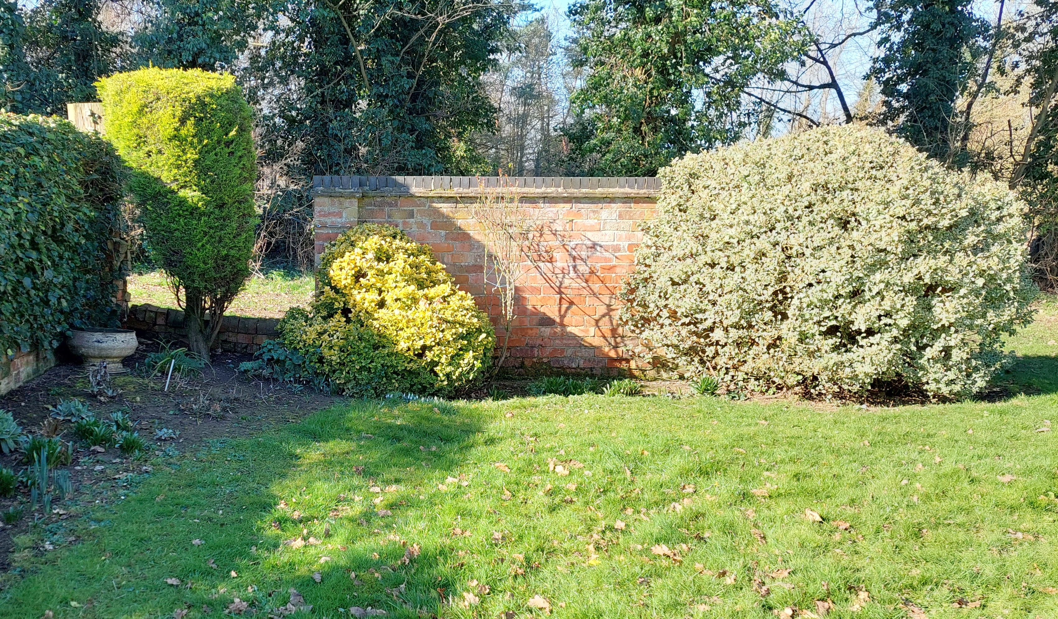
Apethorpe, Peterborough, Northamptonshire
Grid ref: 502370,295700
This pound is named and the site indicated by an arrow on the 1886 OS 1:2,500 map pointing to a small field enclosure. Secure fields were occasionally used to confine animals if the structural pound was in poor condition or the original site had been developed for other purposes, usually housing towards the end of the era of the pound. In this case the field was then developed for housing and a cottage stands on the site at the junction of Main Street and Estate Yard.
Contributed by Michael Trolove, April 2021
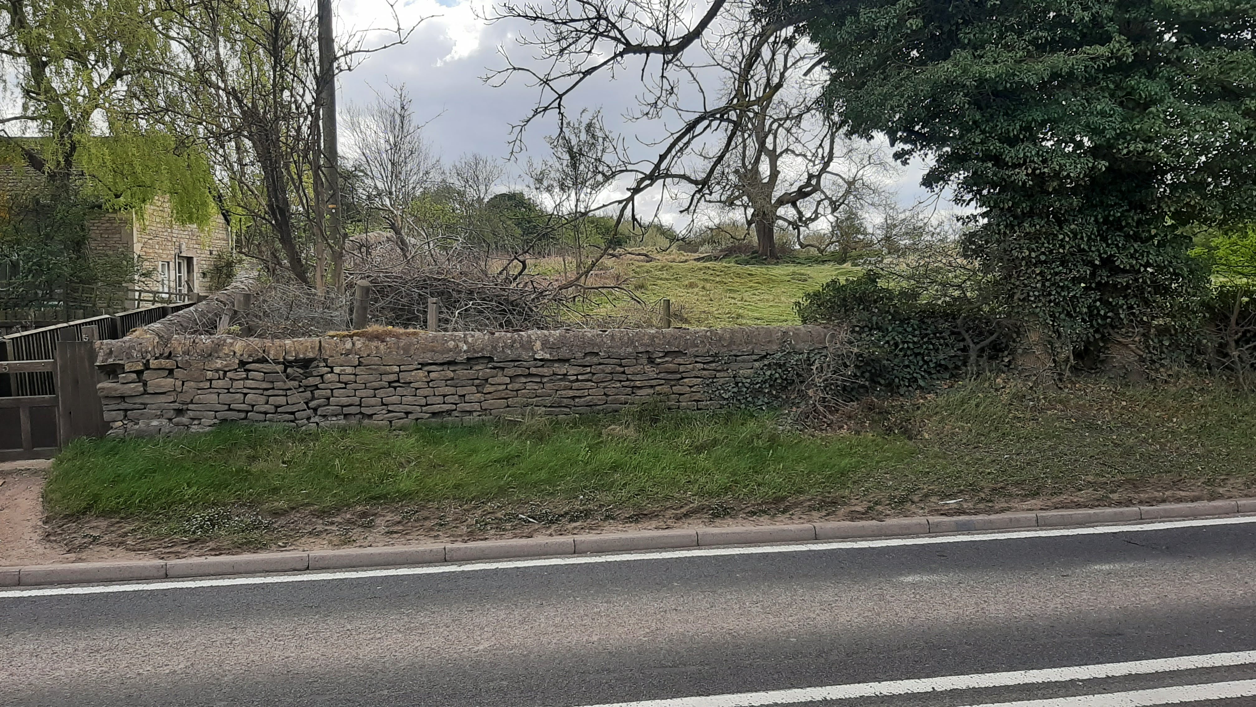
Barrowden, Northamptonshire
Grid ref: 494718,300076
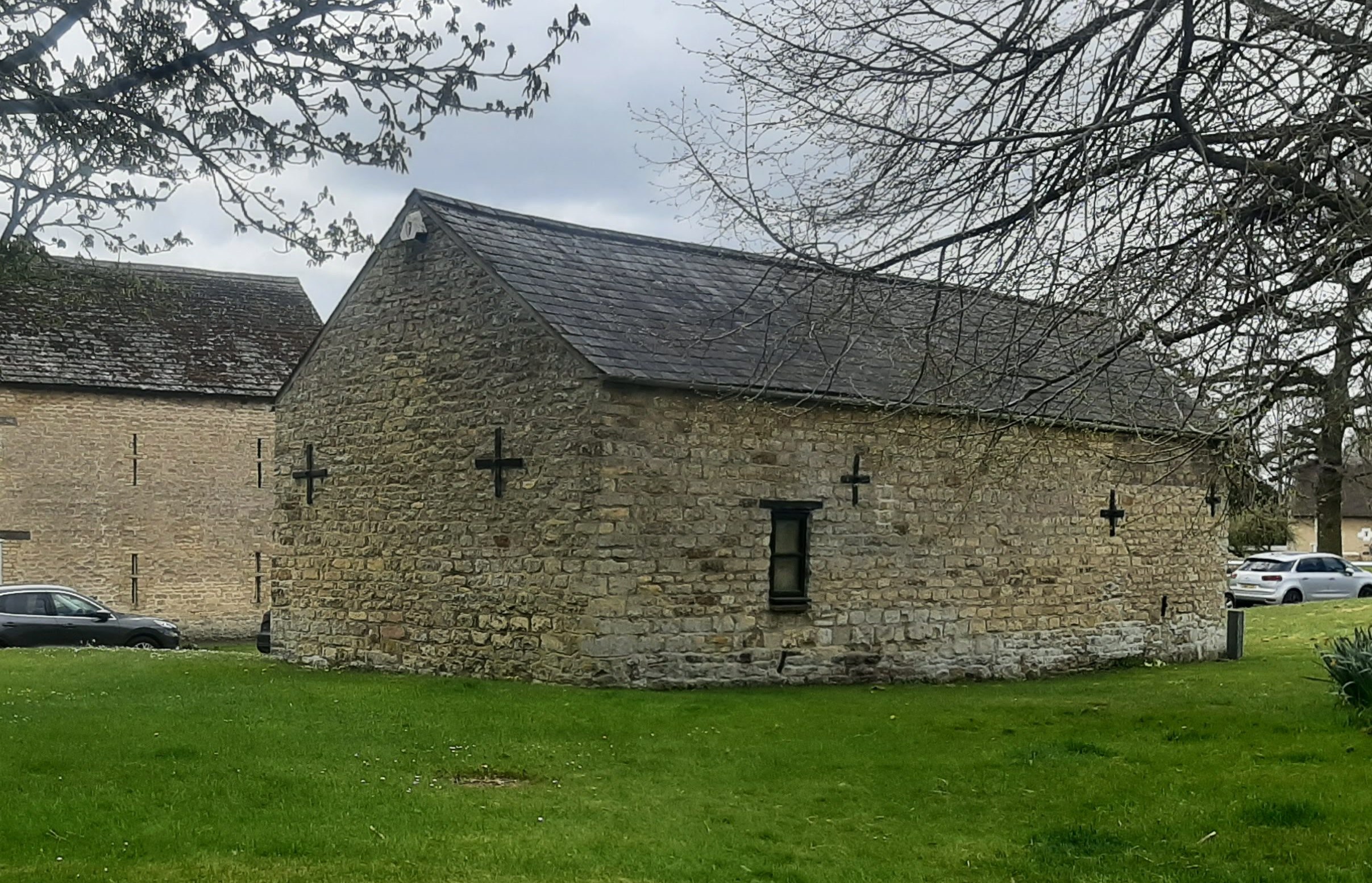
This village has a "pinfold" rather than a pound, as most are known in this county, on the 1886 OS 1:2,500 map. It was large, irregularly shaped and adjacent to the smithy on the common in the old centre of the village. Although not consistently named the outline of the pinfold remained on the OS maps for many years but had disappeared by the OS 1970 revision. No trace remains but smithy building, see image, is still remains in this well kept village popular with walkers. Contributed by Michael Trolove April 2021
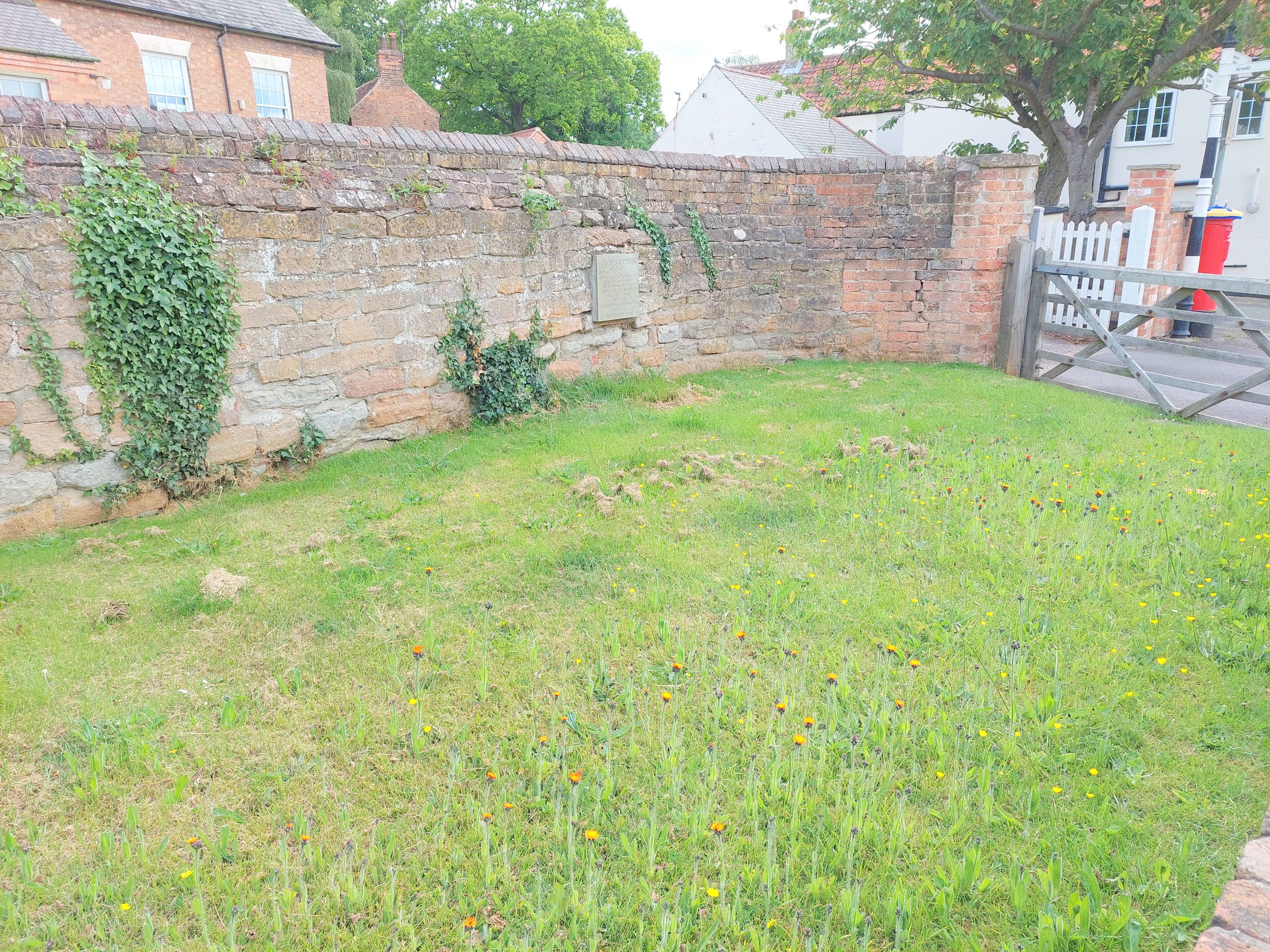
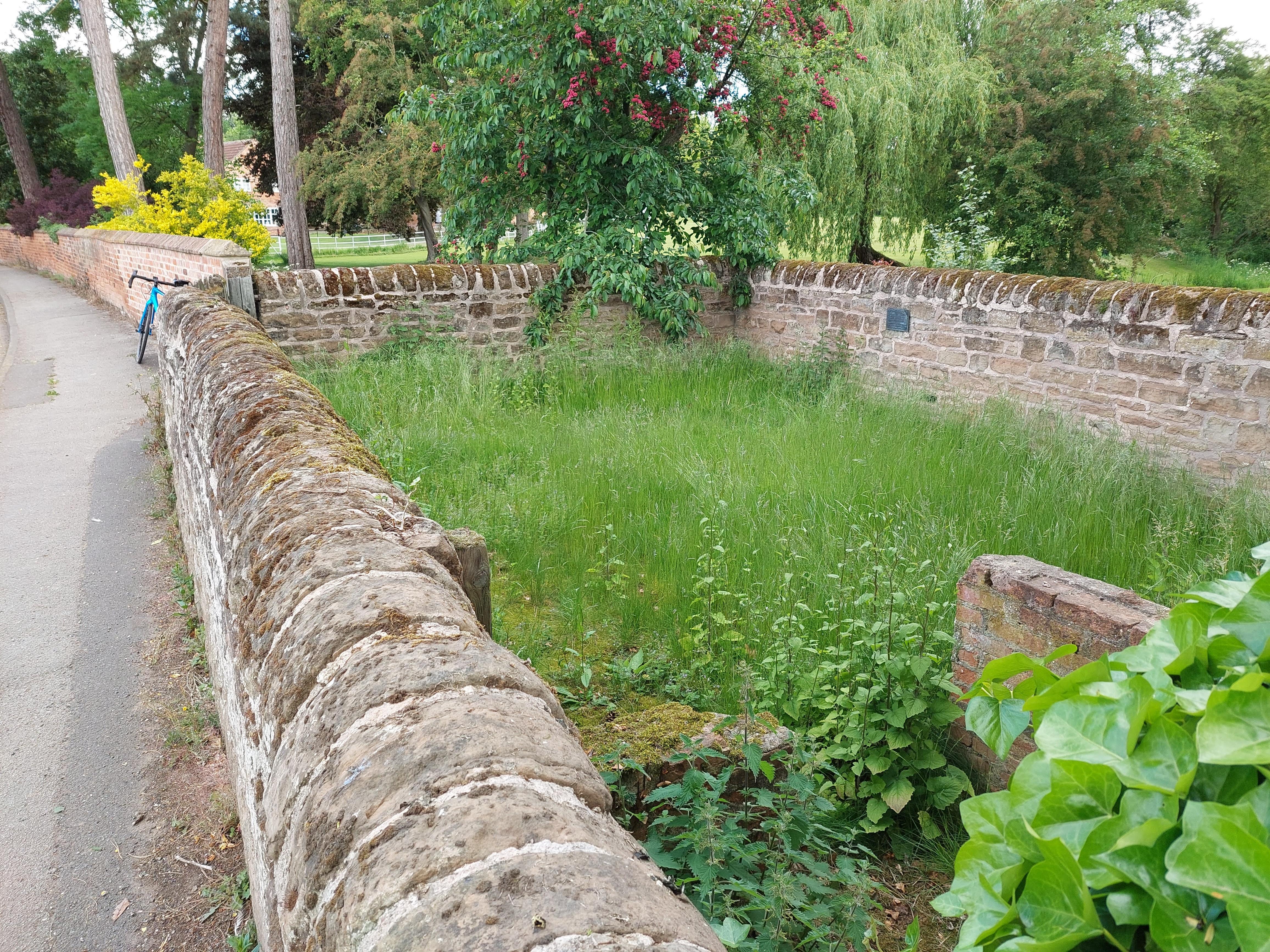
Brigstock, Northamptonshire
Grid ref: SP 94702 85455
The pound located on what was the village boundary is on Benefield Road. As on the early OS maps it has one wall utilising the cottage garden wall and a long curved wall now with a wooden gate. A sign attached recognises the structure as the Village Pound. Contributed by Michael Trolove, January 2023.
Charlton, Northamptonshire
Grid ref: 452900,236114
Although on the 1884 OS as a pound only a dry stone wall, if that, remains. Contributed by Michael Trolove, April 2022
Chelveston, Northamptonshire
Grid ref: 499040,269380
Pound is shown on 1886 OS map in Higham Road but no trace now at the site. Contributed by Michael Trolove, June 2022
Collyweston, Northamptonshire
Grid ref: 499541,302685
Although existing corner walls beteen the A43 Main Road and The Walks appear to mirror the outline of the pound shown on OS maps the development of the road system here, raising the road level, indicats that this is unlikely. However the pound is clearly shown on OS from 1885 through to 1958 even after the school was built set back from the roadway on Pinfold Paddock in 1911. Cotributed by Michael Trolove, April 2021
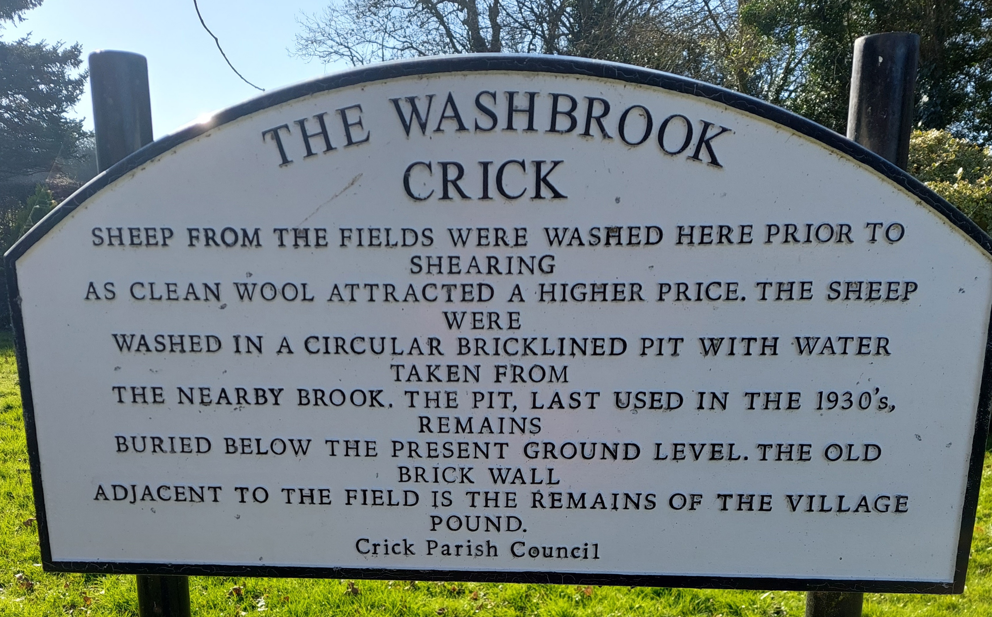
Crick, Northamptonshire
Grid ref: 458796,272311
Although only one brick wall of the pound remains it is adjacent to a sheep wash and both are mentioned on the interpretive plaque at this heritage spot together with a nearby milestone. Contributed by Michael Trolove, February 2022.
Duddington, Northamptonshire
Grid ref: 498890,300490
This pound was situated to the south of the village where High Street meets the main A43. Shown on the earliet 1886 OS map and later ones up to 1958. Road improvements on the A43 probably caused its removal before the issue of the 1975 OS map of the area. Site is now a grassed area allowing clear visibility for traffic. Contributed by Michael Trolove, April 2021
Easton on the Hill, Stamford, Northamptonshire
Grid ref: 501599,304287
Unusually for the OS this pound is marked on maps but not named as a pound until the 1900 OS 1:2,500 map. It is adjacent to the old school, now a private residence, near the junction of Racecourse Road with Stamford Road. Recognisable as a pound but shows signs of some alteration to the walls. Contributed by Michael Trolove, April 2021
Farthingstone, Northamptonshire
Grid ref:561578, 255203
Although shown on the 1884 OS map no trace coule now be found. Contributed by Michael Trolove, May 2022
Great Brington, Northamptonshire
Grifd ref: 466593,264984
Named on the 1884 OS map but site now a domestic house on a road named The Pound. Contributed by Michael Trolove, February 2022
Great Easton, Northamptonshire
Grid ref: 484913,293008
Named as a pound on the 1886 1:2,500 OS map on High Street opposite to the junction with Church Bank. Possibly part of two walls still exist but unconfirmed.
Contributed by Michael Trolove, April 2021
Great Weldon, Northamptonshire
Grid ref: 493027,289465
Lost now but the pound is on the 1885 OS map as a rectangular structure. Contributed by Michael Trolove, July 2021
Gretton, Northamptonshire
Grid ref: 489710,294100
Another pound lost to housing. Located at the junction of Arnhill Road and The Maltings. Shown on the 1886 OS 1:2,500 map but no tace found.
Contributed by Michael Trolove, April 2021
Kings Cliffe, Peterborough, Northamptonshire
Gris ref: 500710,297030
This pound is named on the 1:2,500 OS maps up to 1901 but no later, indicating it met its demise around then as the area developed. No trace of it now exists apart from a corner of it in an image held in the archive of Kings Cliffe Heritage.org. Contributed by Michael Trolove, April 2021
Little Weldon, Northamptoshire
Grid ref: 492318,289736
A pound on the 1885 OS map, the site is now occupied by housing perhaps needed when the nearby steel town of Corby developed. Contributed by Michael Trolove, July 2021
Maidford, Northamptonshire
Grid ref: 460797,252670
Pound on the 1884 OS map indicates the area of the site on Townend but nothing to confirm its present existence could be found. Contrinbuted by Michael Trolove, May 2022
Nether Heyford, Northamptonshire
Grid ref: 466052,258402
Noted on OS maps but could not be definitely located on the roadway named The Pound on the south side of The Green. Contributed by Michael Trolove, May 2022
Newborough, Northamptonshire
Grid ref: 521671,305121
Originally place well out of the village but now no trace exists having given up the site to the A15 road. Contributed by Michael Trolove, April 2022
Rockingham, Northamptonshire
Grid ref: 486608,291965
Although shown on the OS maps from the earliest in 1886 up to the 1958 edition it is not on the OS Plan of 1967. Road re-alignments in the 1960's appears to have been its downfall and trees now grow on the site. Contributed by Michael Trolove, April 2021
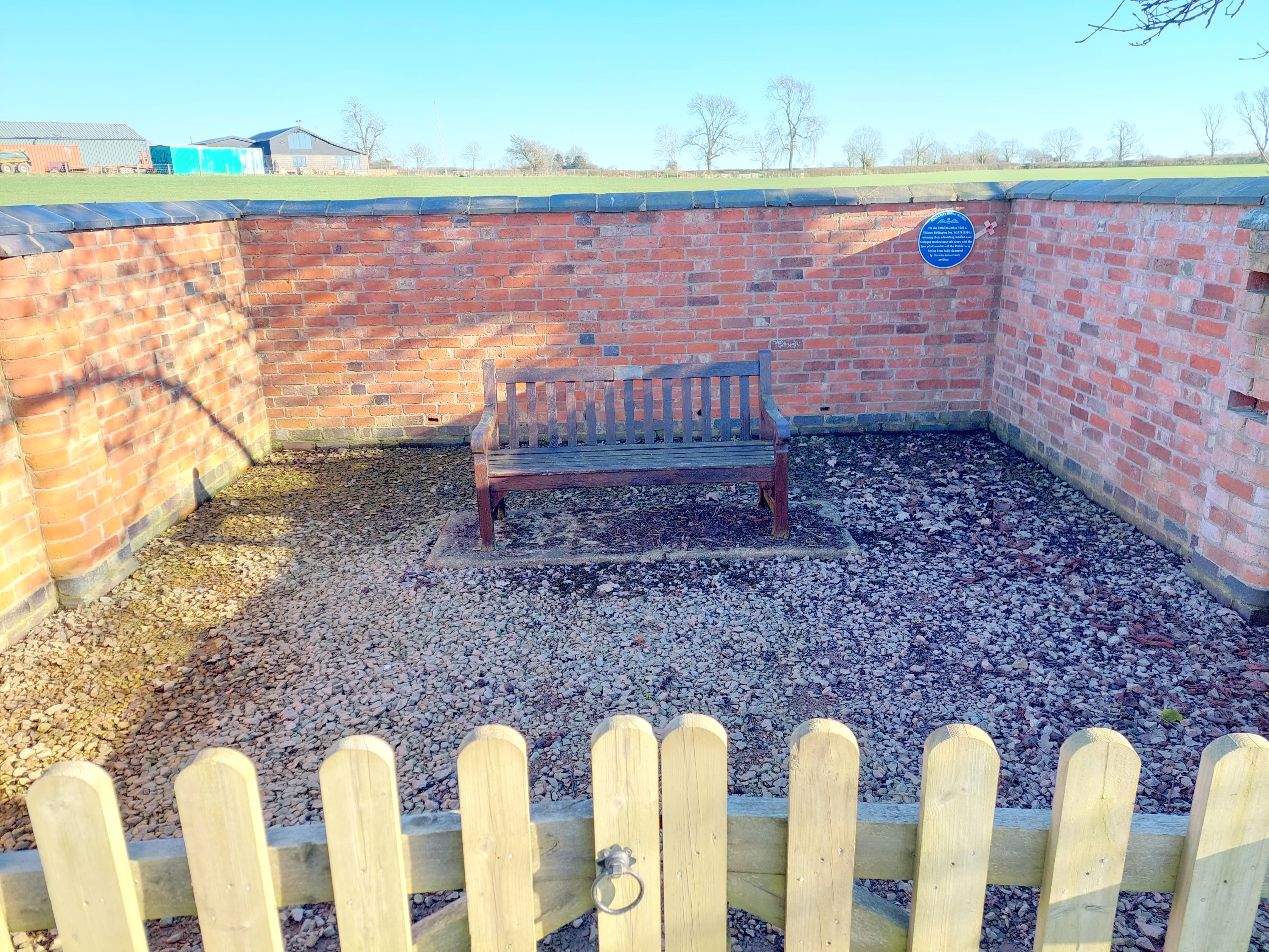
Sibbertoft, Northamptonshire
Grid ref: 468004,282463
A well maintained pound shown on the 1885 OS and still inexistence on Church Street. Lowered front wall has made it suitable for the interior bench and a blue plaque remembers the RAF Halifax bomber which crashed nearby. Contributed by Michael Trolove, February 2022

Southwick, Northamptonshire
Grid ref: 502050,292060
The site of this pinfold named on the 1886 1:2,500 OS map appears to have been incorporated into the graveyard of St Mary the Virgin Church, the war memorial and seats added later to a small piece of adjacent land alongside access to the Rockingham Forest.
Contributed by Michael Trolove, May 2021
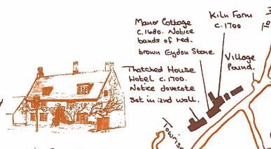
Sulgrave, Northamptonshire
Grid ref: 556080,299893
Does not appear on any viewed OS map but it is noted on the history map on display in the village. It is shown on Manor Road near Manor Cottage indicating its original status as a Manorial Pound. No trace now exists. Contributed by Michael Trolove, May 2022
Tansor, Northamptonshire
Grid ref: 505790,290640
The site of this pound is shown on the 1900 1:2,500 OS map and is now the location of Tansor Village Hall on Main Street. No trace of pound now exists. Contributed by Michael Trolove April 2021
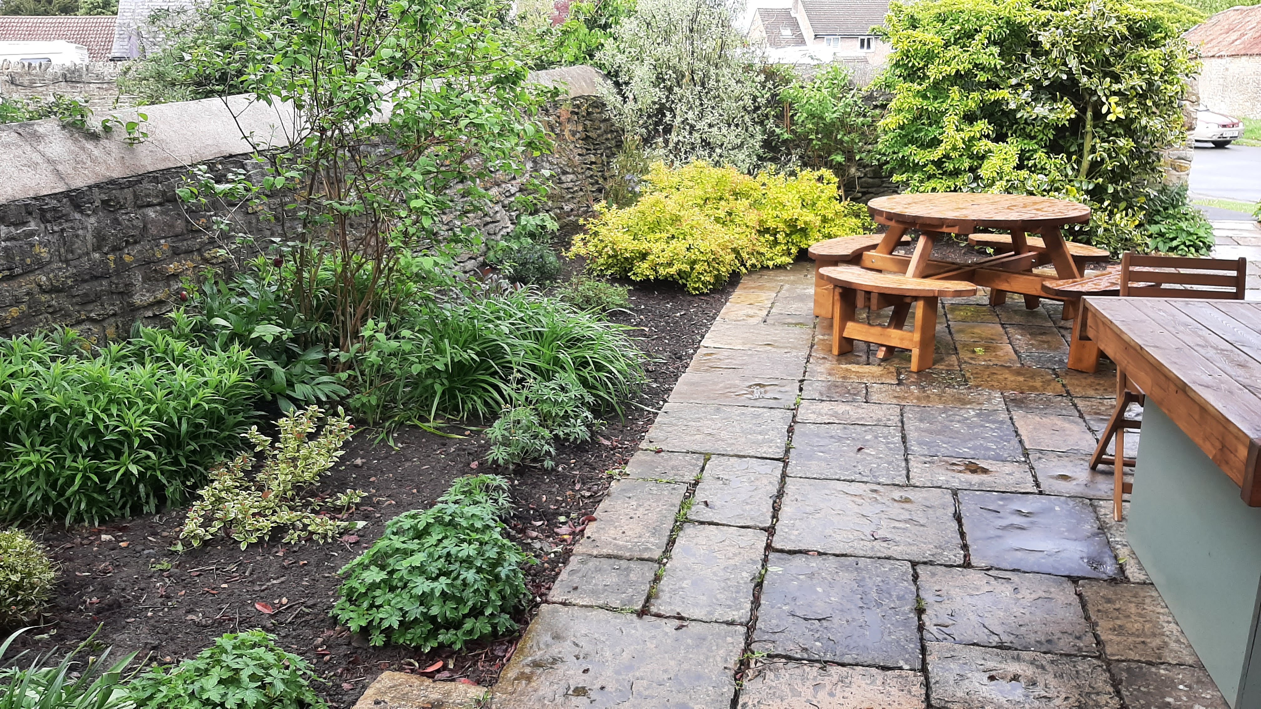
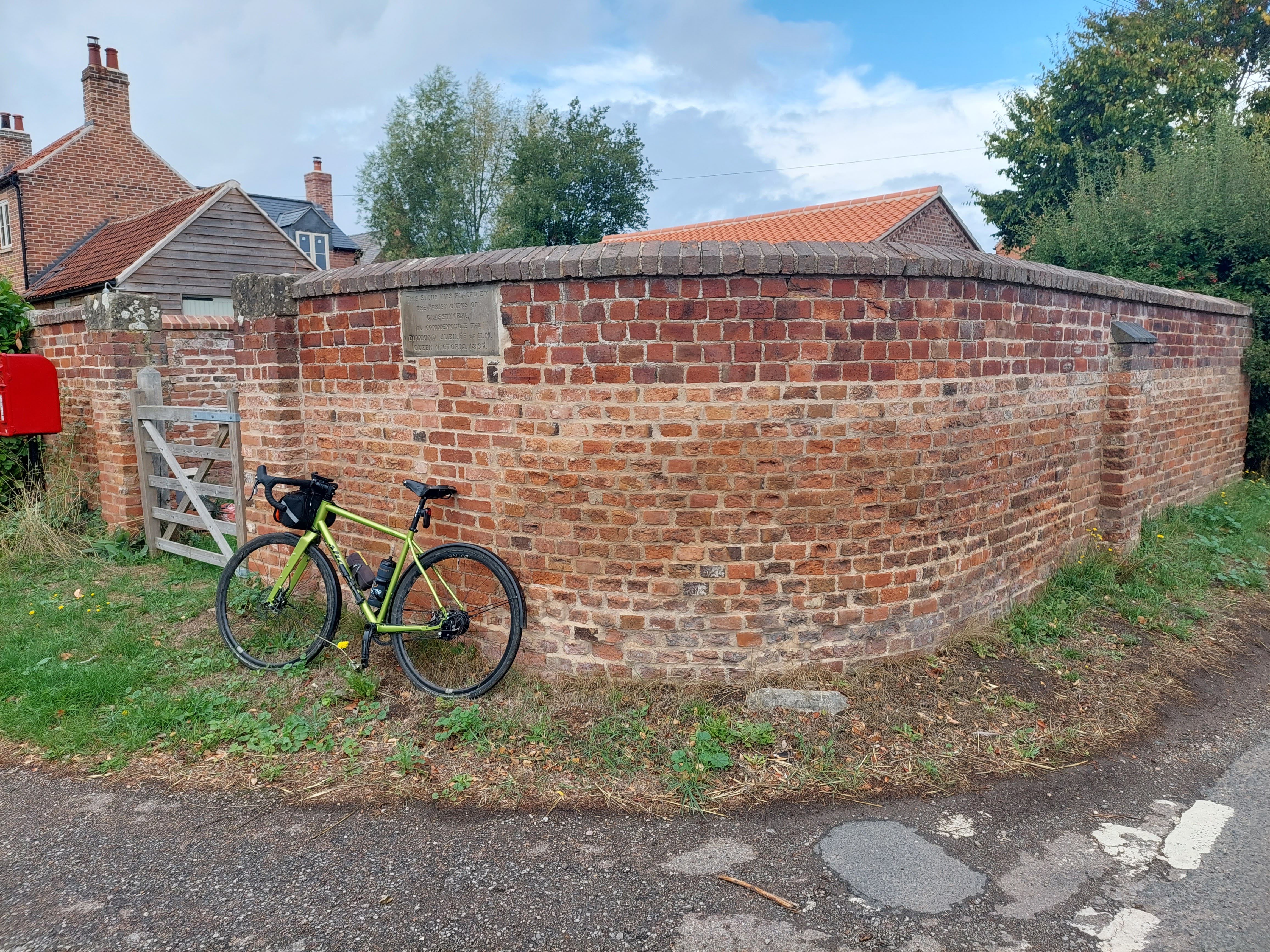
Titchmarsh, Northamptonshire
Grid ref: 502448, 279617
Although not named on OS maps this site is known as the Village Pound and is situated adjacent to the village shop on High Street. Used and maintained as a "peaceful and tranquil garden" approx 6 mtrs square.
Contributed by Michael Trolove, May 2021
Warmington, Peterborough, Northamptonshire
Grid ref: 50775,291210
The site of this pound, shown on the 1886 OS 1:2,500 map, is annexed to Pound House on Chapel Street at its junction with Hautboy Lane. No trace of pound remains but it is acknowleged in the house name. Contributed by Michael Trolove, April 2021
Weston, Northamptonshire
Grid ref: 558945,246947
Not found on OS maps but "The Pound House" announces itself on an oval plaque in the middle of the village. Exact location could not be traced. Contributed by Michael Trolove, May 2022
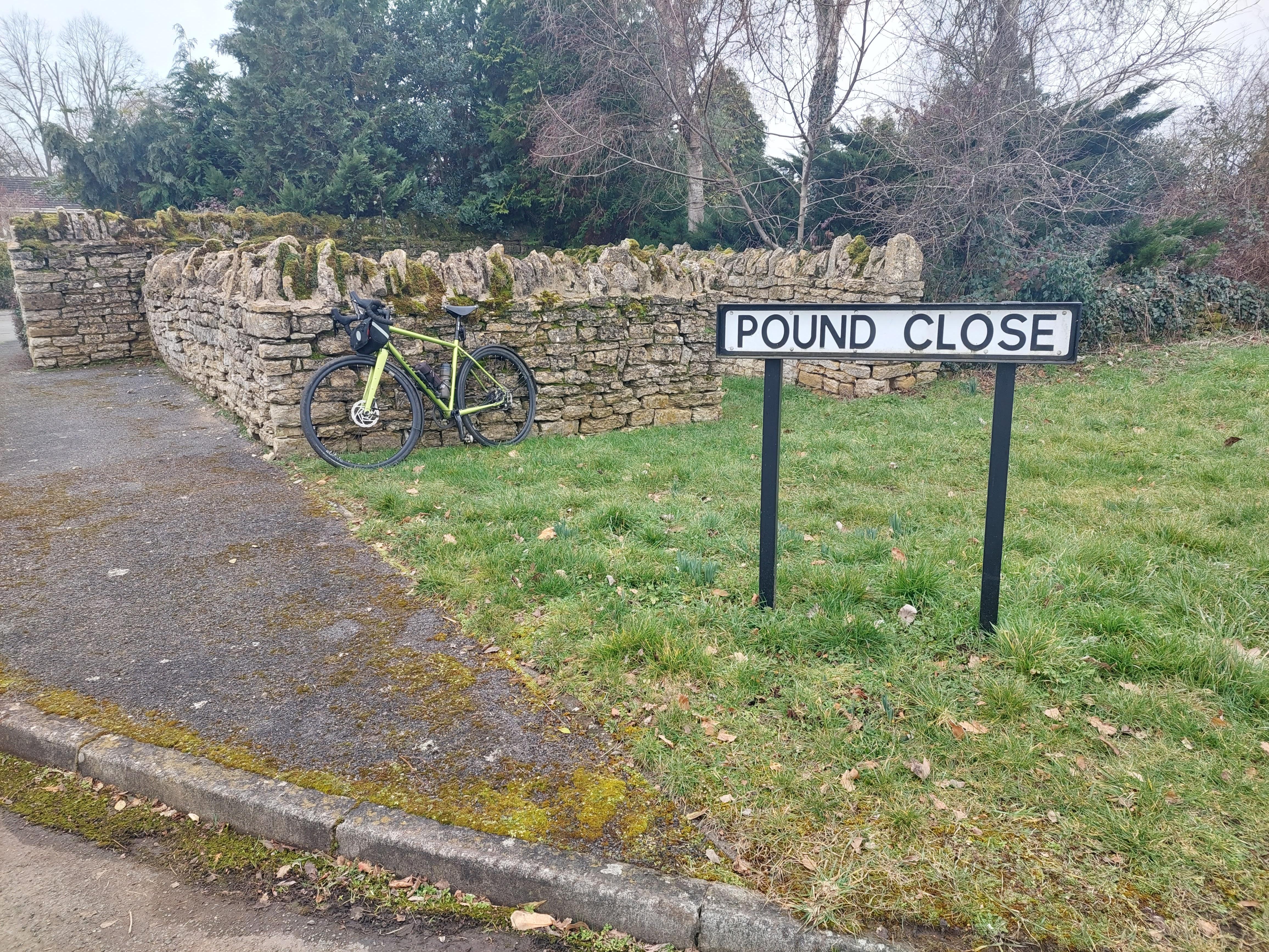
Wicken, Northamptonshire
Grid ref: SP 74500 39591
A rare surviving pound in this area of Northampton in Pound Close. It is of dry stone walled construction with vertical coping and square. Shown on the 1883 OS map Close to houses and may have been rebuilt when the houses were constructed. Contributed by Michael Trolove, February 2023.
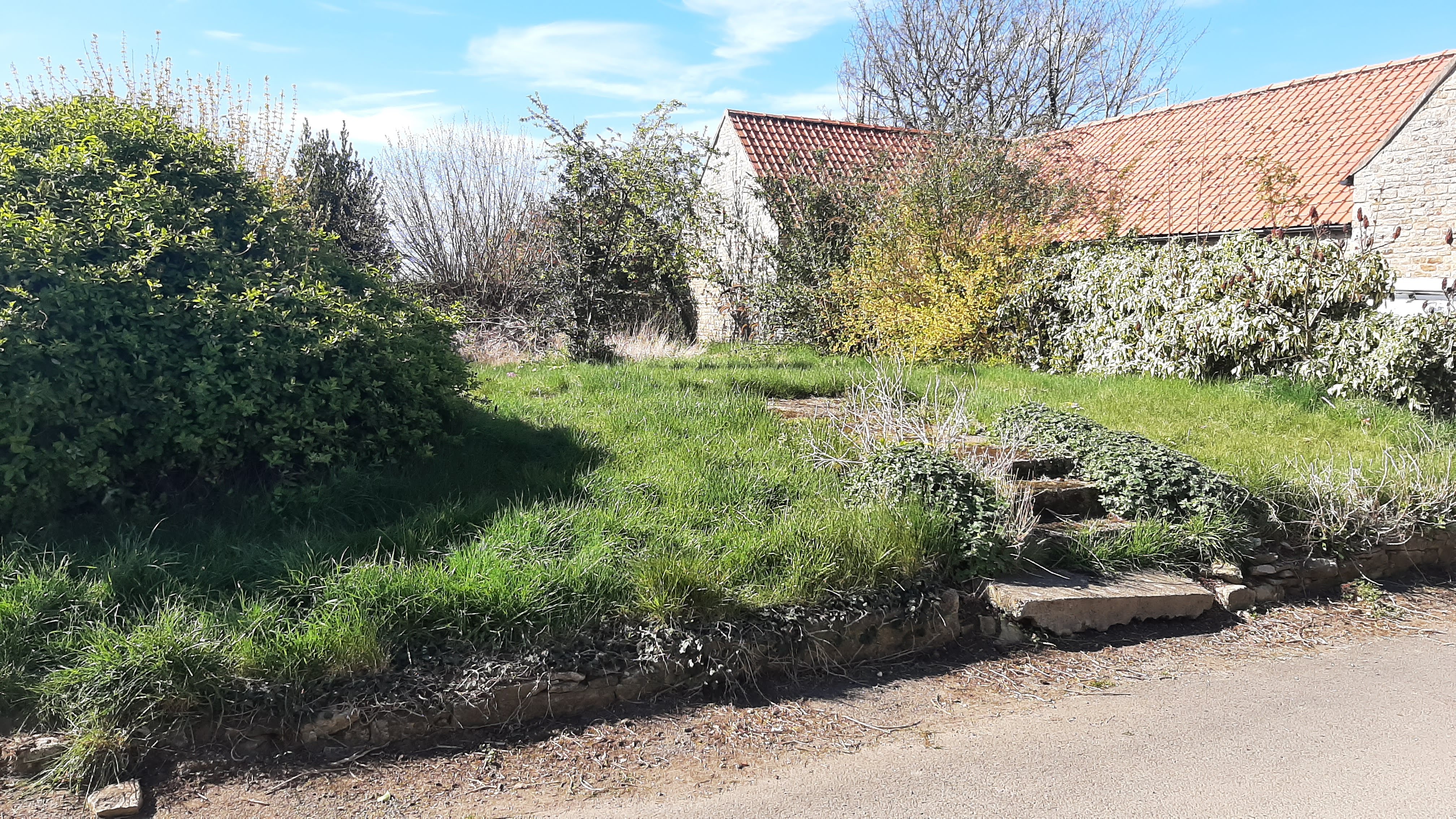
Woodnewton, Peterborough, Northamptonshire
Grid ref: 503741,294160
This pound is named on the 1886 OS 1;2,500 map and the 1778 Enclosure map of the area. Today only 3 walls can be discerned and the area has been annexed to a neighbouring garden. There is no recognition that this is the site of this ancient structure. It can be found in Pound Lane, which is a nod to it's former significance, close to its junction with Oundle Road.
Contributed by Michael Trolove , April 2021
Yarwell, Northamptonshire
Grid ref: 506739,297921
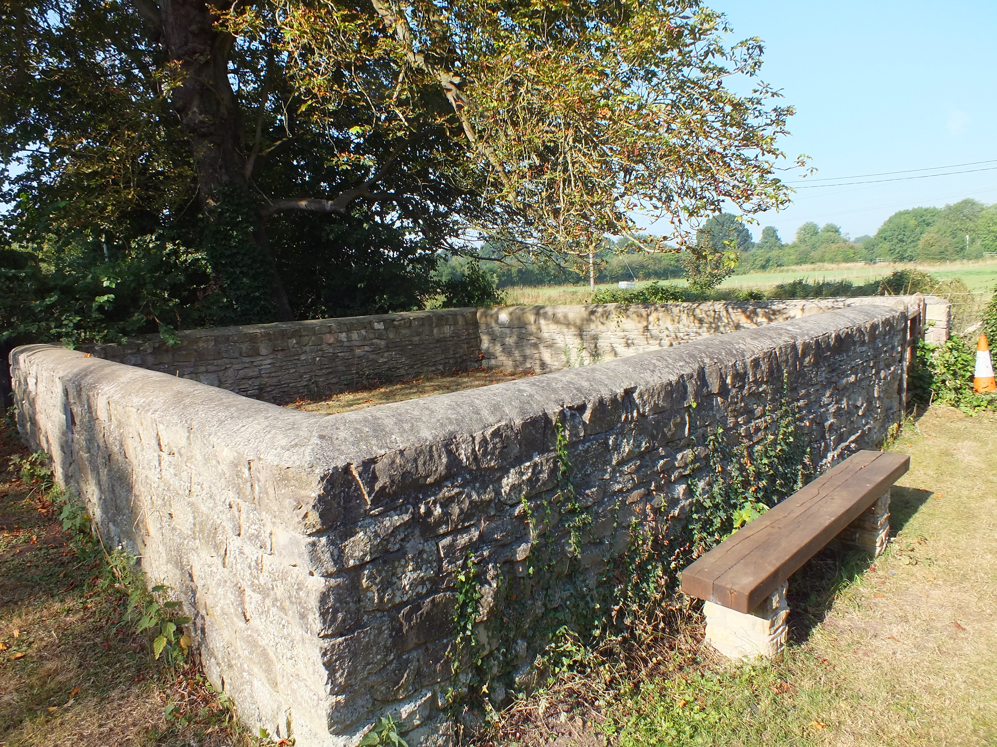
This Grade II listed pound is a well maintained rectangular structure with an entrance in the north wall. Approx. 10mtrs by 4mtrs with low 1mtr walls, the roadside wall has been lowered further during consolidation work. It is contructed of limestone with vertical coping. It is named on the 1886 OS 1:2,500 map and is in Wansford Road close to its junction with Main Street, Yarwell.
Contributed by Michael Trolove, April 2021
--------------------------------------------------------------------------------------------------------------------------------------------------------------------------------------------------
Northumberland Pounds and Pinfolds
Alnwick, Northumberland
Grid ref:
This pinfold was moved here from a site near the War Memorial in 1819 and now acts as a roundabout in the town centre at Green Batt. It is Grade II listed, oval and ashlar built about 1.5 mtrs high. Gates are locked to enclose what seems like a shrub garden.
Nigel Mills August 2017
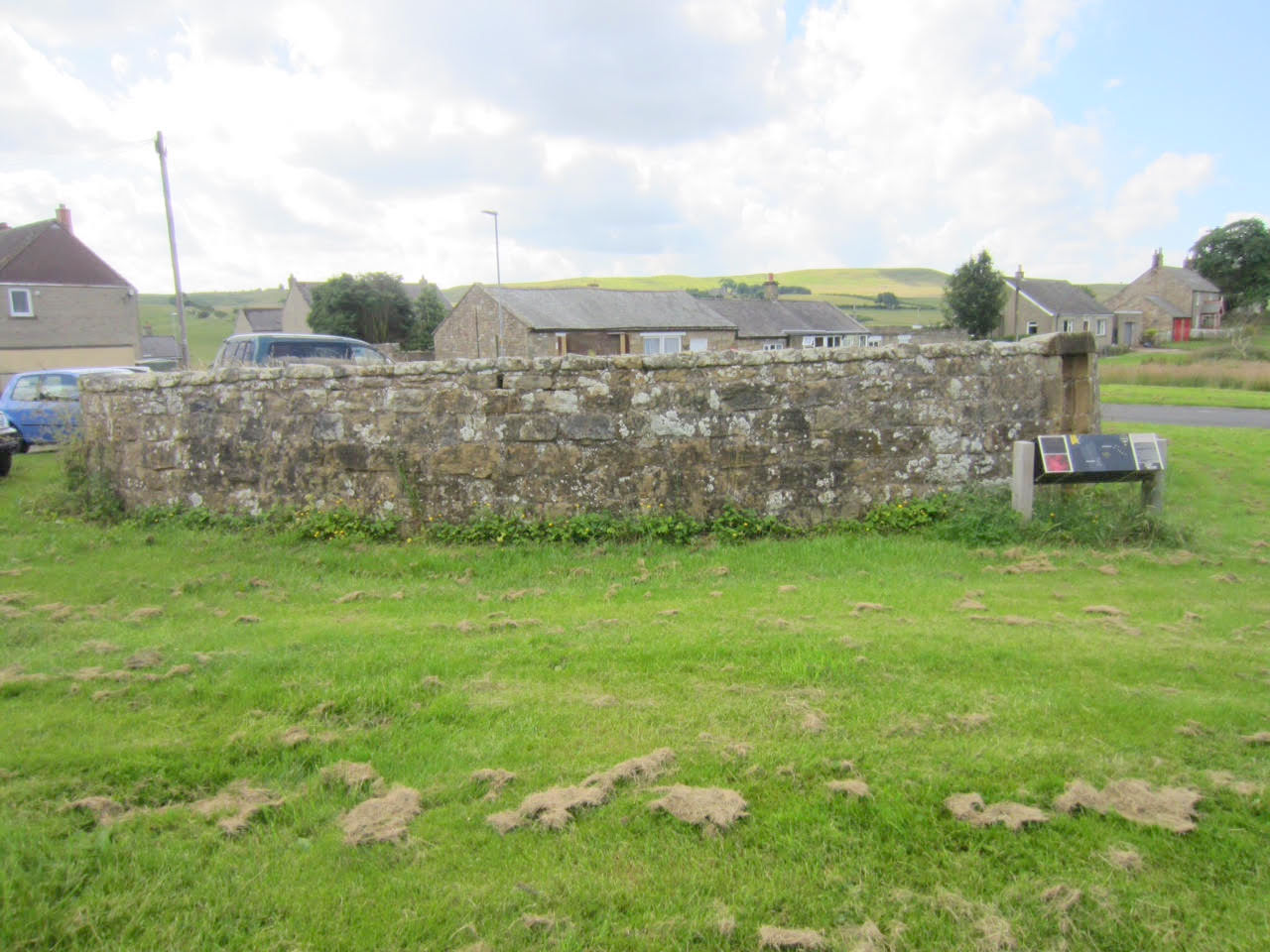
Elsdon, Northumberland
Grid ref: 393659,593102
A large prominent circular pinfold on the village green in Elsdon constructed of random rubble construction with a overhead door lintel, c13mtrs in diameter with 2mtr high walls. Grade II listed and on the 1895 OS 1:2500 map. It is well mainatine and cared for. The green is a designated Dark Sky location.
Contributed by Jacqui Morgan July 2016
Bamburgh, Northumberland
Grid ref:
Grade II listed c 10mtrs diameter.
--------------------------------------------------------------------------------------------------------------------------------------------------------------------------------------------------
Nottingham Pounds and Pinfolds
I am a text block. Click on me to drag me around or click a corner handle to resize me. Click the settings icon (it's the left one, looks like a cog) to change this text. You can type new text into me or cut and paste text from somewhere else. Click outside of me when you're done and any changes will be saved.
- Lost Nottinghamshire Pounds and Pinfolds.xlsx
- Click on icon to download sites lost and not listed below.
Aslockton, Nottinghamshire
Grid ref: 474147,340419
Housing has overtaken again and the pinfold named on the OS map is no longer. Contributed by Michael Trolove, May 2022
Calverton, Nottinghamshire
Grid ref: 461076,349297
This pinfold , shown on the 1885 OS map, is on Main Street at its junction with George's Lane. Constructed of stone with later brick repairs and lowering of walls it is kept in good condition. A plaque explains its purpose and the charges levied on the impounded animals. Contributed by Michael Trolove, May 2022
Caythorpe, Nottinghamshire
Grid ref: 468609,345683
On the 1884 OS as a Pinfold. Another site
where the redundancy of the pinfold has led to a replacement
building for the use of the community. Interestingly the Methodist
chapel (tin tabernacle) to the left is of the corrugated Iron
construction and would have been supplied as a kit building from
the 1840's onwards. A later day village hall now sits on the
pinfold site. Contributed by Michael Trolove, May
2022
Colston Bassett, Nottinghamshire
Grid ref: 470710,333416
Located on the 1884 OS map the site is an overgrown thicket of hawthorn. It is a roadside site that may hide a the remians of the pinfold but more likely it was demolished years ago. Contributed by Michael Trolove, May 2022
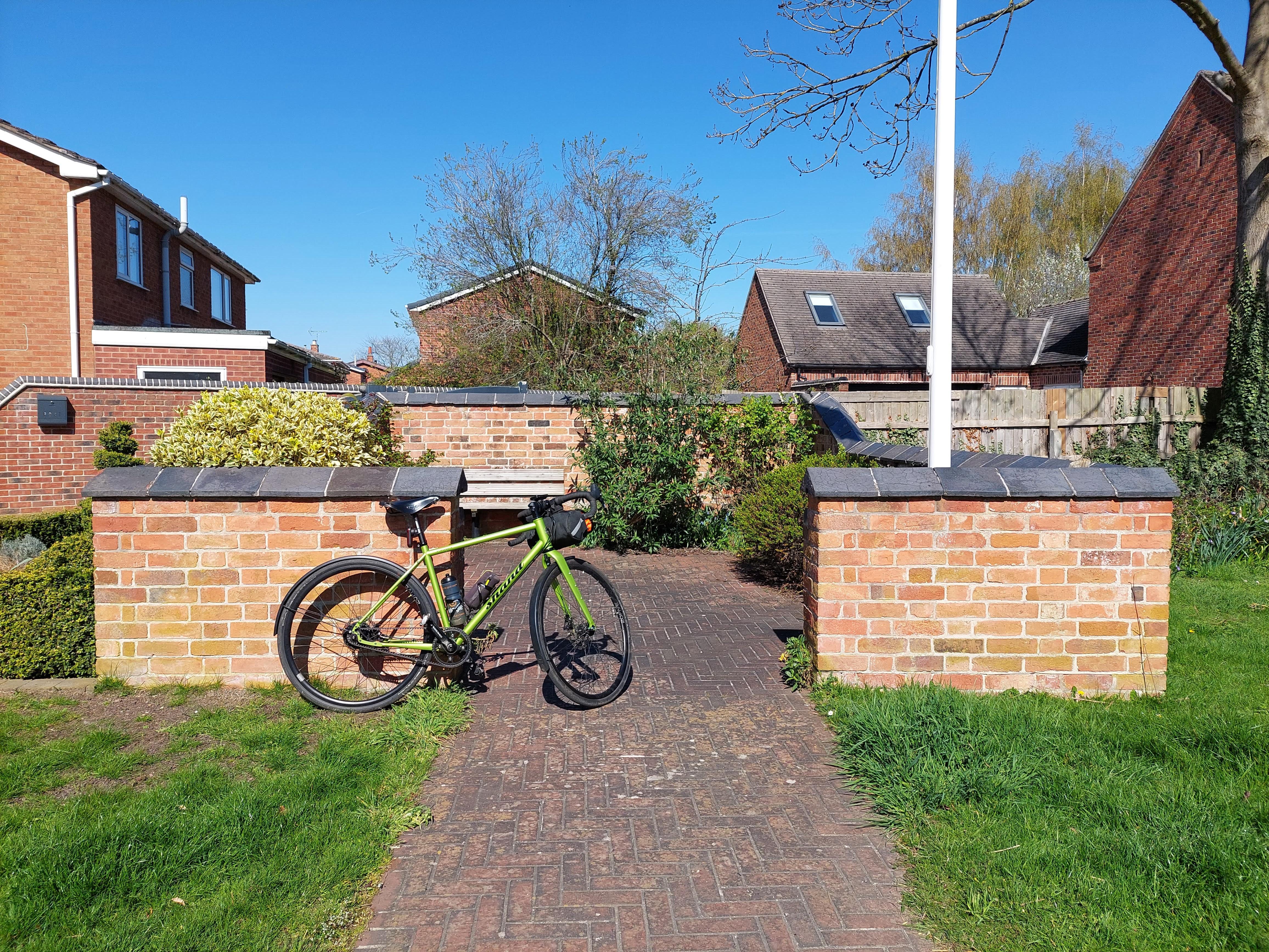
Costock, Nottinghamshire
Grid ref: SK 57274 26375
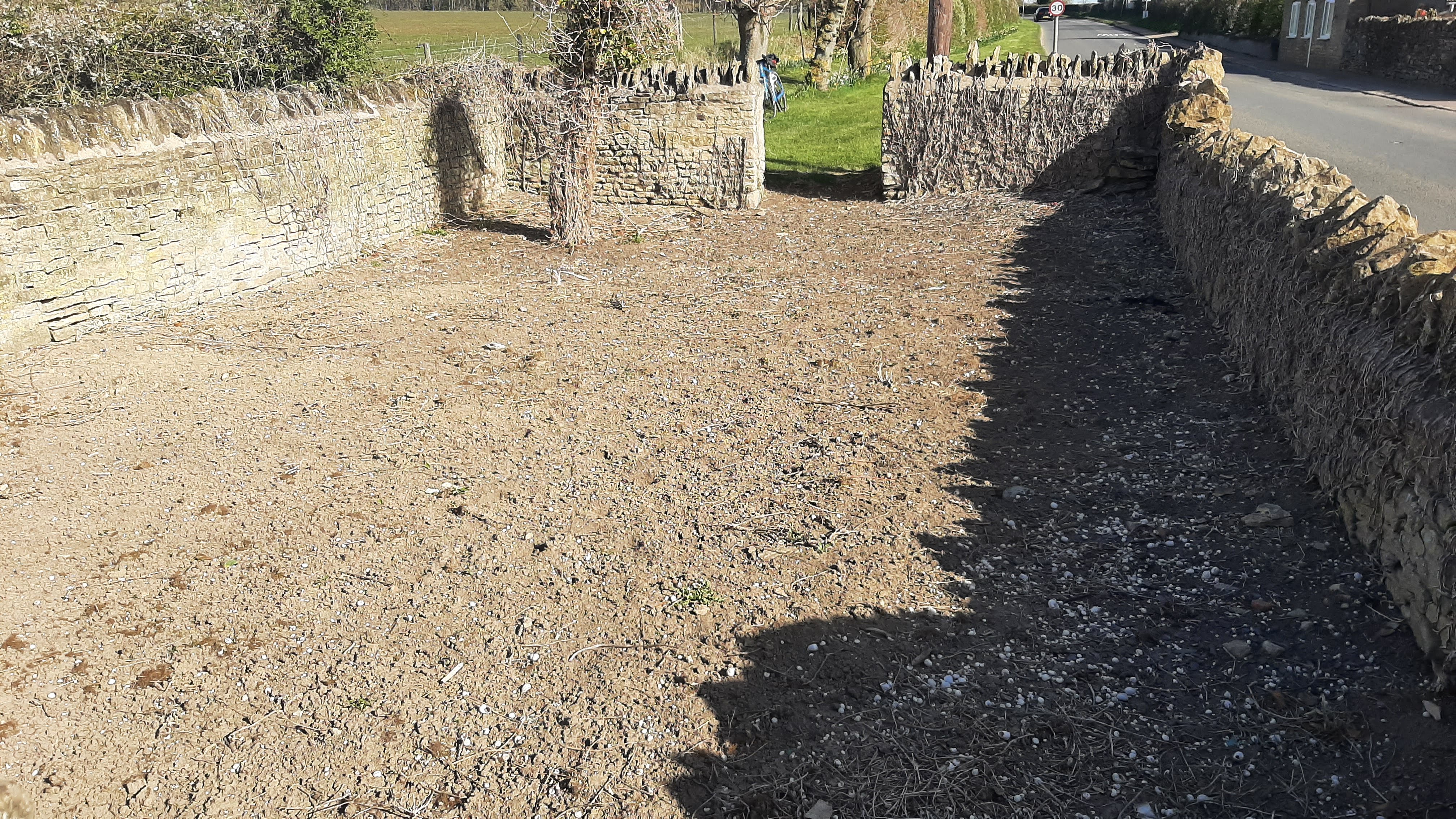
On the main road through Costack it is noticeable by the flagpole, at the time of this image flying the Ukrainian flag. It has been rebuilt and contains a bench seat set in an low maintenance garden. Approximately 8 mtrs by 10 mtres with walls of varying height. Contributed by Michael Trolove April 2023.
Cropwell Butler, Nottinghamshire
Grid ref: 466889,337872
This pinfold was located on the 1884 OS map as half a mile north west of the village. Site has become a gateway and hedge adjacent to another entrance in Cropwell Road. Contributed by Michael Trolove, June 2022
East Bridgford, Nottinghamshire
Grid ref: 468832,342874
Located at the south west end of the village on the 1884 OS map shows a row of cottages near the site. No sign of the pinfold could be found. Contributed by Michael Trolove, May 2022
Easthorpe, Southwell, Nottinghamshire
Grid ref: 470894,353457
A square pinfold on the 1884 OS Map just to the south of the village. No longer there but it was once located at the junction of Crink Lane and Spring Hill. Today it is a grass verge and gateway/entrance to a large allotment area. The pinfold was likely to have served the village of Easthorpe when it was a stand alone village. Today it merges with the popular racecourse town of Southwell which also has a splendid Minster. Contributed by Michael Trolove, May 2022.
East Leake, Nottinghamshire
Grid ref: SK 55306 26259
On the green in old East Leake and constructed of stone with various sized capping stones. Restored in 1980 for the Parish Council by Rural Youth Employment. It is a community space with a garden and benchj seat.
Edingley, Nottinghamshire
Grid ref:466523,355892
Site of the pinfold is now a seating and pull in area for St Giles's Church, a worthy cause! Contributed by Michael Trolove, May 2022
Elston, Nottinghamshire
Grid ref: 475713,348172
A pinfold in 1884 but now the site has turned into the corner of a private garden in Pinfold Lane. Contributed by Michael Trolove, May 2022
Elton on the Hill, Nottinghamshire
Grid ref: 476665,338913
Shown on the 1884 OS map as standing opposite a blacksmiths in an elevated position overlooking the Vale of Belvoir the site is now a private garden which suffers the A52 trunk road close by. Contributed by Michael Trolove, May 2022
Epperstone, Nottinghamshire
Grid ref: 465417,348412
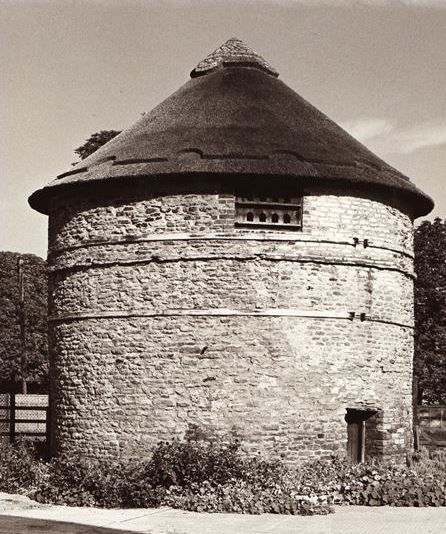
A good stone built pinfold named as one on the 1848 OS map. It is rectangular about 7ft by 21ft, 5ft high with rounded coping. May have had a water trough in one corner. Located on Main Street with an interpretive board.
Contributed by Michael Trolove, May 2022
Farnsfield, Nottinghamshire
Grid ref: 464376,356871
The pinfold site shown on the 1884 OS map is now a Mansfield Road private house. Contributed by Michael Trolove, May 2022
Flintham, Nottinghamshire
Grid ref: 474655,345721
This is a Pinfold shown on the 1884 1:2,500 OS map on Town End Lane, just west of Hill Top Farm and beside the track to Beck Dyke. Grade II listed, it was restored in 1977 to mark the Silver Jubilee of Queen Elizabeth II. It is a circular pinfold of stone construction with coping stones and in excellent order.
Contributed by Michael Trolove, April 2021
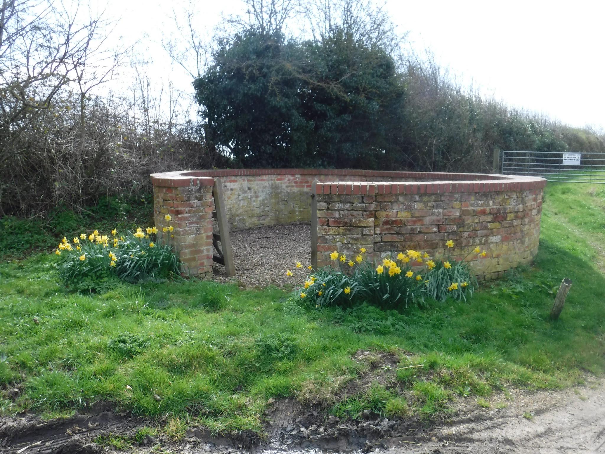
Grassthorpe, Nottinghamshire
Grid ref: 479526,367704
On the 1884 OS map as a pinfold. Approx. 8mtrs by 7mtrs and 2 mtrs high. It shows obvious maintenance and has a coping of bricks. A wooden gate gives access to a partially planted interior. A stone inscription commemorates Queen Victoria's Diamond Jubilee in 1897. Contributed by Michael Trolove, September 2022
Hallam, Nottinghamshire
Grid ref: 467819,354539
An iregular site on the 1884 OS map is now repurposed to improve education facilities at the village school. Contributed by Michael Trolove, May 2022
Halloughton, Nottinghamshire
Grid ref: 468889,351595
Named as a pinfold on the 1848 OS maps. The pinfold in this very small village appears to have given way to an extended blacksmiths shop. The early maps show a small building and a square clear outline with pinfold printed on the map. On slightly later editions the pinfold area is hatched in suggesting the building has expanded. There is a colour differential in the roof tiles and the side wall has large opening doors. A view from the other side might have helped but this is private property and we can only stick to public areas in our quest. Contributed by Michael Trolove May 2022
Harby, Nottinghamshire
Grid ref: 475108,331185
Named as a Pinfold on the 1884 OS map but actual location amongst the houses in Pinfold Lane could not be confirmed. Contributed by Michael Trolove, May 2022
Kneeton, Nottinghamshire
Grid ref: 471250,345843
A pinfold site, shown on the 1884 OS map, still in the countryside not affected by development but still lost. Contributed by Michael Trolove, May 2022
Low Marnham, Nottinghamshire
Grid ref: 480565,369420
A circular brick pinfold on the 1884 OS map. Approx. 8mtrs diameter with coping in engineering brick. Brick piers forming the gateway are capped. Can be found on Church Street close to junction with Holme Lane. Although no interpretive board this site is well kept and tended. Contributed by Michael Trolove September 2022
Morton, Nr Southwell, Nottinghamshire
Grid ref: 472437,351345
At the junction of Middle Lane and Moor Lane and shown on the 1825 1:2,500 OS map this pinfold is in excellent condition. It measures 7 mtrs by 7 mtrs with a 1 mtr high wall, has a grassed interior and accessed via a wooden gate. A plaque reminds us that the Parish Council in 1987 restored the pinfold as part of the Newark Community Programme. Contributed by Rob Smith September 2021
North Scarle, Nottinghamshire
Grif ref: SK 84936 67055
A circular brick pinfold adjacent to village shop. Walls are approx. 1.5 mtrs high and approx 10 mtrs diameter and enclose a small garden area. Contributed by Michael Trolove, and bike, July 2023.
Orston, Nottinghamshire
Grid ref: 476901,341033
The expanding need for housing has led to another lost pinfold from the 1884 OS map. A property is named Pinfold Cottage so it is at least remembered. Contributed by Michael Trolove, May 2022
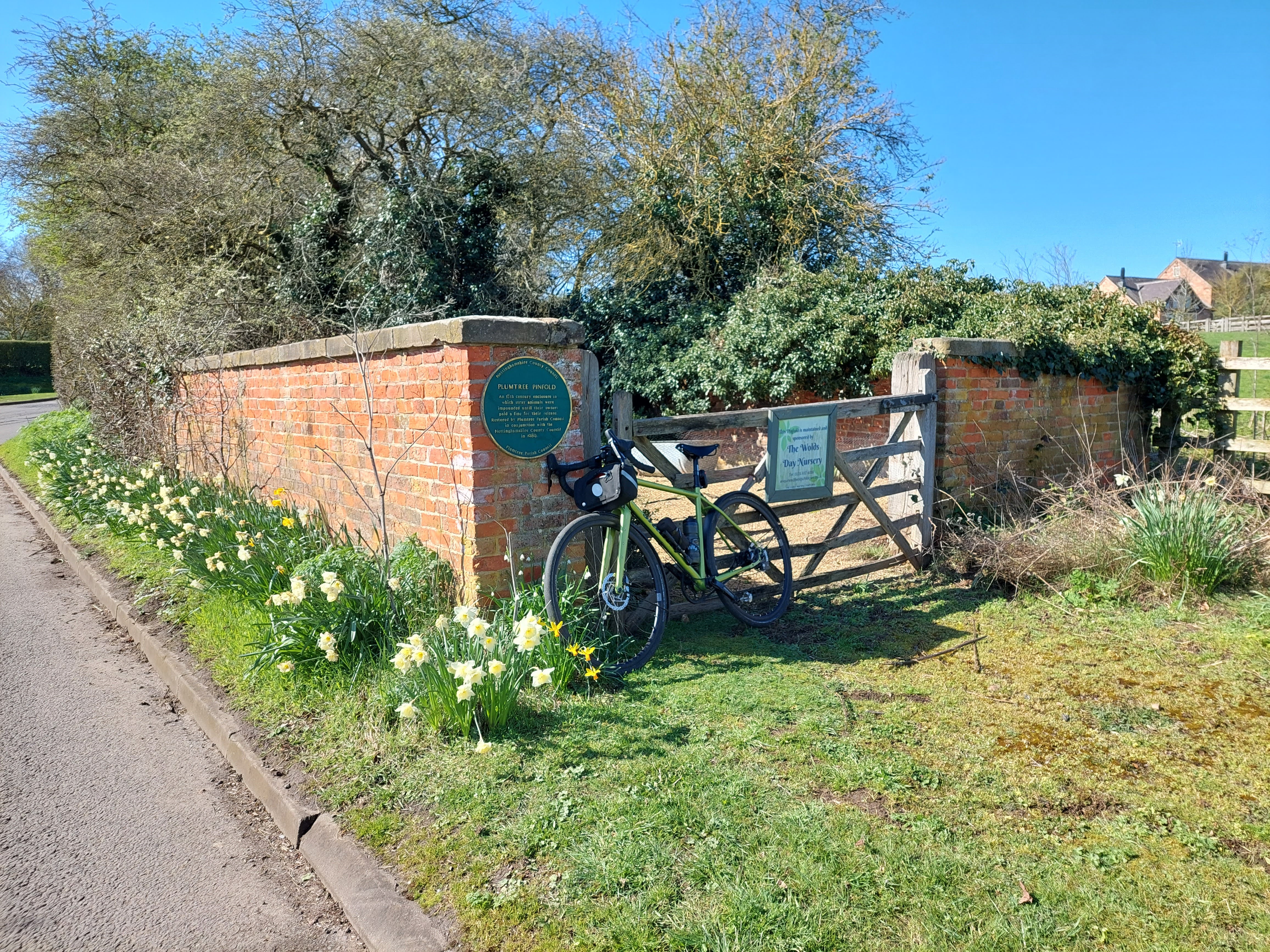
Plumtree, Nottinghamshire
Grid ref: SK 61610 33120
Located on Cotrave Road, as is Pinfold lane a bit further along, this pound is shown on the 1900 OS map. It is of brick construction with concrete capping stones standing approx 2 mtrs high and 8mtrs by 10 mtrs. A large information plaque is attached and the interior contains a bench and low maintenance garden. Contributed by Michael Trolove April 2023
Rolleston, Newark, Nottinghamshire
Grid ref: 474553,352281 No trace found. Contributed by Michael Trolve May 2022
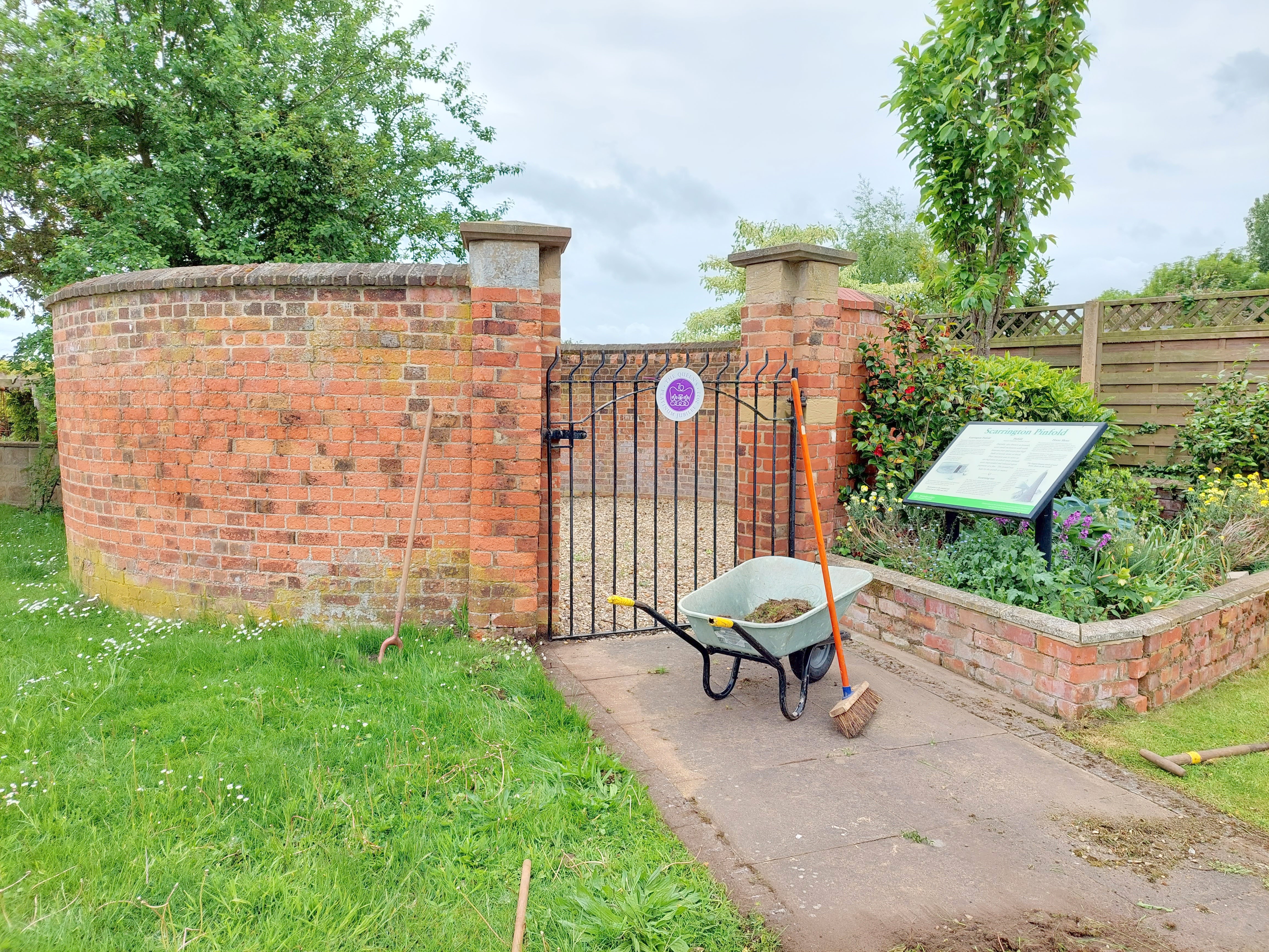
Scarrington, Nottinghamshire
Grid ref: 473514,341543
This is a circular pinfold, unusual for the area, on the 1884 OS map and located adjacent to the Smithy. Although repaired it is cared for and in good condition with an interpretive plaque and at the time of the photograph was being tidied up in prepartaion for the Platinum Jubilee Celebrations. It is approx. 24ft wide, brick built and capped with a metal gate, probably made by the smithy alongside the pinfold. As well as the pinfold the giant column of horseshoes is nearby and worth seeing according to Michael Trolove who contributed this entry.
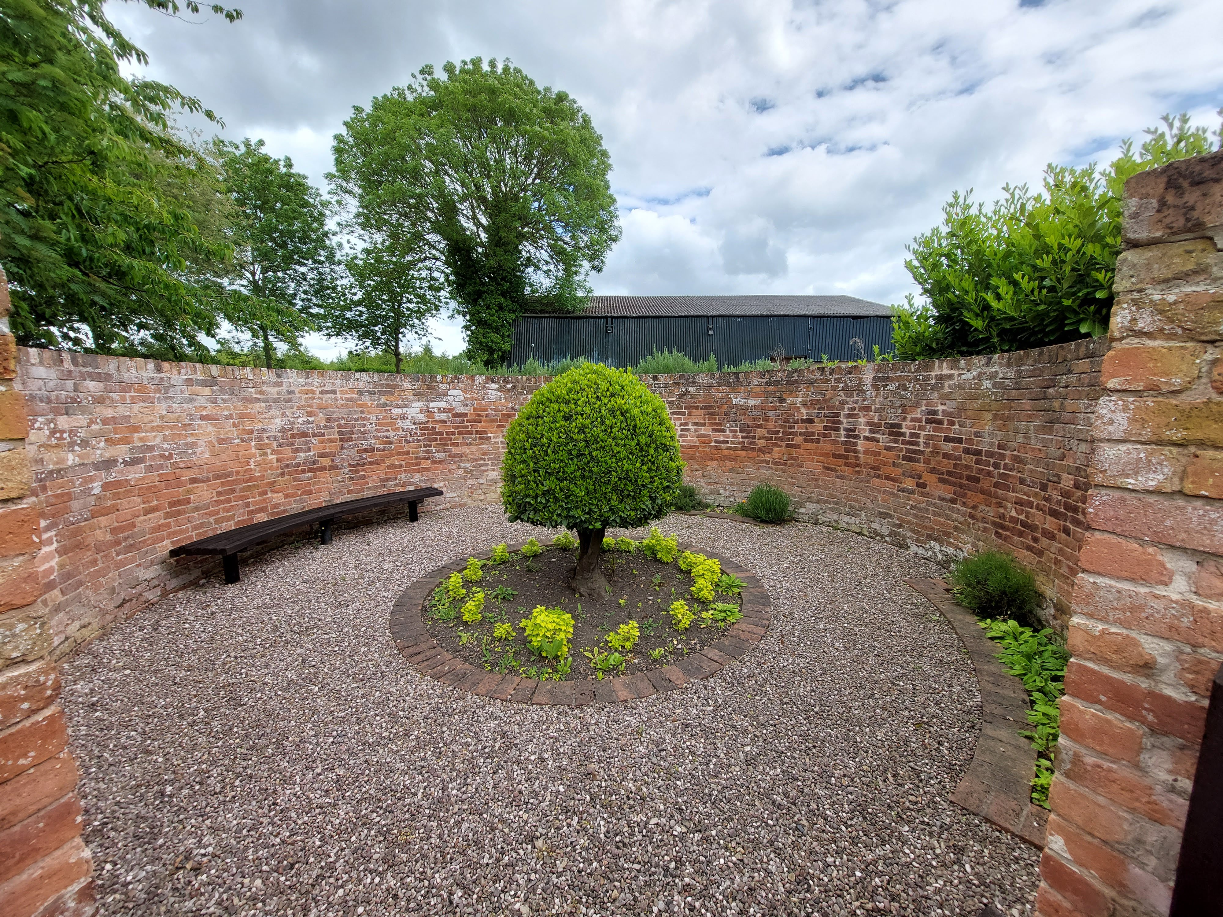
Screveton, Near Rushcliffe,Nottinghamshire
Grid ref: 473109,343767
This pinfold is shown on the 1884 OS map. Located beside Lodge Lane this high walled circular brick pinfold is in great condition and an amenity space containing shrubs and a seat. Having contributed this entry Michael describes it thus:- "Today a small shrub and herb garden along with a curved seat make for a splendid place to sit and think about the Pinfolder extracting his release fee from a none to pleased peasant."
Contributed by Micheal Trolove, May 2022

Thoroton, Nottinghamshire
Grid ref: 476458,342645
A large pinfold shown on the 1884 OS map is now a stable yard oat the junction of Main Street and Thoroton Road with no sign of the pinfold. Of interest is a medieval thatched dovecot just down the road. Contributed by Michael Trolove, May 2022
Thurgarton, Nottinghamshire
Grid ref: 469483,349212
As in so many cases the redundancy of the pinfold has led to other uses for the sites which are often controlled by the Parish through the council or other management bodies. In this case the ground was given over to the placement of the War Memorial. Contributed by Michael Trolove May 2022
Whatton, Nottinghamshire
Grid ref:474677,339268
Lost from the 1884 map where it was named as a pinfold to make way for housing. Contributed by Michael Trolove, May 2022
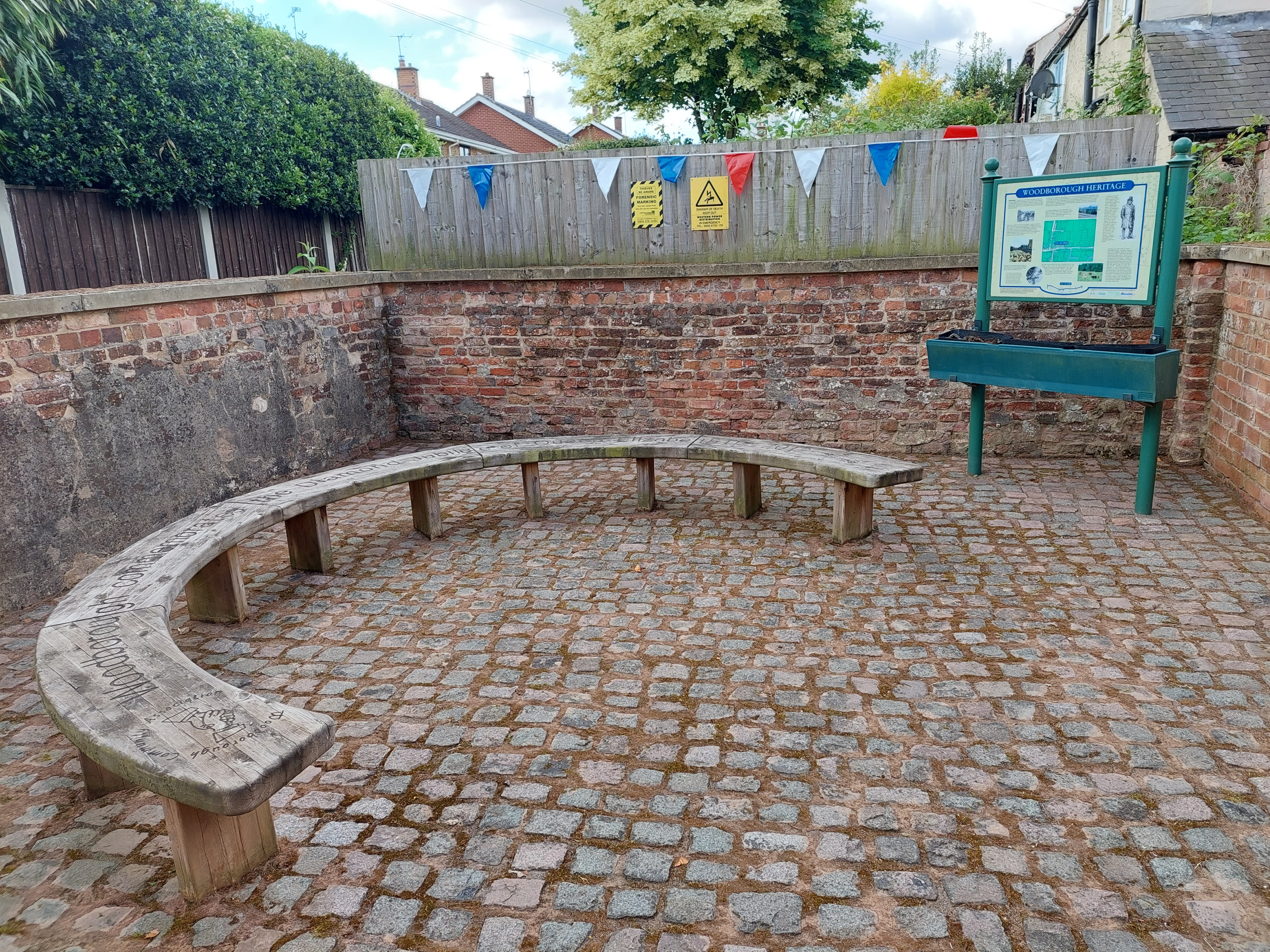
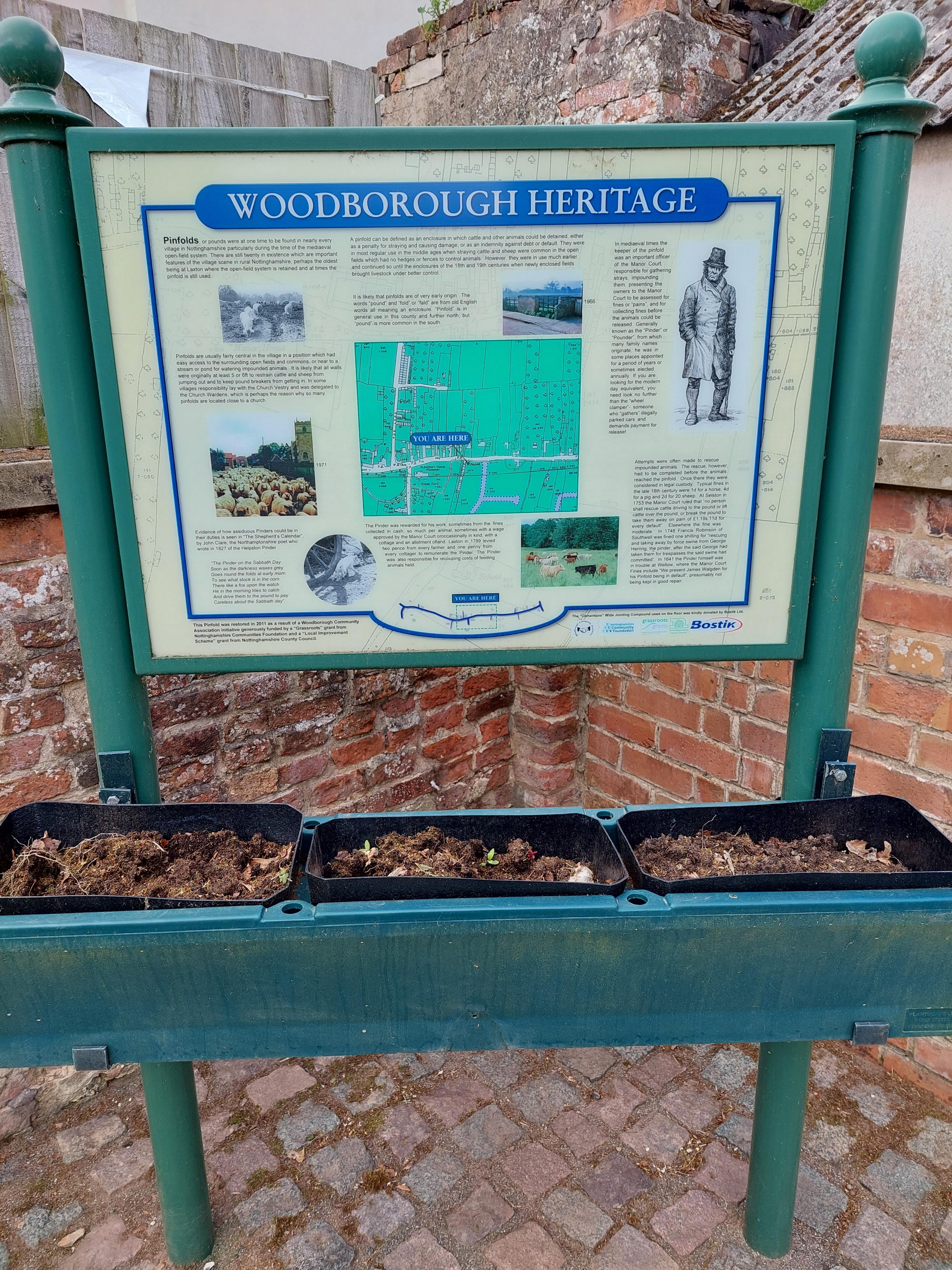
Woodborough, Gedling, Nottinghamshire
Grid ref: 463253,347736
Shown on the 1848 OS map. Woodborough pinfold sits centrally in the village on Main Street. It is brick walled with concrete capping slabs. A wooden gate of about 6ft width leads to a ground size of 20 sq ft. A seat and an information board are contained and on the day of the visit it was decorated for the forthcoming Platinum Jubilee Celebration. Conrtributed by Micahel Trolove, May 2022..
--------------------------------------------------------------------------------------------------------------------------------------------------------------------------------------------------
Oxfordshire Pounds and Pinfolds
- Lost Oxfordshire Pounds and Pinfolds.xlsx
- Click on icon to download sites lost and not listed below.
Chadlington, Oxfordshire
Grid ref; 432537,222522
The village is the home of a celebrity TV car show host and farmer which has no bearing, as far as is known, about the loss of this pound at the Mill End part of the village. Shown on the 1881 OS map but there is now no trace. Contributed by Michael Trolove, July 2022
Charlebury, Oxfordshire
Grid ref: 435452,219808
"Pound" is clearly noted on the 1881 OS map but its location is obscure. Pound Hill Road was searched without successfully identifying its location. It may have been a field or grass area rather than a built structure. Contributed by Michael Trolove, July 2022
East Adderbury, Oxfordshire
Grid ref: 446569,235082
Named on the 1881 OS map but location difficult to pinpoint. No obvious signs of a pound by several walls may be the remains. Contributed by Michael Trolove, April 2022
Great Rollright, Oxfordshire
Grid ref: 432330,231218
On the 1881 OS as a Pound of rectangular shape but now lost although a raised walled area in Old Forge Road near The Green may be the original site. Contributed by Michael Trolove, July 2022
Hanwell, Oxfordshire
Grid ref: 443521,243730
Site is shown on the 1889 OS in Main Street but no trace found. Contributed by Michael Trolove, April 2022
Hook Norton, Oxfordshire
Grid ref: 435648,232898
The near rectangular pound shown on the 1884 OS map is no more. Houses occupy the area as a result of the evr expanding Hook Norton. Contributed by Michael Trolove, April 2022
Horley, Oxfordshire
Grid ref: 441643,244074
Site on the 1882 OS map shows a pound but no trace found unless you count some stones forming the front garden of a house now on the site. Contributed by Michael Trolove, April 2022
Poffley End, Oxfordshire
Grid ref@ SP 35941 12611
On the 1885 OS map and still stands almost un-noticed as dry stone walls with no recognition of its earlier use. A footpath at one end and a house at the other it is probably a walled garden. Contributed by Michael Trolove June 2023.
Sibford Gower, Oxfordshire
Grid ref: 435299,238051
Another pound loss but the name of the lane that led to the site is now Pound Lane. Contributed by Michael Trolove, April 2022
Steeple Ashton, Oxfordshire
Grid ref: 447636,225774
Located originally at the foot of Paine Hill nothing is visible today but is remembered by naming a dwelling "The Pound House". Contributed by Michael Trolove, July 2022
Stoke Lyne, Oxfordshire
Grid Ref: 456628,228309
Possibly part of the original irregularly shaped pound shown on the 1881 OS map still exists. The churchyard wall and an entrance to a footpath have caused changes to be made and part of the site is overgrown. Contributed by Michael Trolove, March 2022

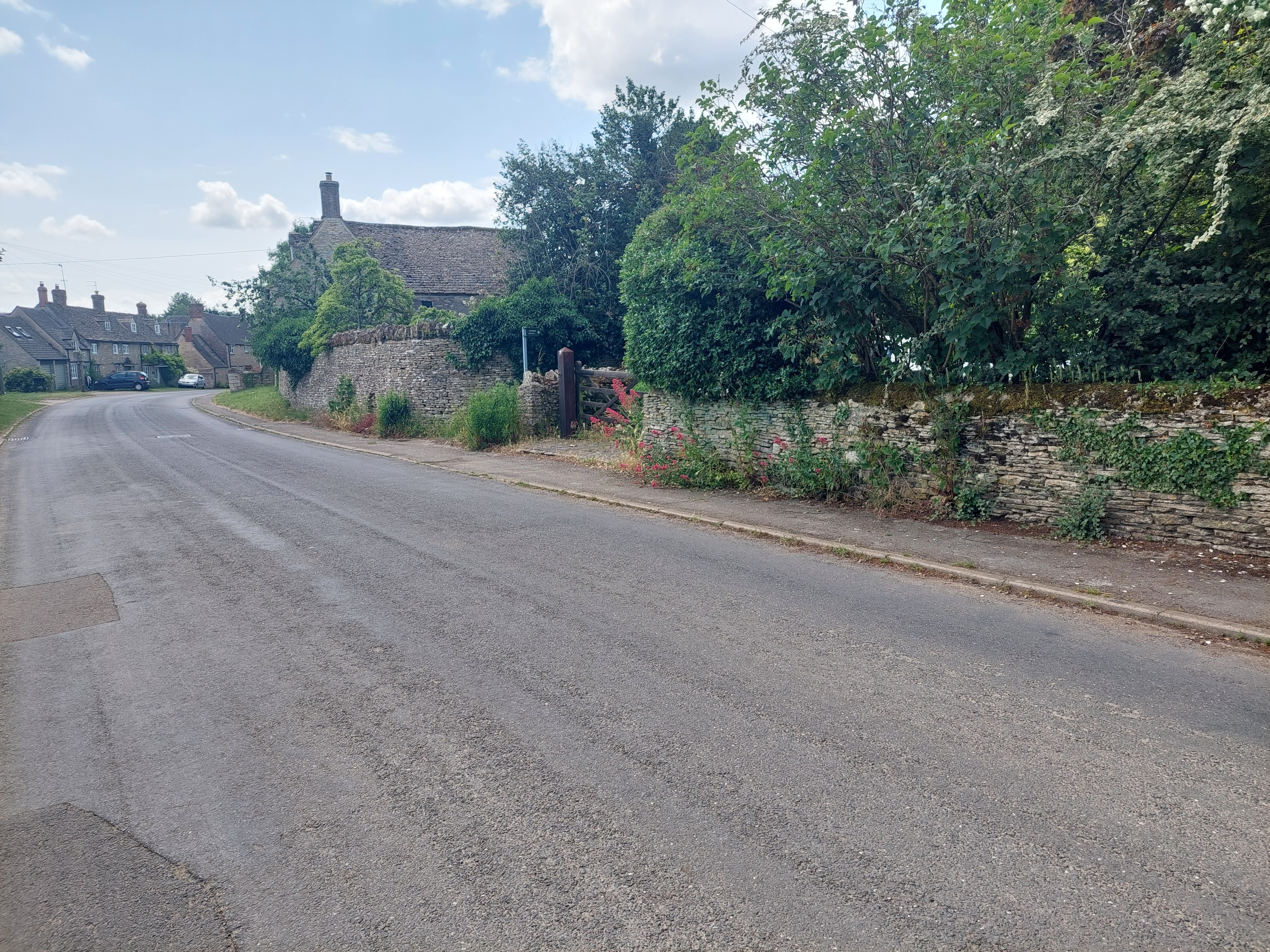
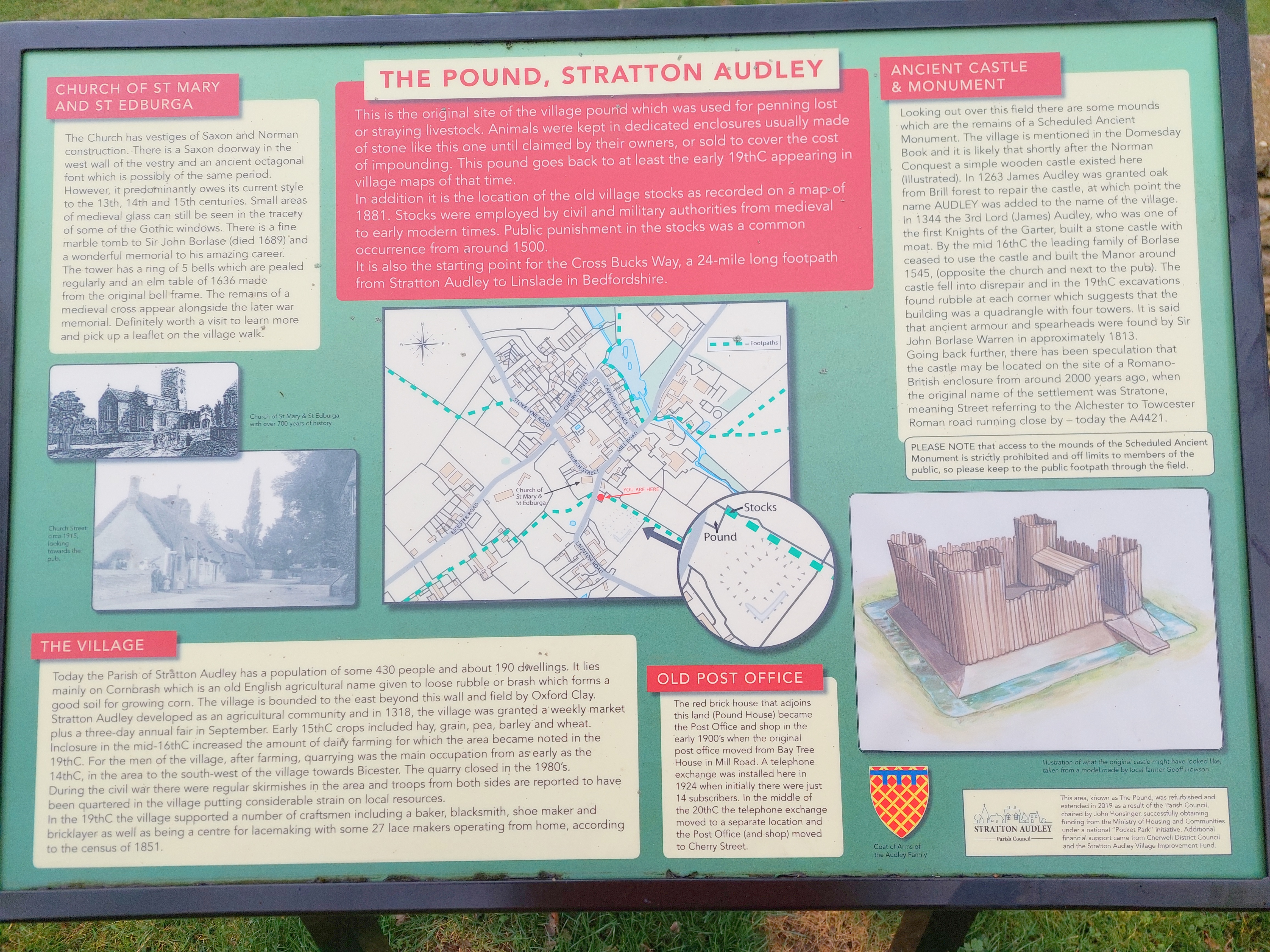
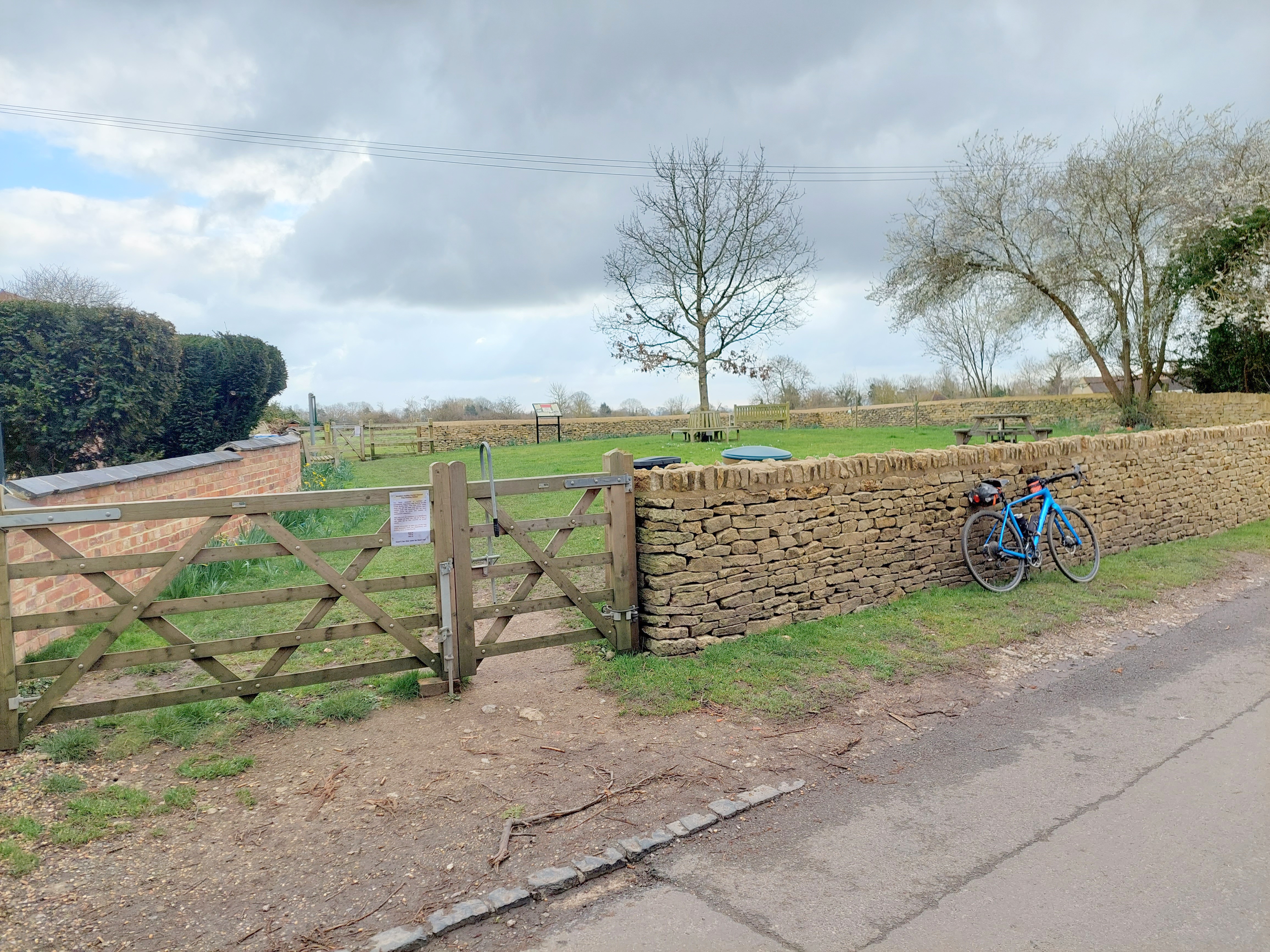
Stratton Audley, Oxfordshire
Grid ref: 460890,225592
The square pound just off Lawnton Road has been reshaped slightly from the 1881 OS map possibly to accommodate fresh boundaries or road alignment and is now a recreation space for the village. Mainly made of dry stone walling this large pound contains benches and an interpretive plaque. Contributed by Michael Trolove, March 2022
West Adderbury, Oxfordshire
Grid ref: 446569,235082
An irregular shaped pound due to adjoining walls but it is complete and maintained. Dry stone wall construction with concrete capping in Hornhill Road and used as a garden. Contributed by Michael Trolove, April 2022
--------------------------------------------------------------------------------------------------------------------------------------------------------------------------------------------------
Rutland Pounds and Pinfolds
- Lost Rutland Pounds and Pinfolds.xlsx
- Click on icon to download sites lost and not listed below.
Barleythorpe, Rutland
Grid ref: 484816,309644
The 1885 OS does not pinpoint location and on the ground there was no evidience to identify the site, but fair to say it no longer exists. As it is shown within the Manor House grounds it was probably quickly demolished when it fell into disuse. Contributed by Michael Trolove, June 2022
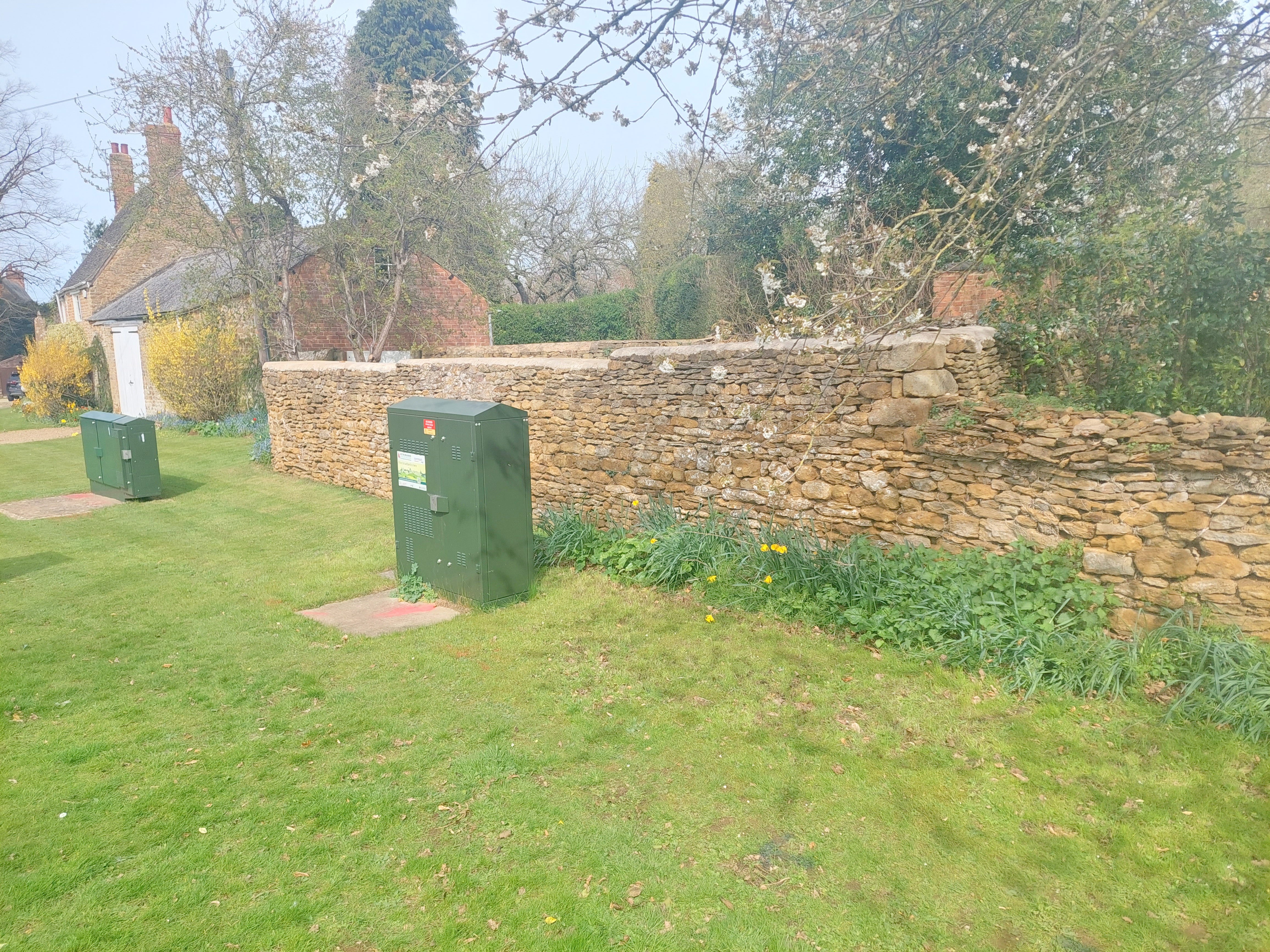
Bisbrooke, Rutland
Grid ref: 488570,399640
Shown on the 1886 1:2,500 OS map, but not on the 1904 version, at the junction of Church Lane and Glaston Road. The site is now a public area entered by steps from the road side and is bounded by a high stone wall at one end. The differing levels of the road and field make confirmation of exact location difficult but its use as a public space indicates it may be on common land, a popular location for a pinfold.
Contributed by Michael Trolove, May 2021
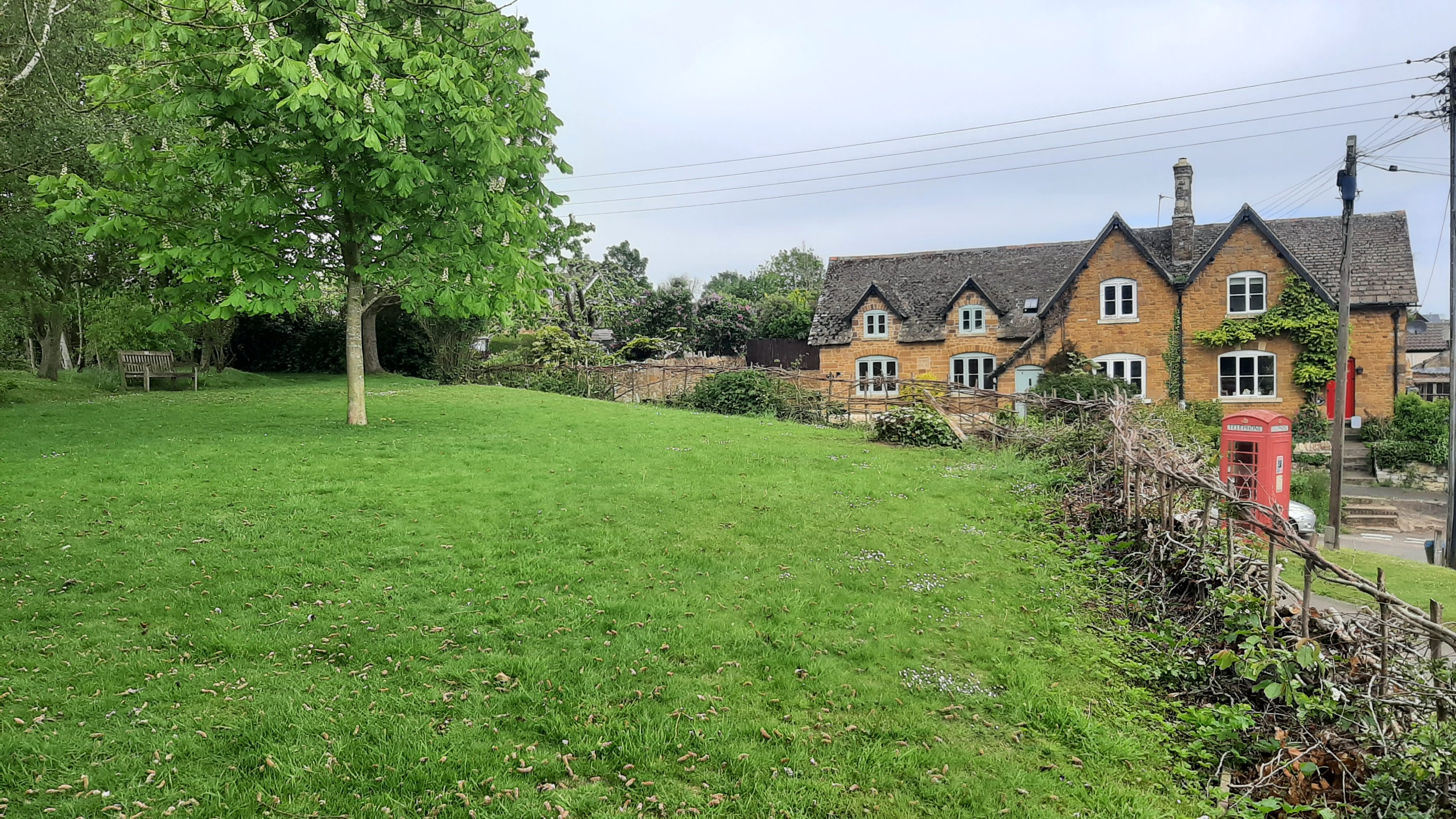
Caldecott, Rutland
Grid ref: 487023,293778
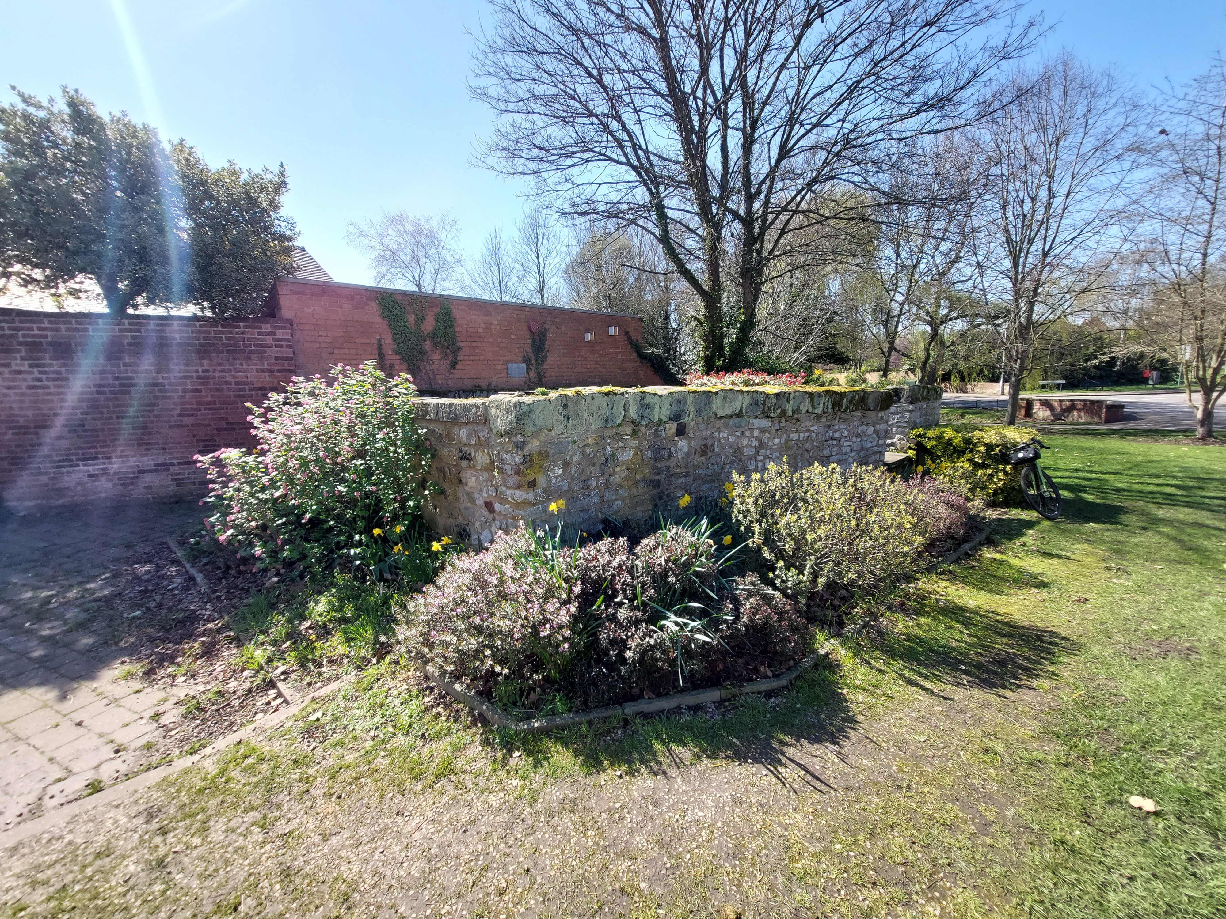
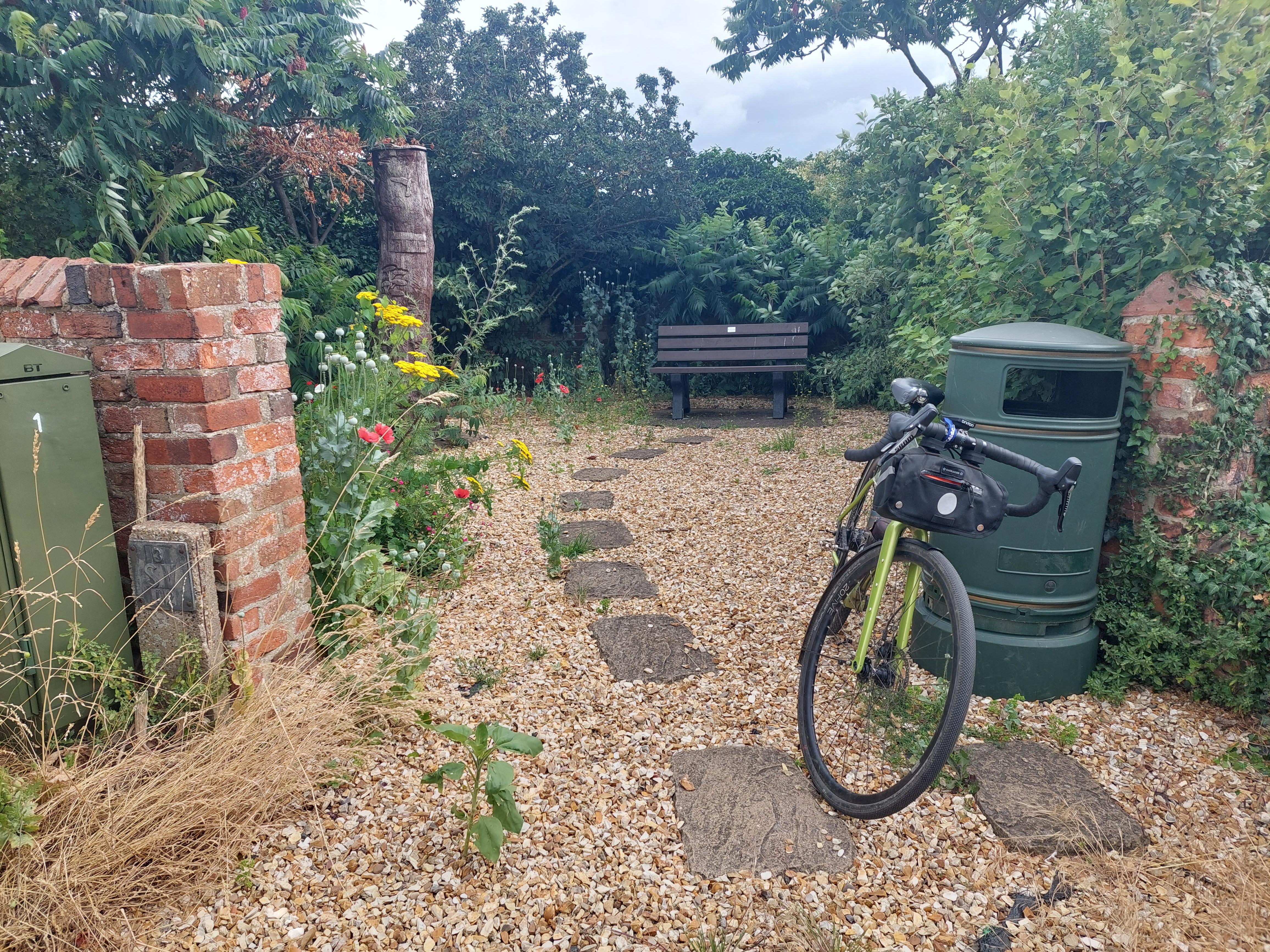
This pinfold is located on the west side the Lyddington Road, to the north of the village, at the 30 speed limit signs. It is named as a Pinfold on the 1885 and 1886 OS maps but not named after 1900. This area was used as allotments at the turn of the century when but now only three walls exist and enclose a small grassed area with a seat. It is well maintained with stone walls and coping. It is approx. 2 mtrs high and approx 6 mtrs square. It is adjacent to a playpark and open area for children named Pinfold Park. Contributed by Michael Trolove, April 2021
Edith Weston, Rutland
Grid ref: 492688,305288
"Pinfold" is written on the 1885 1:2,500 OS map but exact site not clear. Site is on the west side of Weston Road opposite the junction with Church Lane.
Contributed by Michael Trolove, My 2021
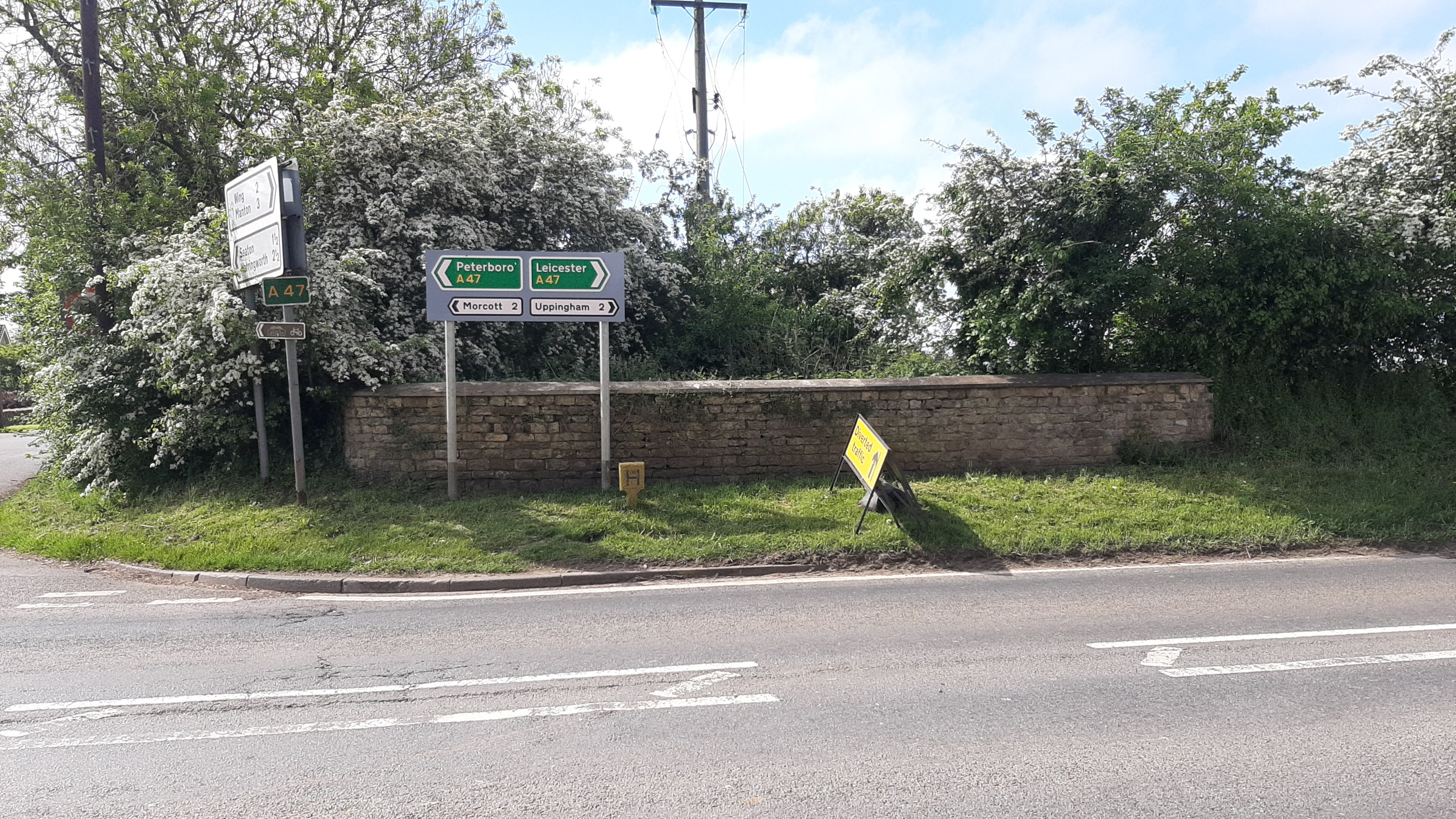
Glaston, Oakham, Rutland
Grid ref: 489580,300390
Just two walls appear to be the remains of this pinfold named on OS maps from 1886 although successive OS maps show varying outlines of the structure. At the junction of Seaton Road with Morcott Road.
Contributed by Michael Trolove, May 2021
Manton, Rutland
Grid ref: 488151,304537
At the junction of South View Close and Lyndon Road once stood Manton pound, shown on the 1885 1:2,500 OS map, but sadly no more.
Contributed by Michael Trolove, May 2021
North Luffenham, Rutland
Grid ref: 493440,303516
No trace found but this pinfold is remembered in the naming of Pinfold Street and Pinfold Close. Contributed by Michael Trolove, May 2021
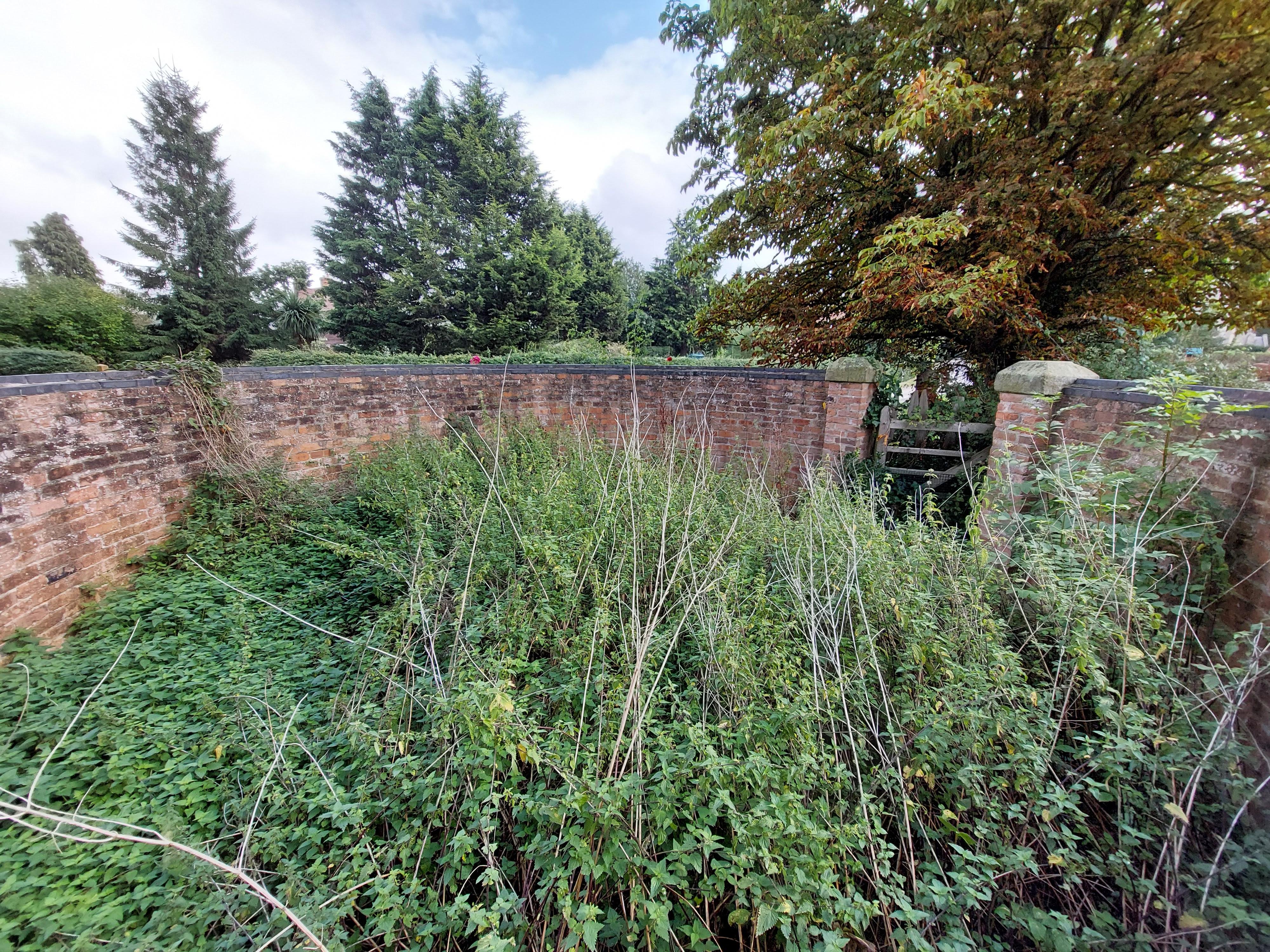
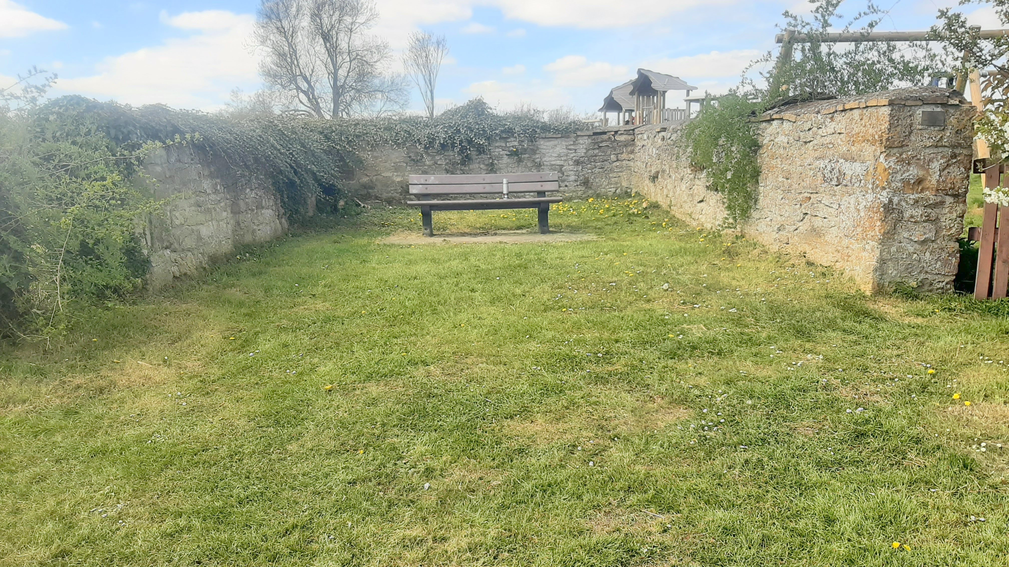
Pilton, Rutland
Grid ref: 491250,303020
Two walls remain of this pinfold now overgrown with vegetation. Although shown complete on OS maps it is never named. It is suggested locally that the site, if cleared, would would attract fly tipping.
Contributed by Michael Trolve, May 2021
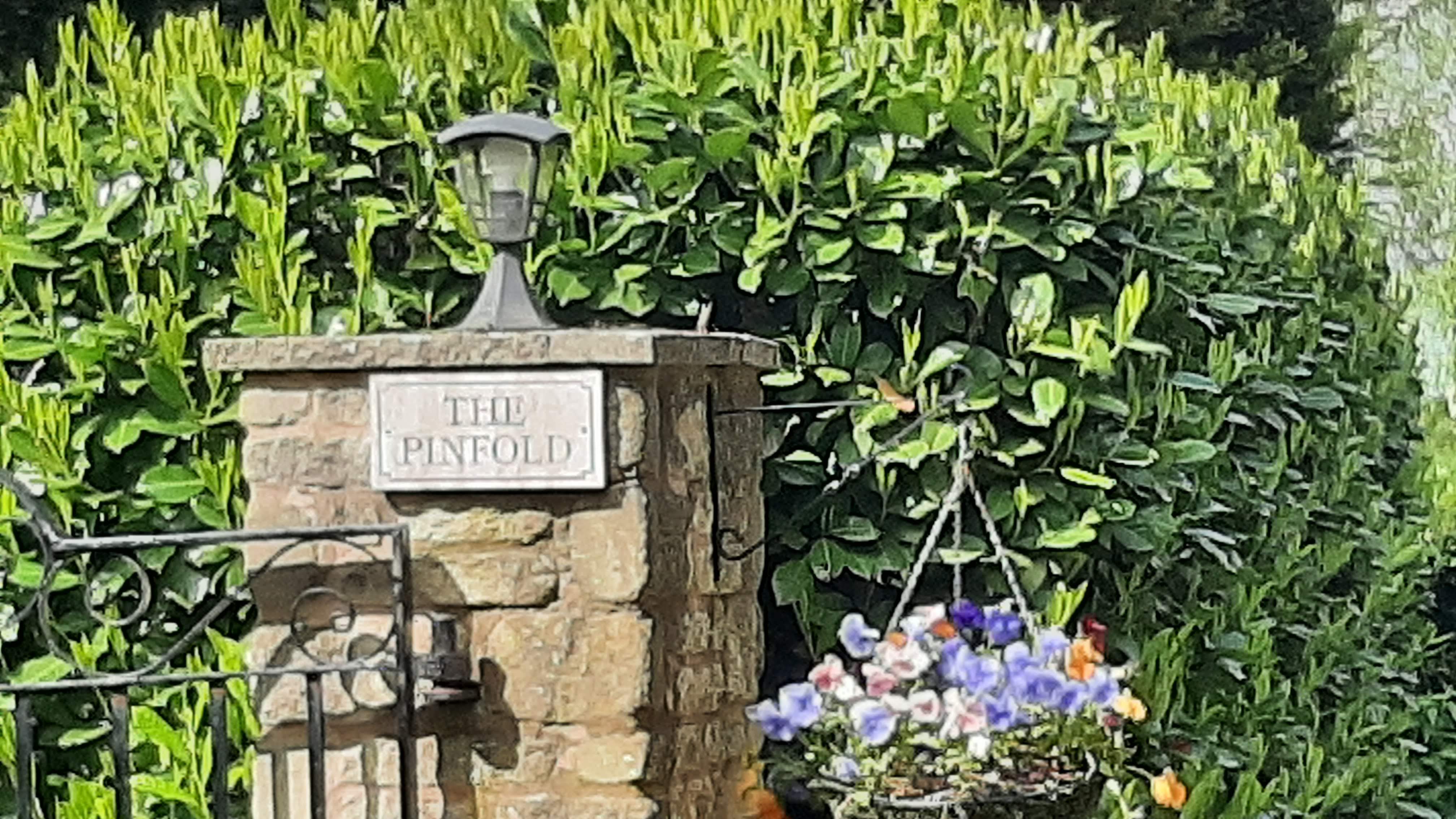
Preston, Rutland
Grid ref: 487040,302260
On the 1886 1:2,500 OS map as a square pinfold. This site is on Ridlington Road and although the pinfold has been removed it is acknowledged by naming the house on the site The Pinfold.
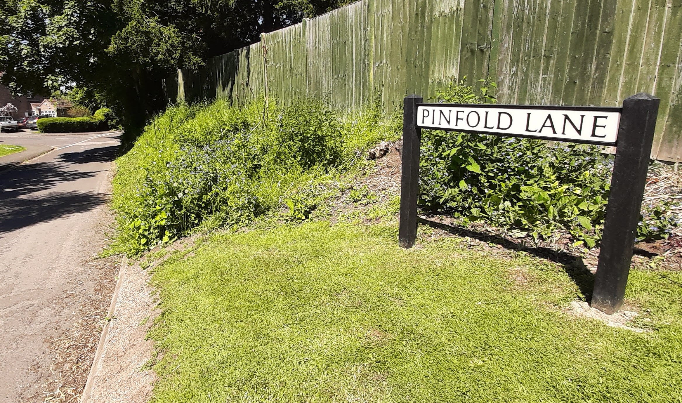
South Luffenham, Rutland
Grid ref: 494420,301979
No trace of the original structure shown in outline only on early OS maps near the junction of Pinfold Lane with Stamford Road. Site is acknowledged by naming Pinfold Close and Pinfold Lane. The small common area with a seat could indicate that this was once an area common land.
Contributed by Michael Trolove, May 2021
Tixover, Rutland
Grid Ref: 497680,300660
A pinfold is noted on OS maps up to the 1900 1:2,500 OS map but the exact location on the ground has not been possible to pinpoint. Realighnment of roads near the junction of Manor Road and Peterborough Road over the years probably caused its demise.
Contributed by Michael Trolove, April 2021
Uppingham, Rutland
Information please?
Wing, Rutland
Grid ref: 489130,302950
Shown as an irregular shaped pinfold on the 1886 1:2,500 OS map it is now subsumed into a private garden. Contributed by Michael Trolove, May 2021
-------------------------------------------------------------------------------------------------------------------------------------------------------------------------------------------------